High-resolution hydrological monitoring method for small-drainage-basin karst water system
A high-resolution, hydrological monitoring technology, applied in the direction of measurement devices, permeability/surface area analysis, suspension and porous material analysis, etc., can solve the problems of uneven karst water-bearing media, difficulties in tunnel water inflow, and groundwater Problems such as the difference in the amount of resources, to achieve the effect of improving efficiency and automation level, saving manpower and material costs, and reducing the amount of engineering
- Summary
- Abstract
- Description
- Claims
- Application Information
AI Technical Summary
Problems solved by technology
Method used
Image
Examples
Embodiment 1
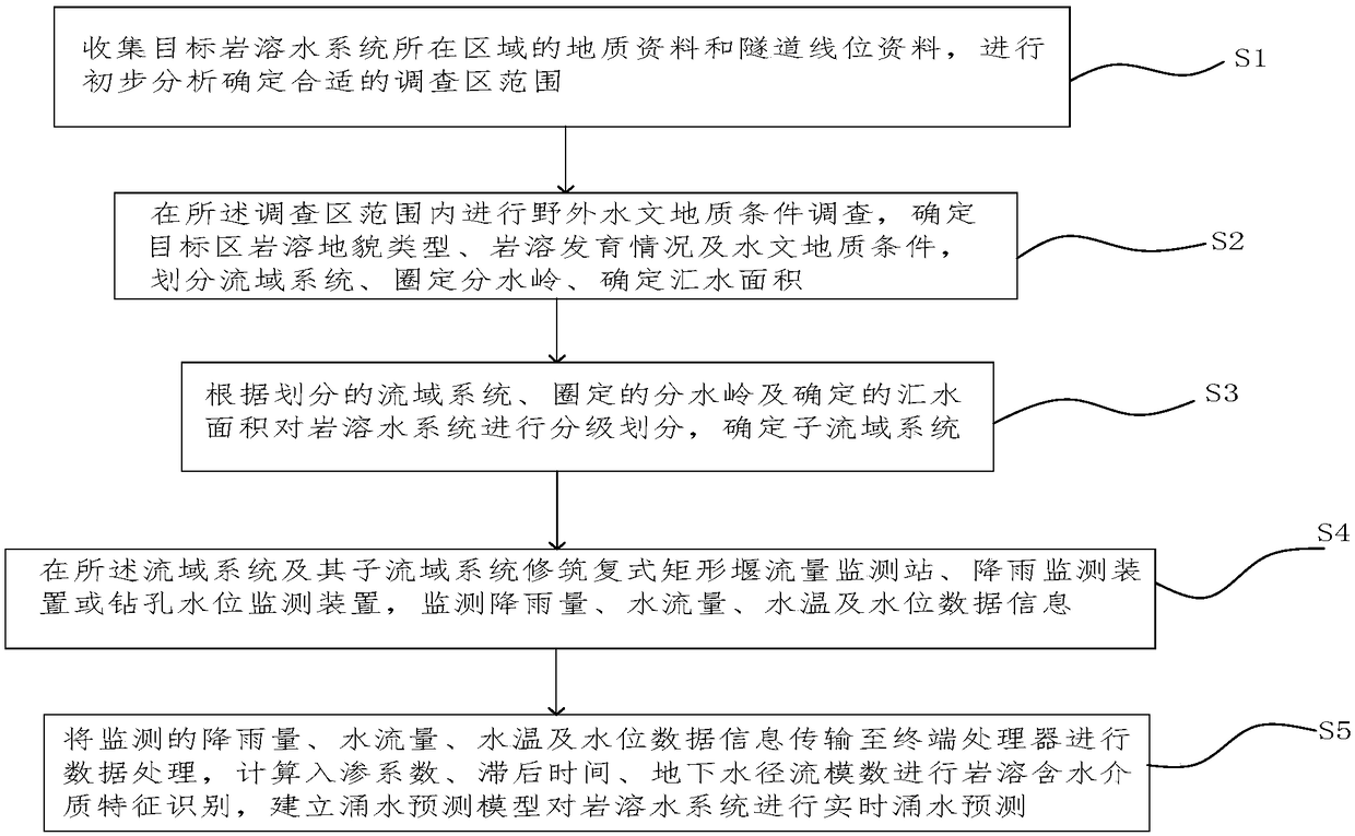
[0036] Please refer to figure 1 , an embodiment of the present invention provides a high-resolution hydrological monitoring method for a small watershed karst water system, comprising the following steps:
[0037] (1) Collect geological data and tunnel alignment data of the area where the target karst water system is located, and conduct preliminary analysis to determine the appropriate scope of the survey area;
[0038] (2) Conduct field investigation of hydrogeological conditions within the scope of the survey area, determine the type of karst landform, karst development and hydrogeological conditions in the target area, divide the watershed system, delineate the watershed, and determine the catchment area;
[0039] (3) Classify the karst water system according to the divided watershed system, the delineated watershed and the determined catchment area, and determine the sub-basin system;
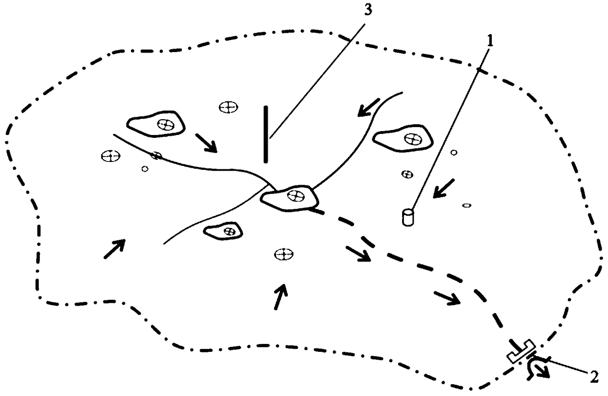
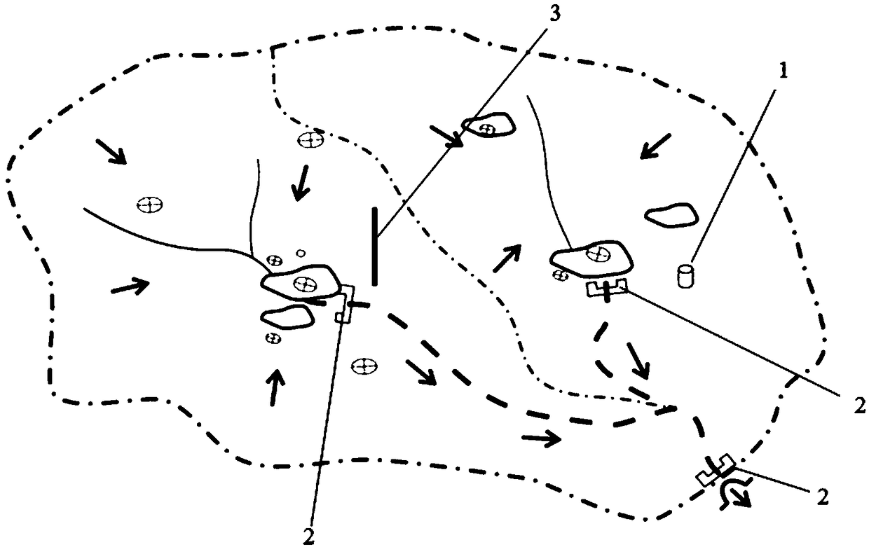
[0040] Refer to attached figure 2 , specifically, the karst water system is classif...
Embodiment 2
[0080] The method of Embodiment 1 of the present invention is used to predict the water gushing situation of the Lanhuadong underground river basin system in Furong Town in real time.
[0081] A high-resolution hydrological monitoring method for the Lanhuadong underground river basin system in Furong Town, including the following steps:
[0082] (1) Collect geological data and tunnel alignment data in the Furong Town area, and conduct preliminary analysis to determine the appropriate scope of the survey area; the geological conditions in the Furong Town area are complex, and karst and groundwater are strongly developed. Developed, rich in groundwater, there is the possibility of tunnel water inrush, and the environmental hydrogeological conditions are relatively sensitive, so it is a very high-risk project;
[0083] (2) Field comprehensive surveys based on the karst assemblage in the Furong Town area, to find out the history of karst development in the study area, the type of ...
PUM
| Property | Measurement | Unit |
|---|---|---|
| Thickness | aaaaa | aaaaa |
| Thickness | aaaaa | aaaaa |
Abstract
Description
Claims
Application Information
 - R&D
- Intellectual Property
- Life Sciences
- Materials
- Tech Scout
- Unparalleled Data Quality
- Higher Quality Content
- 60% Fewer Hallucinations
Browse by: Latest US Patents, China's latest patents, Technical Efficacy Thesaurus, Application Domain, Technology Topic, Popular Technical Reports.
© 2025 PatSnap. All rights reserved.Legal|Privacy policy|Modern Slavery Act Transparency Statement|Sitemap|About US| Contact US: help@patsnap.com


