
A vehicle relative position estimation method based on high-speed visual feature point matching

A technology of visual features and relative positions, applied in image data processing, instruments, character and pattern recognition, etc., can solve problems such as difficulties

Inactive Publication Date: 2019-01-18
WUHAN KOTEI INFORMATICS
View PDF10 Cites 6 Cited by
  • Summary
  • Abstract
  • Description
  • Claims
  • Application Information

AI Technical Summary

Problems solved by technology

However, when surrounded by moving vehicles, most of the field of view is occupied by moving objects, and in tunnels where there are few surrounding objects that can be used as feature objects, it is very difficult to estimate your own position with high accuracy.

Method used


Image

  • A vehicle relative position estimation method based on high-speed visual feature point matching
  • A vehicle relative position estimation method based on high-speed visual feature point matching

Examples


Embodiment Construction

[0039] The principles and features of the present invention are described below in conjunction with the accompanying drawings, and the examples given are only used to explain the present invention, and are not intended to limit the scope of the present invention.

[0040] figure 1 It is a flow chart of the method of the embodiment of the present invention. Such as figure 1 As shown, the present invention provides a method for inferring the relative position of a vehicle based on high-speed visual feature point matching, including:

[0041] Step 1. Install a high-speed ground camera with a frame rate of not less than 500fps, which needs to be vertical to the ground; use the data collected by the camera to calculate the position of the vehicle, and solve the position estimation of the scene without satellite positioning signals. Use the vertical downward camera to solve the situation where most of the field of view is occupied by moving objects. Use a high-speed camera to sol...


PUM


Abstract

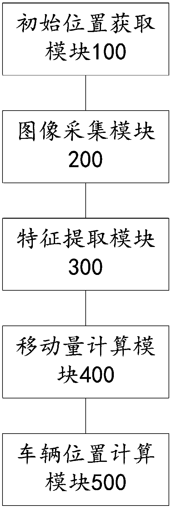
The invention relates to a method and a system for estimating the relative position of a vehicle based on high-speed visual characteristic point matching, which includes: utilizing a high-speed camerato capture a video image to the ground under the vehicle and extracting video frame characteristic points; calculating a moving amount of the current frame relative to the previous frame according tothe video frame characteristic points of the previous two frames; calculating the position of the vehicle in the current frame according to the heading angle, longitude and latitude of the vehicle atthe previous time, and the amount of movement between the two images. The invention adopts a downward-arranged high-speed camera, takes a road surface image as a reference, adopts an ORB feature matching algorithm, and performs self-position estimation, thereby improving position estimation accuracy.

Description

technical field [0001] The invention relates to the technical field of unmanned driving and image recognition, in particular to a method for estimating relative positions of vehicles based on high-speed visual feature point matching. Background technique [0002] The most widely used self-position estimation for vehicles is the Global Positioning Satellite System (GNSS: Global Navigation Satellite System) using navigation satellites. , almost no signal. [0003] In dead reckoning, wheel odometry is widely used using encoder information attached to the wheel, but when the wheel slips or idling occurs, the estimation accuracy will be significantly reduced. Therefore, for the robustness of these problems, this patent focuses on a method called Visual Odometry using a camera. There have been a lot of researches related to Visual Odometry in recent years, but most of them are based on the front camera and the non-moving points in the surrounding environment as references (featu...

Claims


Application Information

Patent Timeline
Patent Type & Authority Applications(China)
IPC IPC(8): G06K9/46G06K9/62G06T7/73
CPCG06T7/73G06V10/462G06F18/22
Inventor 王婷蔡幼波张盈婷卫扬道
Owner WUHAN KOTEI INFORMATICS
Learn More