Drone and multi-sensor fusion positioning method for bridge three-dimensional cruise detection
A multi-sensor fusion and UAV technology, which is applied in the field of UAV positioning, can solve the problems of low UAV accuracy and unstable satellite signals, and achieve the effect of reducing the amount of calculation and improving the positioning accuracy.
- Summary
- Abstract
- Description
- Claims
- Application Information
AI Technical Summary
Problems solved by technology
Method used
Image
Examples
Embodiment Construction
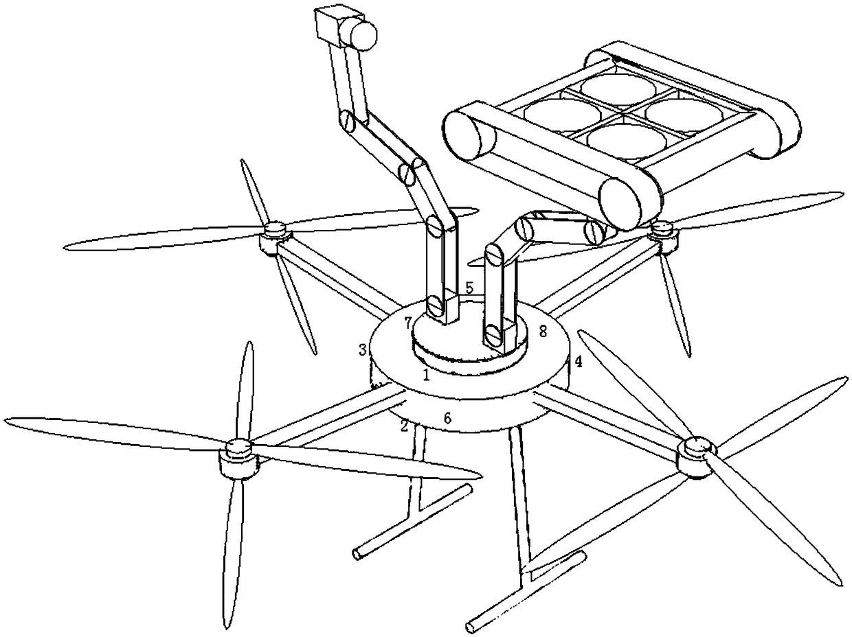
[0045] An unmanned aerial vehicle for three-dimensional cruise detection of bridges, characterized in that: the unmanned aerial vehicle includes a controller and k kinds of positioning sensors, and each positioning sensor is connected to the signal input end of the controller; A multi-sensor fusion positioning program is configured, and the multi-sensor fusion positioning program is used to perform coordinate data fusion on the three-dimensional coordinates of the same point according to m types of sensors, 1<m≤k, so as to output the spatial coordinates of the current cruising of the drone.
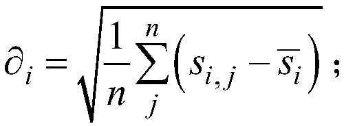
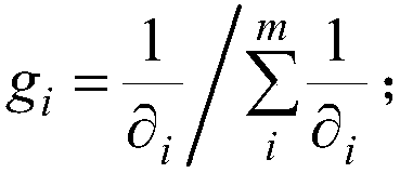
[0046] In this specific embodiment, the multi-sensor fusion positioning program calculates the coordinates of the same point in the X, Y, and Z three-axis directions according to the following steps:
[0047] Step 101: Calculate the coordinate standard deviation of each sensor in the m kinds of sensors on the same point and the same direction, according to the following formula:
[0048] ...
PUM
 Abstract
Description
Claims
Application Information
 - R&D
- Intellectual Property
- Life Sciences
- Materials
- Tech Scout
- Unparalleled Data Quality
- Higher Quality Content
- 60% Fewer Hallucinations
Browse by: Latest US Patents, China's latest patents, Technical Efficacy Thesaurus, Application Domain, Technology Topic, Popular Technical Reports.
© 2025 PatSnap. All rights reserved.Legal|Privacy policy|Modern Slavery Act Transparency Statement|Sitemap|About US| Contact US: help@patsnap.com


