
Traffic state prediction method for urban road network based on key road sections

A prediction method and traffic state technology, applied in the traffic field, can solve the problems of long training time and low prediction efficiency

Inactive Publication Date: 2019-01-29
BEIHANG UNIV
View PDF5 Cites 70 Cited by
  • Summary
  • Abstract
  • Description
  • Claims
  • Application Information

AI Technical Summary

Problems solved by technology

[0006] The purpose of the present invention is to overcome the problems of long training time and low prediction efficiency existing in deep learning, fully excavate the time-space correlation characteristics of road network traffic, identify key road sections that have a greater impact on adjacent road sections and regional road network conditions, and propose a A Forecasting Method for Predicting Road Network Traffic State Using Spatial-Temporal Characteristics of Key Road Sections

Method used


Image

  • Traffic state prediction method for urban road network based on key road sections
  • Traffic state prediction method for urban road network based on key road sections
  • Traffic state prediction method for urban road network based on key road sections

Examples


Embodiment Construction

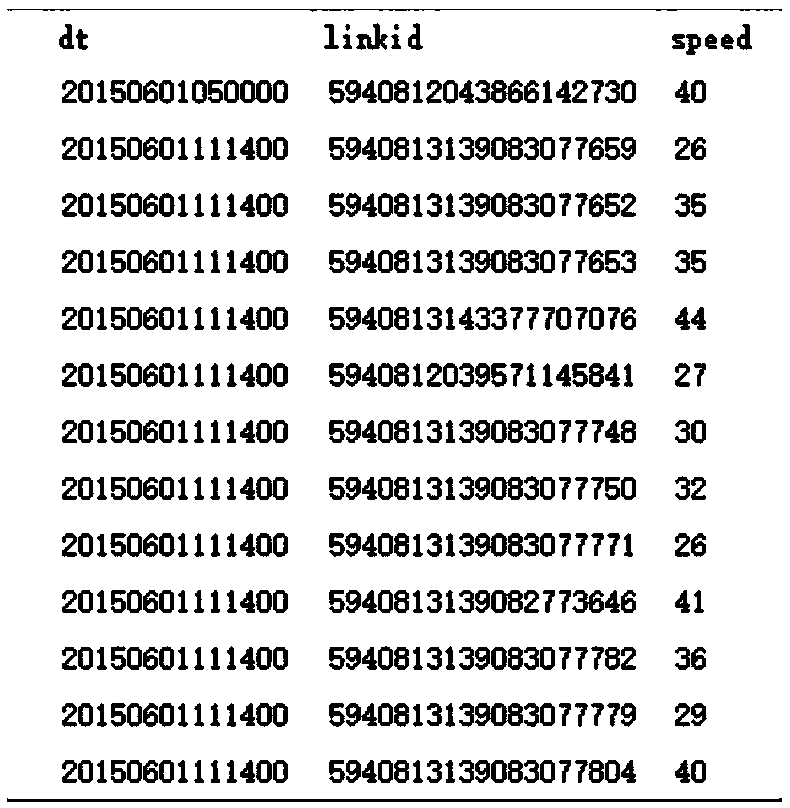
[0071] The present invention will be described in detail below in conjunction with actual data. It should be noted that the data used is the data of floating cars in a certain area of ​​Beijing provided by a certain company, including 278 road sections, and the sampling frequency of the data is 2 minutes, including 92 days in June, July and August. data. For the convenience of calculation, the data from 6:00 to 23:00 every day is screened, that is, the nighttime operation period with small traffic flow is excluded.

[0072] The realization route of the present invention comprises the following steps:

[0073] Step 1: Data preprocessing. Clean the original data, calculate the average speed of each road section, match it to the road section, and select the road network to be studied.

[0074] In order to obtain accurate floating car data, it is first necessary to preprocess the original data. Simply put, the wrong data is deleted, and the missing data is filled by linear inte...


PUM


Abstract

The invention discloses a traffic state prediction method for the urban road network based on key road sections, which is characterized by comprising the steps of first, carrying out data preprocessing; second, establishing a spatial weight matrix of the road network; third, establishing a time correlation matrix; fourth, recognizing key road sections by using a time-space correlation matrix; andfifth, establishing a deep convolution neural network, predicting the state of the road network in the future, and carrying out evaluation on a prediction model. The traffic state prediction method predicts the urban traffic flow state from a level of the wide-range road network, thereby being conducive to guiding the traffic flow from a macroscopic perspective, and fully exploring time-space correlation characteristics of the traffic flow. The key road sections in the road network are recognized, so that the training time of the model can be greatly reduced compared with a method of taking historical states of all road sections as input data, and the prediction efficiency is improved; and the convolution neural network is adopted to serve as the prediction model, and the prediction resultis also more accurate.

Description

technical field [0001] The invention relates to the field of traffic. Specifically, it is a method for predicting the overall traffic flow state of the road network by using the spatio-temporal correlation algorithm to identify key road sections from the urban road network. Background technique [0002] The acceleration of my country's urbanization process and the continuous growth of the number of motor vehicles have made the problem of urban traffic network congestion increasingly serious, which has become one of the important factors hindering the healthy and rapid development of cities. Real-time prediction of short-term traffic flow in the urban road network, providing real-time and reliable routes for travelers, improving travel efficiency, and inducing traffic behavior. At the same time, it provides strong technical support for the management department's traffic information service, traffic guidance, traffic control and traffic congestion relief. [0003] With the ...

Claims


Application Information

Patent Timeline
Patent Type & Authority Applications(China)
IPC IPC(8): G08G1/01H04L12/24G06Q50/30G06Q10/04G06N3/04
CPCH04L41/12G06Q10/04G08G1/0104G08G1/0125G06N3/045G06Q50/40
Inventor 王云鹏杨刚于海洋任毅龙季楠张路
Owner BEIHANG UNIV
Learn More