Large data integration method, system and device for spatial planning
A space planning and integration method technology, applied in the field of data processing, can solve problems such as low work efficiency, difficulty in data collection, and increased workload of data collection, so as to achieve the effects of improving work efficiency, ensuring timeliness, and reducing complexity
- Summary
- Abstract
- Description
- Claims
- Application Information
AI Technical Summary
Problems solved by technology
Method used
Image
Examples
Embodiment Construction
[0062] The present invention will be further explained and described below in conjunction with the accompanying drawings and specific embodiments of the description. For the step numbers in the embodiments of the present invention, they are only set for the convenience of illustration and description, and there is no limitation on the order of the steps. The execution order of each step in the embodiments can be performed according to the understanding of those skilled in the art Adaptive adjustment.
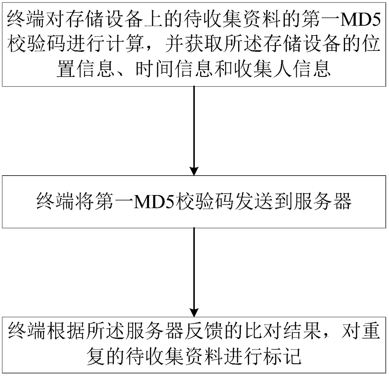
[0063] refer to figure 1 , preferred embodiment 1 of the present invention provides a big data integration method for spatial planning, comprising the following steps:
[0064] S101. The user inputs a user name and a password to log in to the terminal;
[0065] S102, input the item number, and insert the storage device;
[0066] S103. The storage device generates a folder directory according to the item type, stores the data to be collected in the folder directory, and uninst...
PUM
 Abstract
Description
Claims
Application Information
 - R&D
- Intellectual Property
- Life Sciences
- Materials
- Tech Scout
- Unparalleled Data Quality
- Higher Quality Content
- 60% Fewer Hallucinations
Browse by: Latest US Patents, China's latest patents, Technical Efficacy Thesaurus, Application Domain, Technology Topic, Popular Technical Reports.
© 2025 PatSnap. All rights reserved.Legal|Privacy policy|Modern Slavery Act Transparency Statement|Sitemap|About US| Contact US: help@patsnap.com


