A vegetation coverage extraction method and system
A technology of vegetation coverage and extraction method, which is applied in the field of vegetation coverage extraction method and system, can solve the problems of affecting vegetation coverage and failing to maintain camera stability, and achieve the effect of ensuring stability and improving extraction accuracy
- Summary
- Abstract
- Description
- Claims
- Application Information
AI Technical Summary
Problems solved by technology
Method used
Image
Examples
Embodiment 1
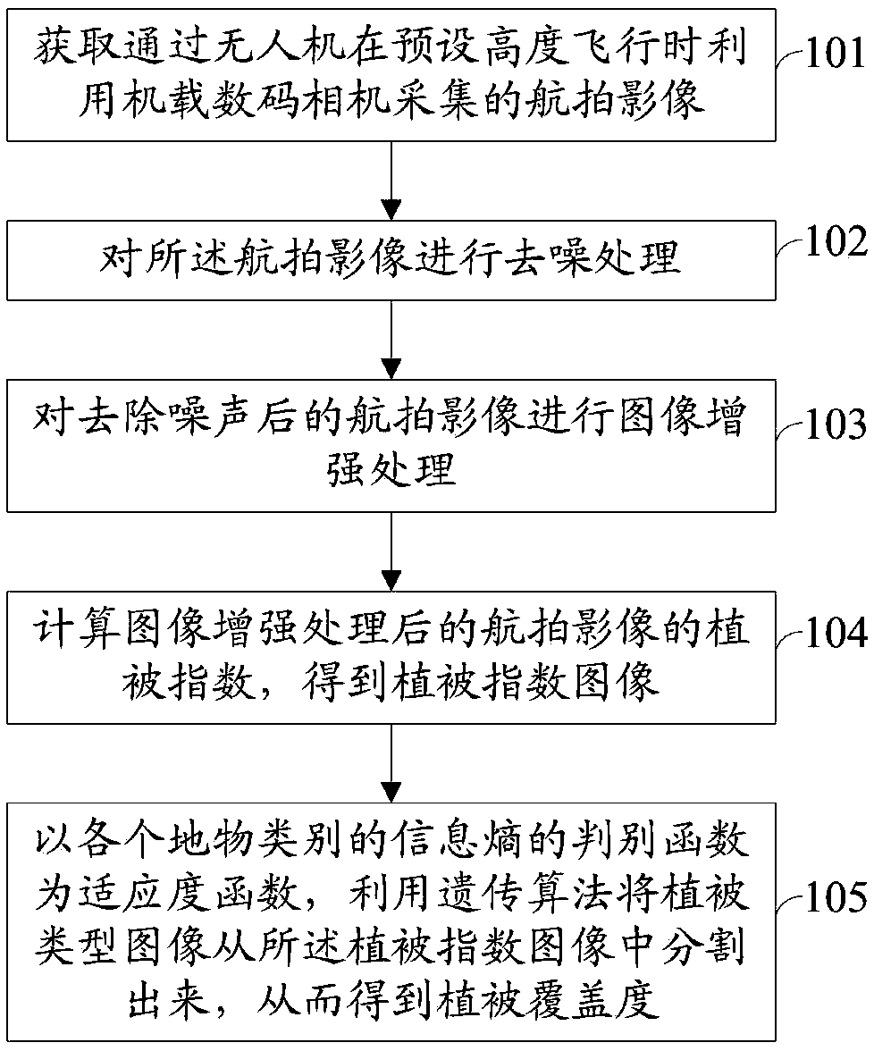
[0049] figure 1 It is a method flowchart of an embodiment of the vegetation coverage extraction method of the present invention.
[0050] see figure 1 , the vegetation coverage extraction method includes:
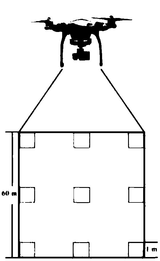
[0051] Step 101: Acquiring aerial images captured by the on-board digital camera when the drone is flying at a preset altitude. As a specific implementation manner, the quadrat size of the aerial image taken by the digital camera is 60m×60m. The UAV flies about 100m above the sample quadrat to obtain the UAV aerial photography remote sensing data. The geographic coordinates of each plot were recorded using GPS.
[0052] Taking the Hulunbuir Grassland in Inner Mongolia as an example, the vegetation types and growth conditions in this area are diverse, and the underlying surface is relatively complex. Vegetation coverage is high.
[0053] figure 2It is the layout map of quadrats during the image collection of Hulunbuir Grassland in Inner Mongolia according to the embo...
Embodiment 2
[0141] Figure 5 It is a system structure diagram of an embodiment of the vegetation coverage extraction system of the present invention.
[0142] see Figure 5 , the vegetation coverage extraction system includes:
[0143] The image acquisition module 201 is used to acquire aerial images captured by the on-board digital camera when the drone is flying at a preset altitude.
[0144] The denoising module 202 is configured to perform denoising processing on the aerial image.
[0145] The denoising module 202 specifically includes:
[0146] The impulse noise filtering unit is used to eliminate the impulse noise in the aerial image by using the switch median filtering method; the Gaussian noise filtering unit is used to eliminate the Gaussian noise in the aerial image by using the wavelet transform method based on Wiener filtering .
[0147] The image enhancement module 203 is configured to perform image enhancement processing on the aerial image after noise removal.
[0148...
PUM
 Abstract
Description
Claims
Application Information
 - R&D
- Intellectual Property
- Life Sciences
- Materials
- Tech Scout
- Unparalleled Data Quality
- Higher Quality Content
- 60% Fewer Hallucinations
Browse by: Latest US Patents, China's latest patents, Technical Efficacy Thesaurus, Application Domain, Technology Topic, Popular Technical Reports.
© 2025 PatSnap. All rights reserved.Legal|Privacy policy|Modern Slavery Act Transparency Statement|Sitemap|About US| Contact US: help@patsnap.com


