Building index construction and building area rapid extraction method for inhibiting bare land

A technology of building areas and extraction methods, applied in image data processing, image analysis, instruments, etc., can solve problems such as heavy workload, easy confusion, cumbersome threshold selection work, etc., to achieve improved accuracy and efficiency, high classification accuracy, and improved Effect of Classification Processing Efficiency

Active Publication Date: 2019-05-24
CHONGQING UNIV OF POSTS & TELECOMM
View PDF10 Cites 2 Cited by
  • Summary
  • Abstract
  • Description
  • Claims
  • Application Information

AI Technical Summary

Problems solved by technology

This paper proposes a method to improve the accuracy and efficiency of building area classification and extraction, and solve the problems of existing indexes or models that are easy to confuse building areas with bare land, threshold selection is cumbersome, and the workload is heavy. Building index construction and construction fast extraction method

Method used


Image

  • Building index construction and building area rapid extraction method for inhibiting bare land
  • Building index construction and building area rapid extraction method for inhibiting bare land
  • Building index construction and building area rapid extraction method for inhibiting bare land

Examples


Embodiment

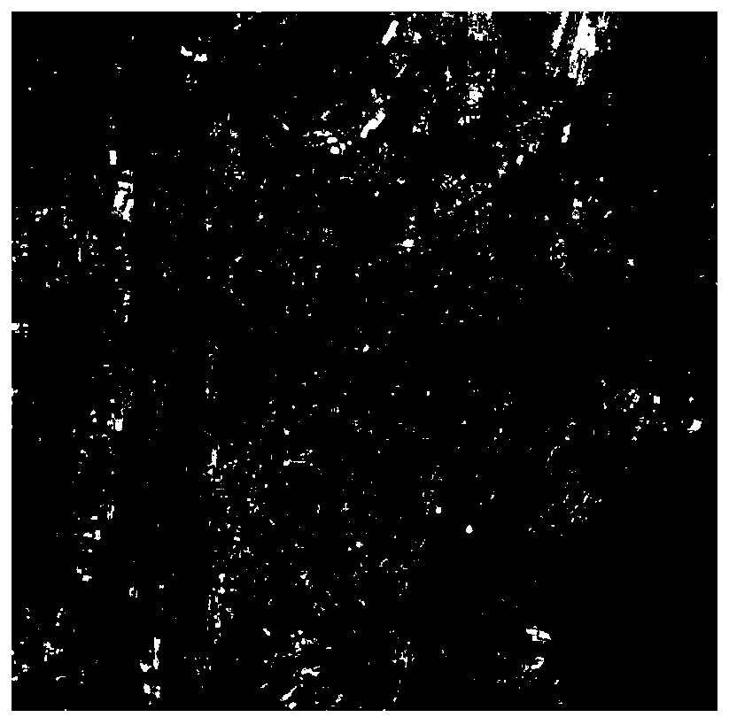
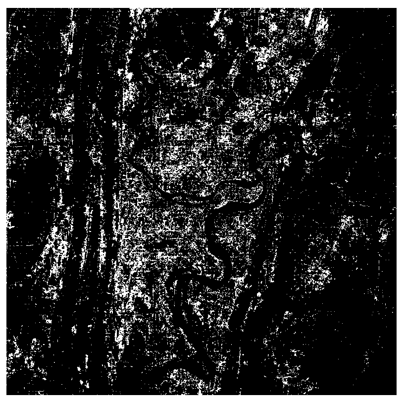
[0035] Embodiment: As shown in the figure, the following steps are used to obtain the building area information data of Chongqing

[0036] (1) Use ENVI 5.1 software to perform radiometric calibration, FLAASH atmospheric correction, and clipping preprocessing on Landsat OLI multispectral raw data, including the following specific content:

[0037] (11) Radiometric calibration of Landsat OLI raw data using remote sensing image processing software;

[0038] (12) Use remote sensing image processing software to carry out FLAASH module atmospheric correction to the multispectral data after calibration in step (11);

[0039] (13) For the data after atmospheric correction in step (12), according to the scope of target area, carry out clipping processing, obtain the complete multispectral data of target area;

[0040] (2) For Landsat OLI multispectral data, as shown in the following table:

[0041] Considering the relationship between the objects in the second, third, fourth, fifth, ...


PUM


Abstract

The invention requests to protect a building index construction and building rapid extraction method based on a Landsat OLI multispectral image, and the method comprises the following steps: 1), carrying out the preprocessing of Landsat OLI multispectral data, including radiation calibration, geometric correction, atmospheric correction, and cutting; 2) constructing a building index model which comprises two secondary indexes; 3) selecting an optimal threshold value for the index model, and extracting building area information; 4) exporting continuous building area information, and generatingbuilding area vector data; And 5) cutting the Landsat OLI multispectral image by using the building area vector data to obtain building area data. According to the building area information extractionmethod, the second waveband information, the third waveband information, the fourth waveband information, the fifth waveband information, the sixth waveband information and the seventh waveband information of the Landsat OLI are comprehensively utilized, images of bare land information are eliminated to the maximum degree, the building area information extraction speed and precision are improved,and related data are provided for subsequent research.

Description

technical field [0001] The invention belongs to the technical field of remote sensing image processing, in particular to a building index construction and building area extraction method based on Landsat OLI multi-spectral images. Background technique [0002] Urban construction land refers to the most basic place where human beings engage in all social and economic activities, carrying the development of regional economy, politics, culture and other fields. The urban built-up area has grown rapidly since 1981, and the urban permanent population also exceeded 50% for the first time in 2011. With the development and progress of society, the rational and effective use of urban construction land has become more and more important, which is directly related to the sustainable development of society. Changes in its area and distribution will have a major impact on the urban ecological environment. Therefore, accurate acquisition and understanding of building land information an...

Claims


Application Information

Patent Timeline
Patent Type & Authority Applications(China)
IPC IPC(8): G06T7/136
Inventor 罗小波邓陆
Owner CHONGQING UNIV OF POSTS & TELECOMM
Why Eureka
Try Eureka