Multi-angle remote sensing image forest height extraction method based on convolutional neural network
A convolutional neural network and remote sensing image technology, applied in the field of deep learning and forestry, can solve difficult, time-consuming and labor-intensive acquisition problems
- Summary
- Abstract
- Description
- Claims
- Application Information
AI Technical Summary
Problems solved by technology
Method used
Image


Examples
Embodiment Construction
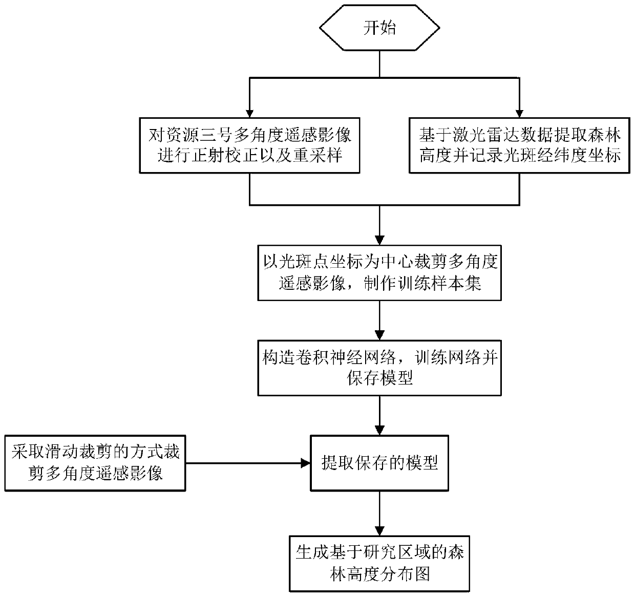
[0033] An example of the present invention provides a method for extracting forest heights from multi-angle remote sensing images based on a convolutional neural network. The present invention will be explained and illustrated below in conjunction with the relevant drawings.
[0034] The data set used in the example of the present invention is the multi-angle remote sensing image of Ziyuan No. 3 in a certain area in 2017, including full-color front view, full-color front view and full-color rear view. The TensorFlow deep learning framework is selected to construct a convolutional neural network model and train the model. Used to generate a forest height distribution map for the study area. The concrete implementation scheme of the example of the present invention is:
[0035] Step 1: Perform orthorectification and resampling on the multi-angle remote sensing image of Ziyuan No. 3; the specific steps include:
[0036] Step 1.1: Obtain the 30m resolution data of ASTER GDEM, the...
PUM
 Abstract
Description
Claims
Application Information
 - R&D
- Intellectual Property
- Life Sciences
- Materials
- Tech Scout
- Unparalleled Data Quality
- Higher Quality Content
- 60% Fewer Hallucinations
Browse by: Latest US Patents, China's latest patents, Technical Efficacy Thesaurus, Application Domain, Technology Topic, Popular Technical Reports.
© 2025 PatSnap. All rights reserved.Legal|Privacy policy|Modern Slavery Act Transparency Statement|Sitemap|About US| Contact US: help@patsnap.com