Carrier navigation attitude measurement method based on geomagnetic information updating

A technology of information update and measurement method, applied in the direction of ground navigation, etc., can solve the problems of weak signal, poor environmental adaptability, slow response speed, etc.

Active Publication Date: 2019-08-06
HEFEI INSTITUTES OF PHYSICAL SCIENCE - CHINESE ACAD OF SCI
View PDF5 Cites 0 Cited by
  • Summary
  • Abstract
  • Description
  • Claims
  • Application Information

AI Technical Summary

Problems solved by technology

[0003] The astronomical measurement system uses the measurement of celestial bodies to realize the output of attitude information, which is greatly affected by the atmosphere and has poor environmental adaptability
The satellite navigation measurement method is based on the positioning technology of the satellite navigation system. It uses two antennas to measure the heading and pitch angle, or three antennas to calculate the heading attitude. Due to the influence of antenna installation position errors and elevation differences, its accuracy will be reduced, and the general accuracy will vary with time. The baseline is lengthened and improved, which is not suitable for use on small-sized equipment; the satellite data output frequency generally does not exceed 10Hz, the response speed is slow, and high-frequency or real-time attitude information cannot be given; in addition, satellite navigation measurement methods need to accept navigation satellites The characteristics of the signal determine that it has the following limitations: (1) The signal is weak and susceptible to interference and spoofing; (2) Due to serious attenuation, it is difficult to reach indoors, jungles, underwater and ground; (3) Navigation satellites are in danger of being attacked
However, changes in the external magnetic environment, such as the existence of ferromagnetic buildings such as magnetic minerals and steel bars, will cause changes in the magnetic declination, which will distort the heading angle information obtained by the electronic compass.

Method used


Image

  • Carrier navigation attitude measurement method based on geomagnetic information updating
  • Carrier navigation attitude measurement method based on geomagnetic information updating
  • Carrier navigation attitude measurement method based on geomagnetic information updating

Examples


Embodiment Construction

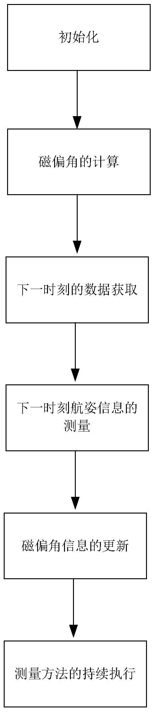
[0094] In order to have a further understanding and understanding of the structural features of the present invention and the achieved effects, a detailed description will be provided in conjunction with preferred embodiments and accompanying drawings, as follows:

[0095] Such as figure 1 Shown, a kind of carrier attitude measurement method based on geomagnetic information update of the present invention, it comprises the following steps:

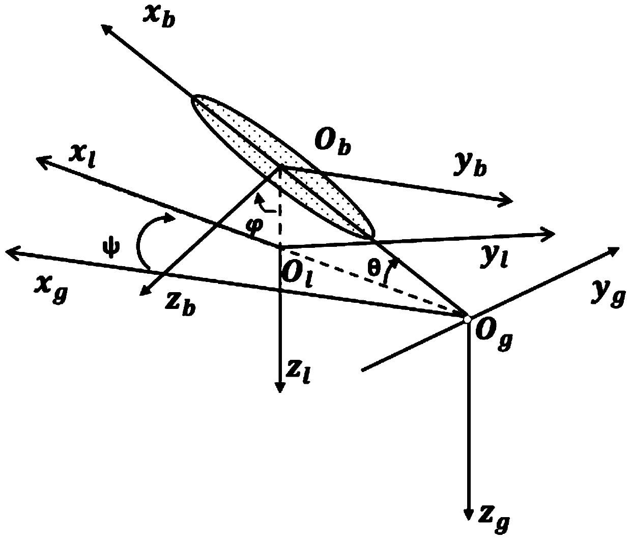
[0096] The first step, initialization: the carrier is in a static state, and based on external input, obtain the heading angle ψ at the current moment t=k k Information; based on the three-axis accelerometer measurement data after calibration, obtain the pitch angle θ at the current moment t=k k roll angle information, the calculation formula is as follows:

[0097]

[0098]

[0099] Among them, θ m,k with Respectively, when the carrier is in a static state, the measurement information of pitch angle and roll angle at the curr...


PUM


Abstract

The invention relates to a carrier navigation attitude measurement method based on geomagnetic information updating. The method comprises: carrying out initialization; calculating a magnetic declination angle; acquiring data at a next time; measuring navigation attitude information at a next time; updating magnetic declination angle information, and performing the measurement method continuously.According to the invention, data are measured based on an accelerometer, a gyroscope and a magnetic sensor; and on the basis of a discretized Kalman filter algorithm, the magnetic declination angle information is estimated and updated in real time. Therefore, a problem that the course angle information distorts and thus is not reliable due to the magnetic declination angle change caused by ferromagnetic materials like magnetic minerals, reinforcing steel bars and the like is solved.

Description

technical field [0001] The invention relates to the technical field of carrier attitude measurement, in particular to a carrier attitude measurement method based on geomagnetic information update. Background technique [0002] The attitude measurement method refers to the measurement of heading angle ψ, pitch angle θ and roll angle Methods. According to the different measurement principles of heading angle ψ, the current attitude measurement methods mainly include: astronomical measurement method, satellite navigation measurement method, inertial measurement method and geomagnetic measurement method. [0003] The astronomical measurement system uses the measurement of celestial bodies to realize the output of attitude information, which is greatly affected by the atmosphere and has poor environmental adaptability. The satellite navigation measurement method is based on the positioning technology of the satellite navigation system. It uses two antennas to measure the headi...

Claims


Application Information

Patent Timeline
IPC IPC(8): G01C21/06
CPCG01C21/06
Inventor 林新华支祖伟刘友江邵叔芳关柯王英先张瑞
Owner HEFEI INSTITUTES OF PHYSICAL SCIENCE - CHINESE ACAD OF SCI
Why Eureka
Try Eureka