Geographical calibration ranging method for single-station optical servo monitoring
A technology of optical monitoring and ranging methods, applied in satellite radio beacon positioning systems, measuring devices, surveying and mapping and navigation, etc., can solve the problems of high cost and inability to measure distances accurately with photoelectric technology
- Summary
- Abstract
- Description
- Claims
- Application Information
AI Technical Summary
Problems solved by technology
Method used
Image
Examples
specific Embodiment approach 1
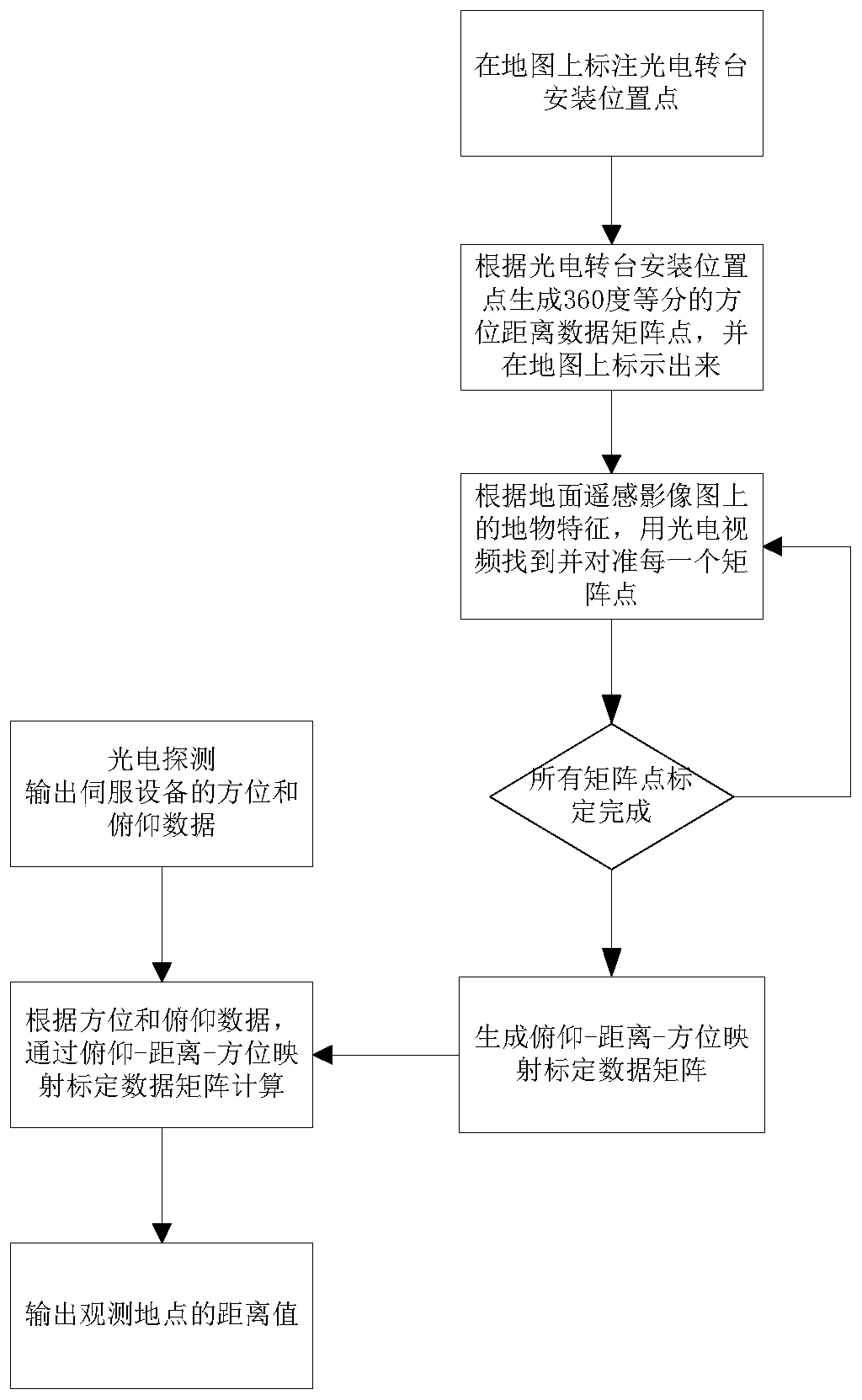
[0018] A geographic calibration ranging method for single-station optical servo monitoring, such as figure 1 shown, including the following steps:
[0019] Step a, fixedly erect a servo turntable optical monitoring equipment, the model of the servo turntable optical monitoring equipment is ARD-PRT-02;
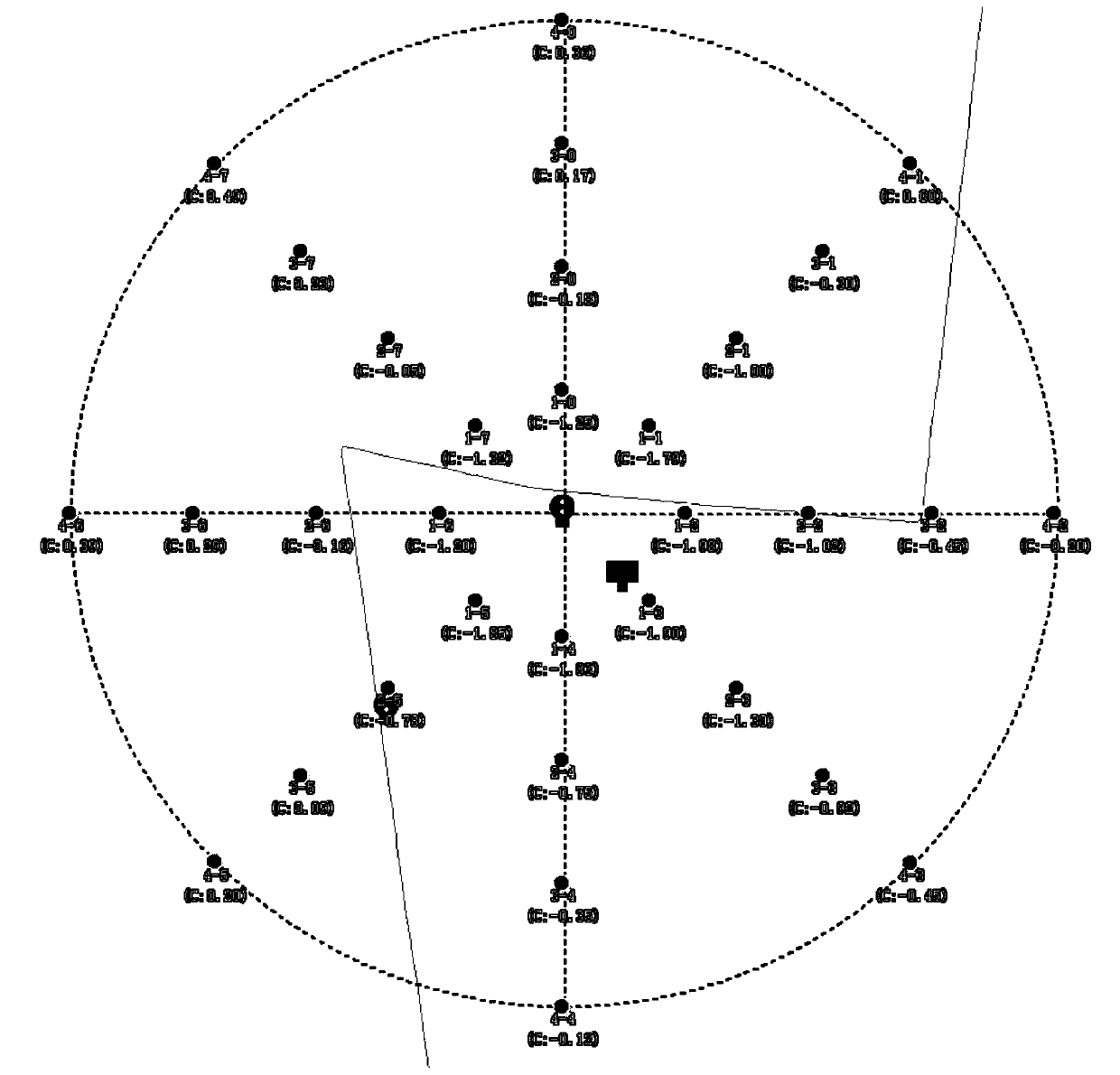
[0020] Step b. Mark the installation location of the servo turntable optical monitoring equipment on the map, generate 360-degree azimuth distance data matrix points equally divided according to the installation location of the servo turntable optical monitoring equipment, and mark it on the map. Ground features, the calibration personnel use the photoelectric video of the blessing turntable optical monitoring equipment to find and align each matrix point, that is, the calibration point, and calibrate all the matrix points, that is, the azimuth and pitch data of ground targets at different distances in different directions, and generate a Refer to the data matrix;
[0021] St...
PUM
 Abstract
Description
Claims
Application Information
 - R&D
- Intellectual Property
- Life Sciences
- Materials
- Tech Scout
- Unparalleled Data Quality
- Higher Quality Content
- 60% Fewer Hallucinations
Browse by: Latest US Patents, China's latest patents, Technical Efficacy Thesaurus, Application Domain, Technology Topic, Popular Technical Reports.
© 2025 PatSnap. All rights reserved.Legal|Privacy policy|Modern Slavery Act Transparency Statement|Sitemap|About US| Contact US: help@patsnap.com


