
Model-independent non-cooperative satellite pose measurement method

A pose measurement, non-cooperative technology, applied in the field of non-cooperative satellite pose measurement that does not depend on the model, can solve the problems of complex methods, not making full use of the structural characteristics of non-cooperative satellites, etc., and achieve the effect of high precision

Active Publication Date: 2019-10-08
NANJING UNIV OF SCI & TECH
View PDF5 Cites 6 Cited by
  • Summary
  • Abstract
  • Description
  • Claims
  • Application Information

AI Technical Summary

Problems solved by technology

The invention patent "Modeling Method of Relative Pose Dynamics Based on the Surface Reference Point of the Failed Satellite" (application number CN201210066492, publication number CN102759358A) provides a method for constructing the target coordinate system of the failed satellite, which requires the calculation of the inertia of the rotation axis Pointing, and using a reference star to establish the target coordinate system, this method does not make full use of the structural characteristics of non-cooperative satellites, and the method is more complicated

Method used

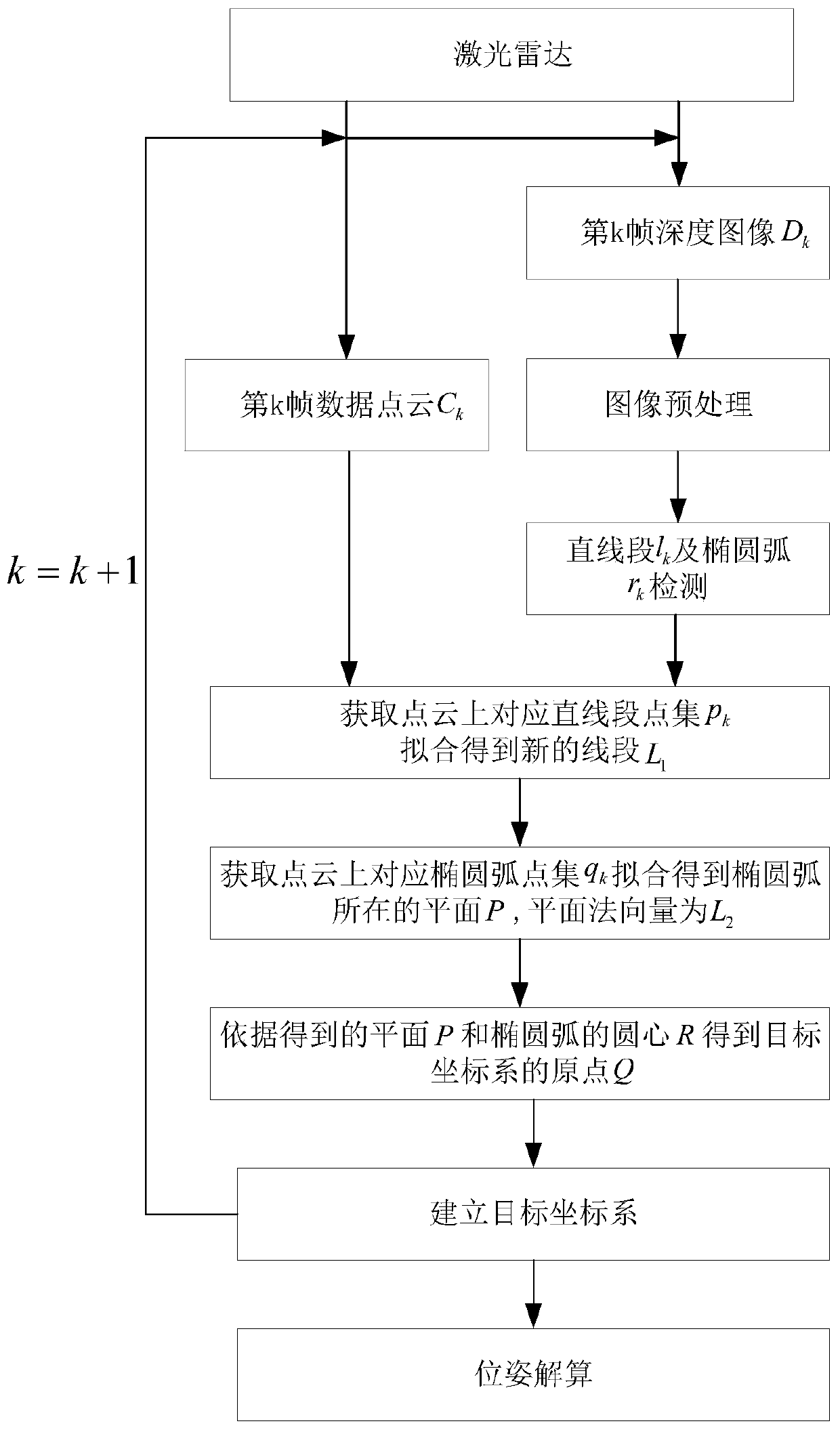
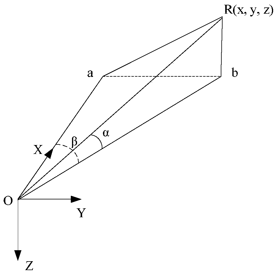
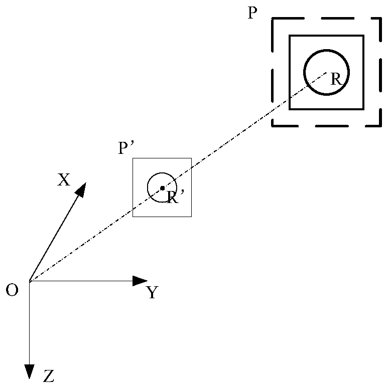

Image

  • Model-independent non-cooperative satellite pose measurement method
  • Model-independent non-cooperative satellite pose measurement method
  • Model-independent non-cooperative satellite pose measurement method

Examples


Embodiment

[0077] In order to illustrate the effectiveness of the algorithm of the present invention and fully demonstrate that the method has more accurate pose acquisition performance, the completed experiment is as follows:

[0078] (1) Experimental initial conditions and parameter settings

[0079] The simulation experiment uses virtual laser radar and target model point cloud, according to the parameters and imaging principle of laser imaging radar, the measurement data of the sensor is generated through software simulation. The parameters of the laser imaging radar are set as follows: resolution 500×500, field of view 20°×20°. The initial position is 8m. The pose change of the relative motion process is set as follows: the amount of translation is to move along the X axis from 8m to 3m at a constant speed of 30mm / s, and the amount of rotation is to rotate around the X axis from 0° to 1.5° / s. There are 7 Nutation changes within °.

[0080] (2) Analysis of experimental results

...


PUM


Abstract

The invention discloses a model-independent non-cooperative satellite pose measurement method. For a completely non-cooperative satellite with the unknown model, a target coordinate system of a non-cooperative satellite is constructed by using a point cloud and a depth map obtained by a laser imaging radar; calculation is performed by using the target coordinate system and a laser imaging radar coordinate system to obtain a relative pose value. The method has the following advantages: the method is suitable for the non-cooperative satellites with the unknown model; the target coordinate systemis constructed only by using a typical single circular part on the satellite and a straight frame of the body. With the disclosed method, the target coordinate system can be stably constructed and the relative pose measurement can be completed with high precision.

Description

technical field [0001] The invention belongs to the technical field of space autonomous navigation, in particular to a model-independent non-cooperative satellite pose measurement method. Background technique [0002] With the development of aerospace technology and the increasing frequency of space activities, more and more failed spacecraft (such as failed satellites, space debris) will cause space orbit congestion, affecting the normal operation of orbiting spacecraft, and on-orbit maintenance or Cleaning up and removing is of great significance to safeguarding normal space activities. How to realize the accurate measurement of short-range relative position and relative attitude parameters (referred to as relative pose) is one of the core problems that must be solved to achieve autonomous approach and relative navigation. For completely non-cooperative satellites with unknown models, due to the lack of priori Information and assisted artificial identification, when measu...

Claims


Application Information

Patent Timeline
Patent Type & Authority Applications(China)
IPC IPC(8): G01S17/89G01S7/48G01C21/24
CPCG01S17/89G01S7/4802G01S7/4808G01C21/24Y02A90/10
Inventor 赵高鹏范佳杰薄煜明王超尘韦雷黄皓冉
Owner NANJING UNIV OF SCI & TECH
Learn More