Floating adjustment method combining GPS and SRTM fusion

A technology of adjustment and adjustment model, which is applied in the field of traveling adjustment combined with GPS and SRTM, can solve problems such as gaps, abnormalities, and affecting data application potential, and achieve the effect of improving elevation accuracy

Active Publication Date: 2019-10-11
CENTRAL SOUTH UNIVERSITY OF FORESTRY AND TECHNOLOGY
View PDF3 Cites 0 Cited by
  • Summary
  • Abstract
  • Description
  • Claims
  • Application Information

AI Technical Summary

Problems solved by technology

However, limited by the radar side-view imaging mode, there are still gaps

Method used


Image

  • Floating adjustment method combining GPS and SRTM fusion
  • Floating adjustment method combining GPS and SRTM fusion
  • Floating adjustment method combining GPS and SRTM fusion

Examples


Embodiment

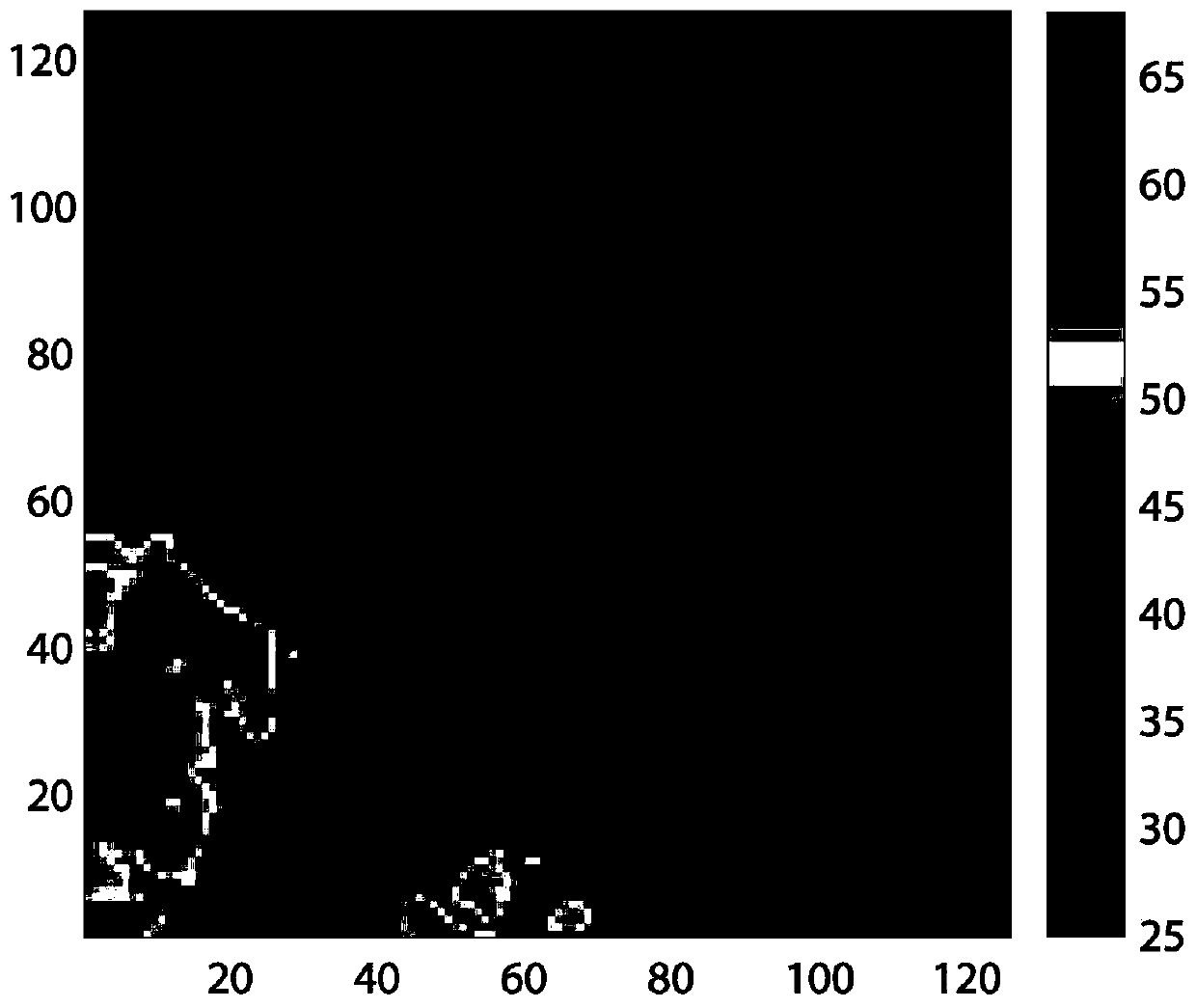
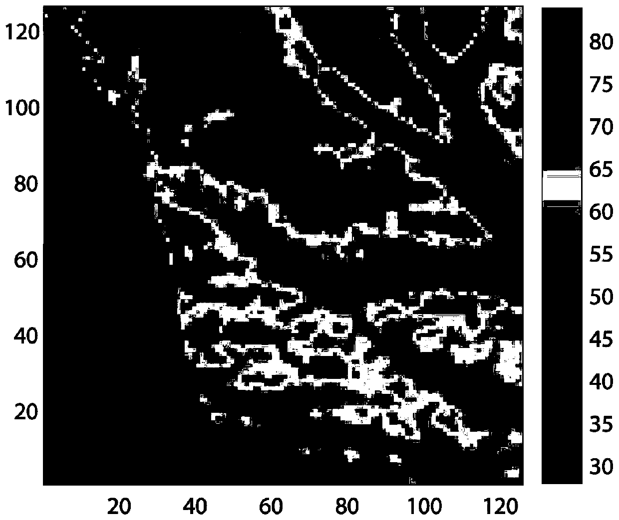
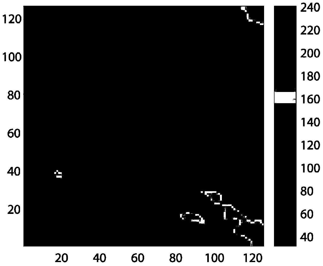
[0051] Select a certain area in China as the research area, download the SRTM data of this area from the website http: / / earthexplorer.usgs.gov / , and then intercept three areas with different geographical characteristics from this area as experimental data, and their size is 128 *128, the slopes of the three areas are 0-10 degrees, 10-20 degrees, and more than 20 degrees, such as Figure 1-Figure 3 The shown areas correspond to flat areas, slope areas, and steep areas, respectively, and the geographical features are very representative. The elevations of known elevation points in this area come from the elevations of a large number of GPS mobile stations in this area recorded by CORS stations. The GPS data set of each research area is divided into two parts: experimental GPS data and verification GPS data, as shown in Table 1. Then, a walk adjustment algorithm is applied to the experimental GPS elevation data of each research area to improve the SRTM image of the corresponding...


PUM


Abstract

The invention discloses a floating adjustment method combining GPS and SRTM fusion. The method comprises the following steps: 1) establishing an adjustment model of a known first GPS point and nine adjacent grids corresponding to an SRTM grid at the first known GPS point; 2) solving the adjustment model to calculate improved elevation values corresponding to the SRTM grid and four angular points;3) taking the four angular points as known values of the next round of improved SRTM, solving a difference value between a new value obtained after adjustment fusion of each layer and an original gridvalue, and if a mean value (threshold value is less than 0.5 m) of the difference values, determining that the algorithm converges; and 4) continuously searching a second known GPS point in the areaoutside the first GPS point, and then carrying out a second round of improvement, the method being consistent with the first GPS point until the fusion of the whole area is completed, and the method can improve the elevation precision of the SRTM of the fusion area.

Description

technical field [0001] The invention relates to an image processing method, in particular to a traveling adjustment method combined with GPS and SRTM fusion. Background technique [0002] Digital Elevation Model (DEM for short) is a digital expression of surface relief and is also an important basic data for various geoscience analysis. It has been widely used in earthquakes, volcanoes, landslides, land subsidence, flood disasters and military affairs. field. With the continuous development of earth observation technology, the ability to obtain DEM data is increasing, and the demand for high-quality DEM in various research fields is also increasing. At present, DEM data acquisition methods mainly include field survey, photogrammetry and remote sensing, cartography digitization, synthetic aperture radar and airborne laser scanning. Today, there is a significant advantage to using satellite imagery to generate a DEM as it is relatively cheap and takes less time to generate a...

Claims


Application Information

Patent Timeline
IPC IPC(8): G06T17/05G06K9/62
CPCG06T17/05G06T2207/30181G06T2207/10032G06T2207/10044G06F18/25
Inventor 周璀张贵朱建军李卫刘志卫张智填
Owner CENTRAL SOUTH UNIVERSITY OF FORESTRY AND TECHNOLOGY
Why Eureka
Try Eureka