Three-dimensional Oil Spill Operational Emergency Forecasting and Evaluation System in the Northwest Pacific Ocean
An evaluation system and oil spill technology, which is applied in the short-term, medium- and long-term prediction of three-dimensional numerical simulation of deep-sea waters, and numerical simulation of marine oil spill drift and diffusion.
- Summary
- Abstract
- Description
- Claims
- Application Information
AI Technical Summary
Problems solved by technology
Method used
Image
Examples
Embodiment 1
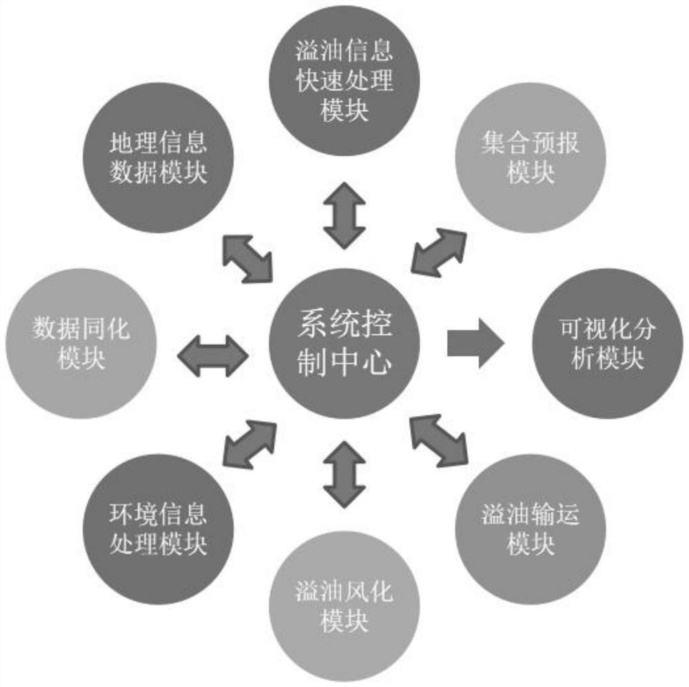
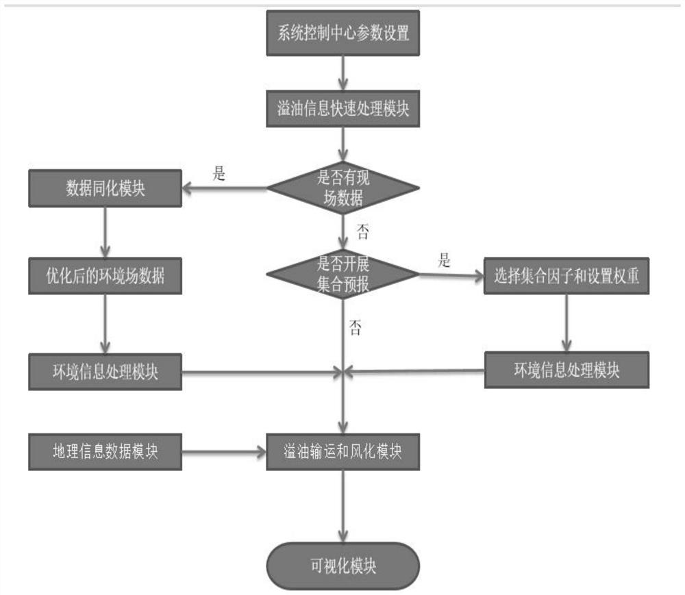
[0153] The embodiment of the present invention provides a three-dimensional oil spill operational emergency forecast and evaluation system in the Northwest Pacific Ocean, and realizes the operational operation of the system. For the system structure, see figure 1 , see the business operation process figure 2 . The specific implementation of the system includes the following steps:
[0154] 1. System Control Center
[0155] This module is the control command center and data exchange center, and controls the other 8 modules. Before starting the system, set the important parameters of the system control center manually or by default, such as manually selecting the processing method of oil spill source information, manually selecting whether to start the assimilation module, manually selecting whether to start the collective forecast module, manually or by default to external Select the forced field file and input oil spill parameters, send instructions to the visualization m...
Embodiment 2
[0271] At 20:15 on January 6, 2018, Panamanian-registered oil tanker "Sanji" and Hong Kong-registered bulk carrier "Changfeng Crystal" were at 124°56.7′ east longitude and 30°42.7′N latitude in the open sea off the Yangtze River Estuary. A ship collision occurred, 32 people fell into the water, oil pollution spread, and the "Sanchi" tanker caught fire. At 16:45 on January 14, the oil tanker sank at a position of 125°58.4' east longitude and 28°21.9' north latitude, and the oil spilled from the ship was still burning in the sunken sea area. At 09:58 on the 15th, all the open fires on the scene disappeared, and a large area of oil pollution began to drift on the sea surface. By January 25, the oil pollution on the sea surface monitored by satellites had turned to sporadic distribution. Using this system, the oil spill drift trajectory and spread prediction of this oil spill accident was carried out based on the on-site reported shipwreck position and the oil spill position in ...
PUM
 Abstract
Description
Claims
Application Information
 - R&D
- Intellectual Property
- Life Sciences
- Materials
- Tech Scout
- Unparalleled Data Quality
- Higher Quality Content
- 60% Fewer Hallucinations
Browse by: Latest US Patents, China's latest patents, Technical Efficacy Thesaurus, Application Domain, Technology Topic, Popular Technical Reports.
© 2025 PatSnap. All rights reserved.Legal|Privacy policy|Modern Slavery Act Transparency Statement|Sitemap|About US| Contact US: help@patsnap.com


