
Watershed hydrological simulation method integrating satellite remote sensing and machine learning technologies

A technology of satellite remote sensing and machine learning, applied in neural learning methods, instruments, biological neural network models, etc., can solve problems such as low spatial resolution, limited quality and length of meteorological data, failure to consider runoff simulation errors, etc., to achieve Overcome the effect of low spatial resolution

Active Publication Date: 2019-11-12
WUHAN UNIV
View PDF10 Cites 17 Cited by
  • Summary
  • Abstract
  • Description
  • Claims
  • Application Information

AI Technical Summary

Problems solved by technology

However, the above methods are limited by the quality and length of meteorological data in the reference watershed. It is often difficult to obtain complete meteorological observation data in areas with scarce data, and it is difficult to realize long series of runoff simulations.
[0005]Satellite remote sensing mainly realizes the measurement of meteorological data through the sensors carried by meteorological satellites, but satellite remote sensing technology has the problems of large grid scale and low spatial resolution. It is difficult to directly meet the actual requirements, how to make reasonable use of satellite telemetry data becomes the key to hydrological simulation of watersheds in data-scarce areas
At the same time, the hydrological model is suitable for simulating the runoff process in the natural state. Engineering measures such as dams, reservoirs, agricultural irrigation, water diversion, and cross-basin water transfer often destroy the consistency of the underlying surface, resulting in large errors in the hydrological model of the basin. Restricts the accuracy of hydrological simulation
Existing literature fails to make full use of satellite telemetry meteorological information, fails to consider the error caused by human activity interference on runoff simulation, and fails to solve the long series of runoff simulation problems in areas with scarce data

Method used


Image

  • Watershed hydrological simulation method integrating satellite remote sensing and machine learning technologies
  • Watershed hydrological simulation method integrating satellite remote sensing and machine learning technologies
  • Watershed hydrological simulation method integrating satellite remote sensing and machine learning technologies

Examples


Embodiment Construction

[0042] In order to make the object, technical solution and advantages of the present invention clearer, the present invention will be further described in detail below in conjunction with the accompanying drawings and embodiments. It should be understood that the specific embodiments described here are only used to explain the present invention, not to limit the present invention.

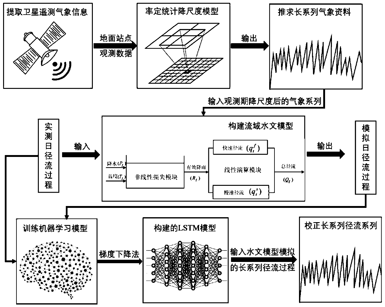
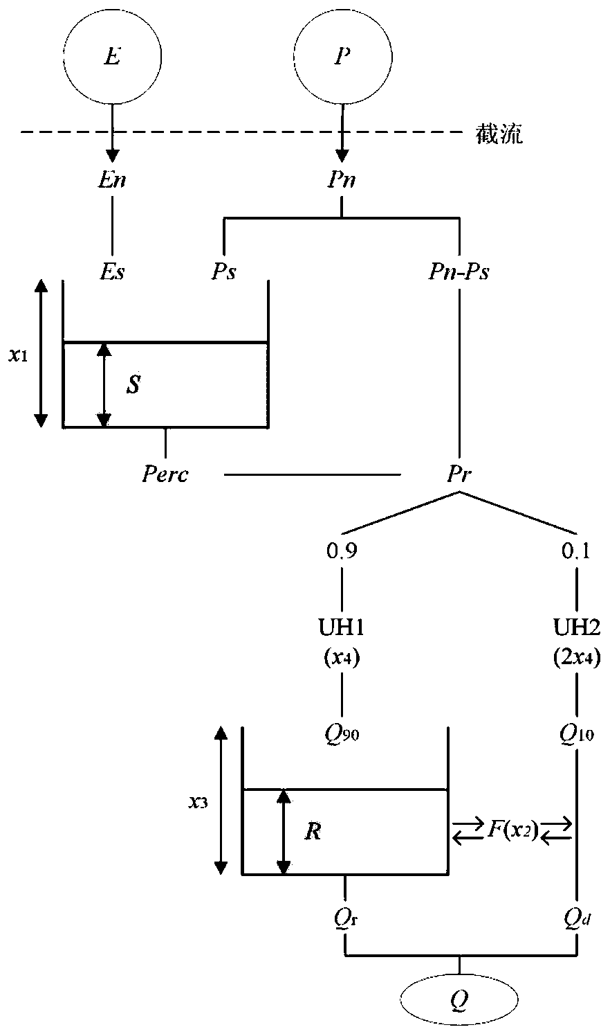
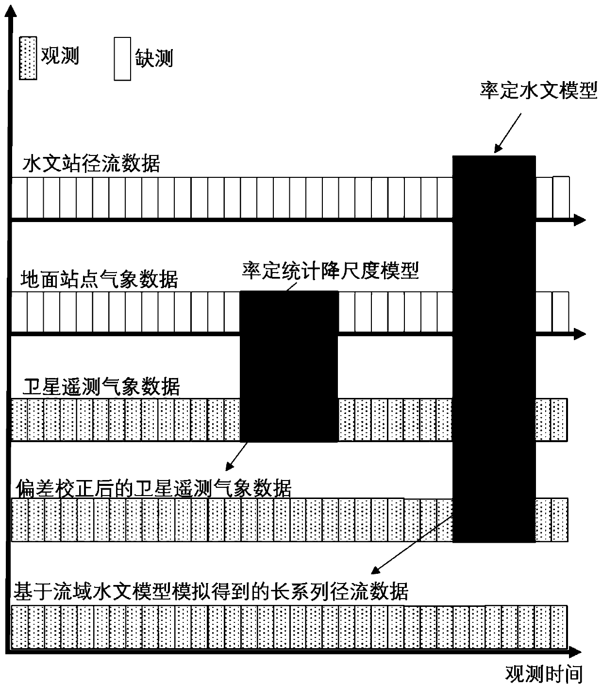
[0043] In the watershed hydrological simulation method that integrates satellite remote sensing and machine learning technology in the embodiment of the present invention, firstly, the statistical downscaling model is established by using the limited observation data of ground meteorological stations in data-scarce areas and the large-scale grid data of satellite remote sensing, so as to obtain a long series of meteorological data Observational data; based on the short series of runoff observation data and downscaled meteorological data in areas with scarce data, a hydrological model of the basin is...


PUM


Abstract

The invention discloses a watershed hydrological simulation method integrating satellite remote sensing and machine learning technologies, and the method comprises the following steps: building a statistical downscaling model through the limited observation data of a ground meteorological station in a scarce data region and the large-scale raster data of satellite remote sensing, and obtaining a long series of meteorological observation data; establishing a basin hydrological model based on the short-series runoff observation data of the scarce data area and the downscaled meteorological datato realize preliminary runoff simulation; constructing a long-term and short-term memory neural network model to correct the preliminary simulated runoff so as to reduce simulation errors caused by human activities and water conservancy projects; and inputting the obtained long-series meteorological observation data into the established basin hydrological model and the long-short-term memory neural network model, and simulating a long-series runoff process. According to the method, long-series runoff simulation of regions with scarce data can be realized, and an important reference basis withhigh operability can be provided for basin water resource management and planning.

Description

technical field [0001] The invention relates to the technical field of watershed hydrological simulation, in particular to a watershed hydrological simulation method that integrates satellite remote sensing and machine learning technologies. Background technique [0002] Hydrometeorological data are the basic basis for project planning, design, construction and operation management, and are also important data for assessing the flood control risk of water conservancy projects in the basin. However, hydrometeorological data are extremely scarce in most areas of my country, and some areas have only a small amount of measured hydrometeorological data. Therefore, how to do a good job in watershed hydrological simulation in areas with scarce data is a major challenge for hydrologists. [0003] Watershed hydrological model is one of the most important branches of hydrological science. It is the main tool for studying hydrological natural laws and solving hydrological practical pro...

Claims


Application Information

Patent Timeline
Patent Type & Authority Applications(China)
IPC IPC(8): G06F17/50G06N3/04G06N3/08
CPCG06N3/08G06N3/045G06N3/044Y02A10/40Y02A90/10
Inventor 尹家波郭生练巴欢欢顾磊邓乐乐李千珣
Owner WUHAN UNIV
Learn More