Geologic body variable attribute interpolation method and system
An interpolation method, a technology of geological bodies, applied in image data processing, instrumentation, design optimization/simulation, etc., can solve problems such as non-conformity, and achieve the effects of rapid attribute modeling, strong practicability, and high modeling efficiency
- Summary
- Abstract
- Description
- Claims
- Application Information
AI Technical Summary
Problems solved by technology
Method used
Image
Examples
Embodiment
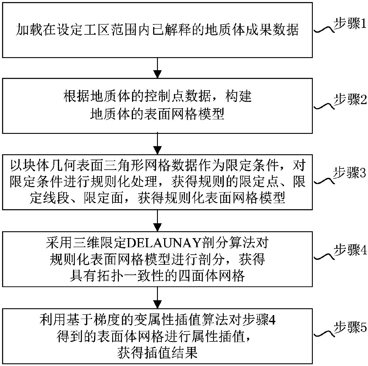
[0108] figure 1 A flow chart of a geological volume variable attribute interpolation method according to an embodiment of the present invention is shown.
[0109] Such as figure 1 As shown, the interpolation method of geological volume change attributes includes:
[0110] Step 1: Load the geological body result data that has been explained within the set work area;
[0111] Step 2: Construct the surface grid model of the geological body according to the control point data of the geological body;
[0112] Among them, the geometric modeling method is used to construct the surface mesh model of complex geological bodies. The geometric modeling methods include: two-dimensional limited Delaunay subsection, surface intersection, surface stitching and complex geological body fast tracking method;
[0113] Step 3: Taking the triangular mesh data of the geometric surface of the block as the limiting condition, regularize the limiting condition, obtain regular limiting points, limiti...
PUM
 Abstract
Description
Claims
Application Information
 - R&D
- Intellectual Property
- Life Sciences
- Materials
- Tech Scout
- Unparalleled Data Quality
- Higher Quality Content
- 60% Fewer Hallucinations
Browse by: Latest US Patents, China's latest patents, Technical Efficacy Thesaurus, Application Domain, Technology Topic, Popular Technical Reports.
© 2025 PatSnap. All rights reserved.Legal|Privacy policy|Modern Slavery Act Transparency Statement|Sitemap|About US| Contact US: help@patsnap.com


