Full-link photon counting laser altimeter point cloud generation method

A laser altimeter and photon counting technology, applied in the field of data simulation, can solve the problems of difficult parameter adjustment, accurate point cloud data generation and low efficiency

Active Publication Date: 2020-04-14
WUHAN UNIV
View PDF6 Cites 9 Cited by
  • Summary
  • Abstract
  • Description
  • Claims
  • Application Information

AI Technical Summary

Problems solved by technology

[0006] In view of this, the present invention provides a full-link photon counting laser altimeter point cloud generation method to solve, or at least partly s

Method used


Image

  • Full-link photon counting laser altimeter point cloud generation method
  • Full-link photon counting laser altimeter point cloud generation method
  • Full-link photon counting laser altimeter point cloud generation method

Examples


Embodiment 1

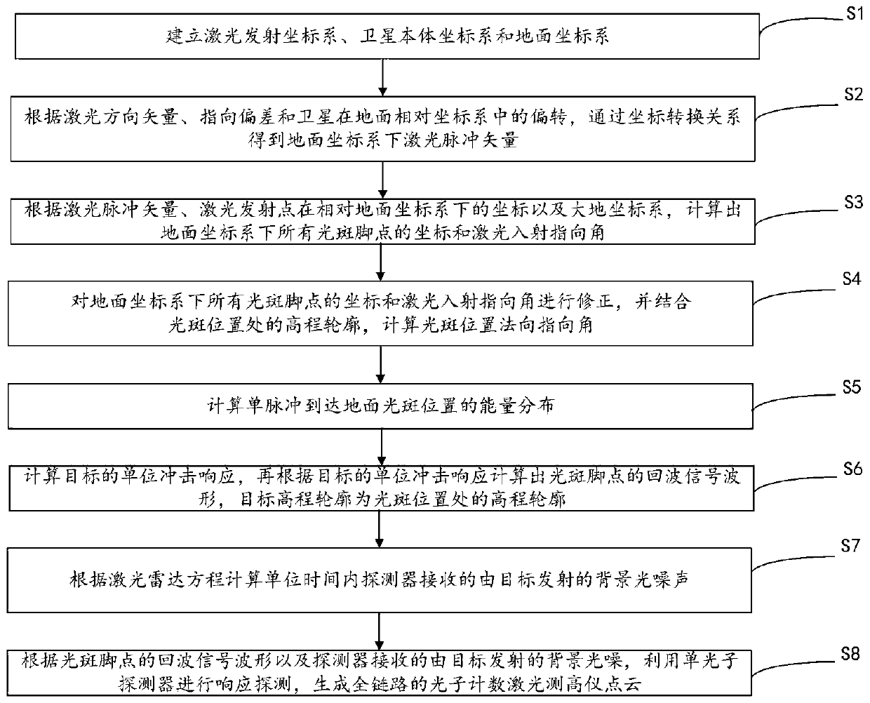
[0074] This embodiment provides a method for generating a point cloud of a full-link photon counting laser altimeter, please refer to figure 1 , the method includes:

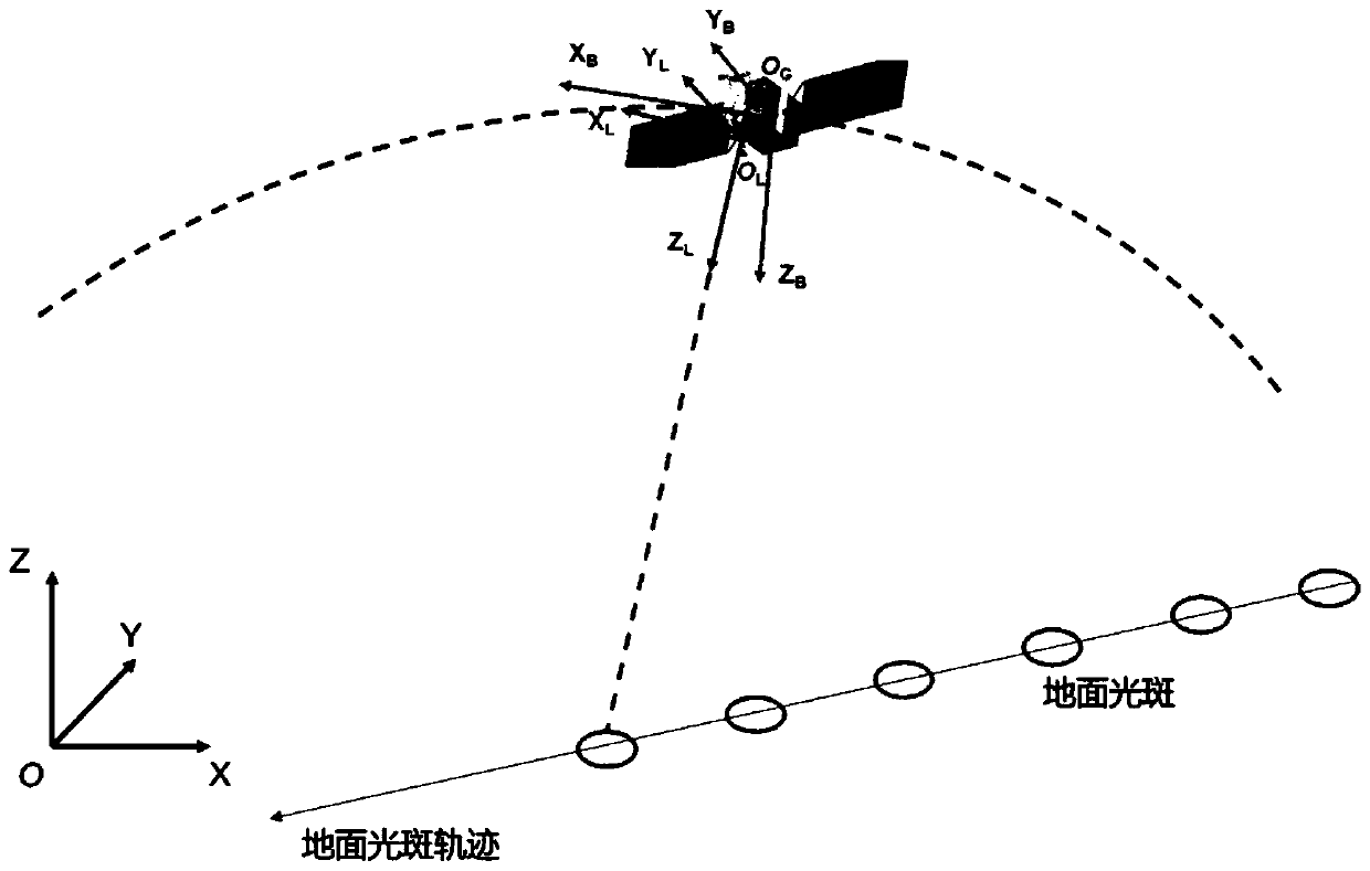
[0075] Step S1: Establish the laser emission coordinate system, the satellite body coordinate system and the ground coordinate system;

[0076] Step S2: Determine the laser direction vector, pointing deviation and deflection of the satellite in the relative ground coordinate system. According to the laser direction vector, pointing deviation and deflection of the satellite in the relative ground coordinate system, the laser pulse in the ground coordinate system is obtained through the coordinate conversion relationship vector;

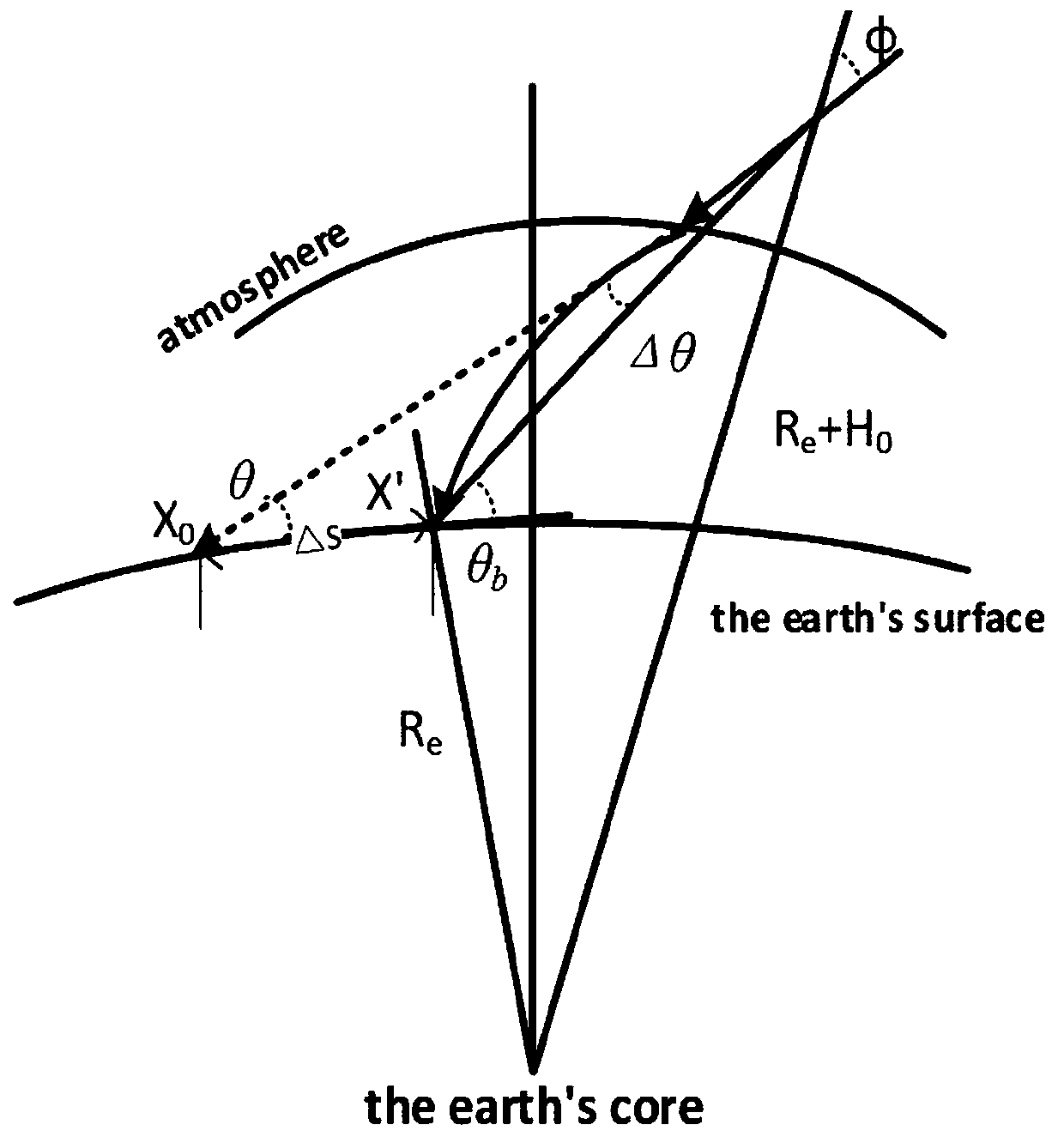
[0077] Step S3: According to the laser pulse vector, the coordinates of the laser emitting point in the relative ground coordinate system, and the earth coordinate system, calculate the coordinates of all light spot foot points in the ground coordinate system and the laser incident poin...


PUM


Abstract

The invention discloses a full-link photon counting laser altimeter point cloud generation method. A full-link simulation model including ground light spot coordinate calculation, atmospheric refraction offset correction, target geometry and radiation characteristics, detector response and the like in the height measurement process of a satellite-borne laser altimeter is established, and high-precision single-photon point cloud is generated through simulation in combination with satellite platform parameters, laser altimeter system parameters, environmental parameters, target characteristic parameters and the like. The laser altimeter point cloud generation method can accurately adjust various system parameters and environmental parameters, and has the advantages of being rapid, easy to simulate various conditions and good in expansibility. ICESat-2 system parameters can be used as input to simulate and detect randomly generated terrain surfaces, and high-quality photon point clouds are generated.

Description

technical field [0001] The invention relates to the technical field of data simulation, in particular to a method for generating a point cloud of a full-link photon counting laser altimeter. Background technique [0002] Compared with the linear system laser altimeter, the photon counting laser altimeter uses a single photon detector as the receiving device, and the sensitivity is increased by 2 to 3 orders of magnitude, which solves the problem between single pulse energy and repetition frequency. The contradiction brings many advantages such as small size, multi-beam, high repetition frequency, etc., which is the development trend of laser altimeter in the future. [0003] In the process of implementing the present invention, the inventor of the present application found that the method of the prior art has at least the following technical problems: [0004] At present, there are few reports on the laser altimeter simulation model of the domestic photon counting system, e...

Claims


Application Information

Patent Timeline
IPC IPC(8): G01S17/88G01S7/48
CPCG01S7/4802G01S17/88
Inventor 李松杨坚张智宇曾昊旻刘欣缘
Owner WUHAN UNIV
Why Eureka
Try Eureka