
Positioning method based on satellite observation angle error estimation

A positioning method and satellite observation technology, applied in the field of remote sensing satellite image processing, can solve problems such as the inability to achieve high-precision direct positioning of remote sensing satellite images.

Inactive Publication Date: 2020-04-24
彭耿
View PDF3 Cites 2 Cited by
  • Summary
  • Abstract
  • Description
  • Claims
  • Application Information

AI Technical Summary

Problems solved by technology

[0006] The main purpose of this application is to provide a positioning method based on satellite observation angle error estimation to solve the problem of inability to achieve high-precision direct positioning of remote sensing satellite images

Method used


Image

  • Positioning method based on satellite observation angle error estimation
  • Positioning method based on satellite observation angle error estimation
  • Positioning method based on satellite observation angle error estimation

Examples


specific Embodiment approach

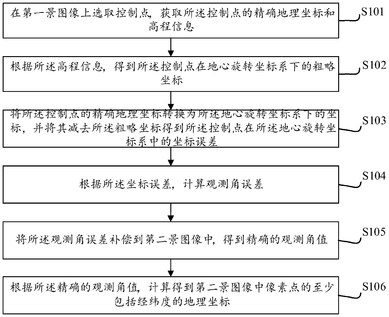
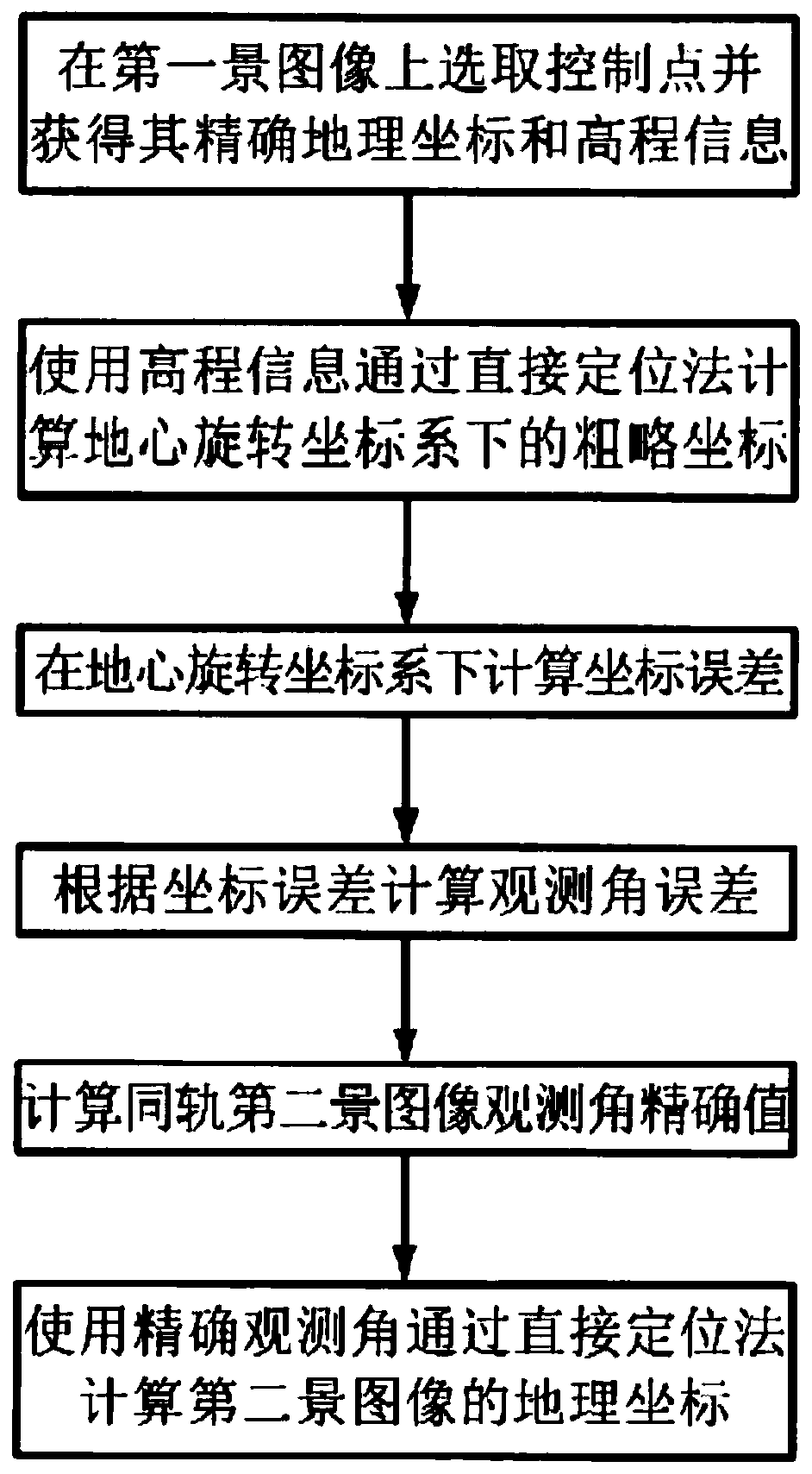
[0077] Step 1: Select a small number of control points in the first scene image, and obtain the precise geographic coordinates of the corresponding control points on the digital map n is the number of control points, and use the DEM model to obtain the elevation information of the control points (L i ,B i ,H i ), i=1,...,n.

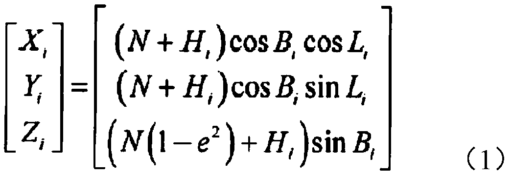
[0078]The geographic coordinate system is also called the terrestrial ginseng coordinate system, which is commonly referred to as the latitude-longitude coordinate system. Usually, the reference ellipsoid is selected as the basic reference surface, and a reference point is selected as the starting point of the geodetic survey (the geodetic origin). The position and direction of the reference ellipsoid inside the earth can be determined by using the astronomical observations of the geodetic origin. It is worth noting that the center of the reference ellipsoid thus determined generally does not coincide with the center of mass of the earth. In this coo...


PUM


Abstract

The invention discloses a positioning method based on satellite observation angle error estimation. The method comprises the following steps of selecting a control point on a first scene image, and acquiring accurate geographic coordinate and elevation information of the control point; obtaining a rough coordinate of the control point under a geocentric rotating coordinate system according to theelevation information; converting the accurate geographic coordinate of the control point into the coordinate under the geocentric rotating coordinate system, and subtracting the rough coordinate to obtain a coordinate error of the control point in the geocentric rotating coordinate system; calculating an observation angle error according to the coordinate error; compensating the observation angleerror into a second scene image to obtain an accurate observation angle value; and according to the accurate observation angle value, calculating to obtain a geographic coordinate which at least includes a longitude and latitude of a pixel point in the second scene image. A technical problem that high-precision direct positioning of a remote sensing satellite image cannot be realized is solved. In the invention, high-precision direct positioning based on satellite observation angle error estimation is realized.

Description

technical field [0001] The present application relates to the field of remote sensing satellite image processing, in particular, to a positioning method based on satellite observation angle error estimation. Background technique [0002] The high-precision geometric positioning technology of satellite remote sensing data is one of the key basic supporting technologies for the quantification of satellite remote sensing data, and its accuracy will directly affect the depth of quantitative processing and value-added processing. [0003] From the direct positioning model of remote sensing satellites, it can be seen that positioning errors may occur in many places, such as the observation angle of the sensor, the attitude, position, and speed of the satellite platform, etc. Among them, the observation angle of the satellite sensor is a very important factor. [0004] In order to meet the high-precision geometric positioning problems to be solved in many remote sensing applicatio...

Claims


Application Information

Patent Timeline
IPC IPC(8): G01C11/04G06F17/10G06T17/05
CPCG01C11/04G06F17/10G06T17/05
Inventor 彭耿杨中书商旭升王吉心李涛
Owner 彭耿
Learn More