Map area processing method
A region processing and region technology, applied in image data processing, geographic information database, special data processing applications, etc., can solve problems affecting data accuracy, polygonal regions cannot form a plane, and algorithms cannot perform multi-deformation cutting, etc.
- Summary
- Abstract
- Description
- Claims
- Application Information
AI Technical Summary
Problems solved by technology
Method used
Image
Examples
Embodiment Construction
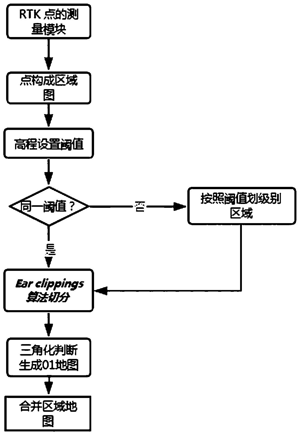
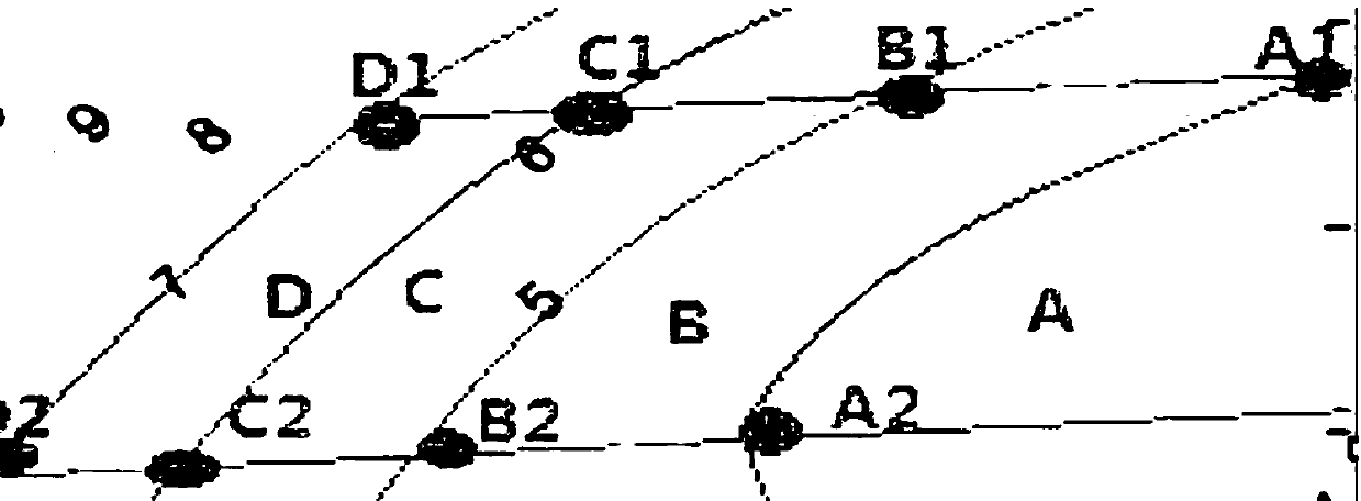
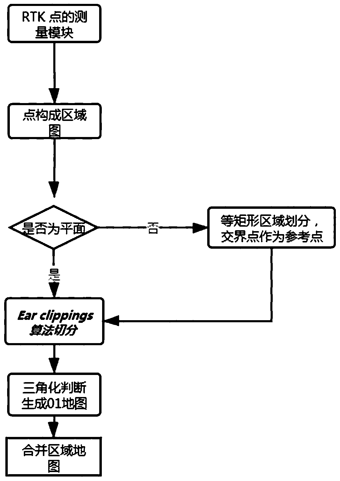
[0036] Regarding the aforementioned and other technical contents, features and effects of the present invention, refer to the appended figure 1 to attach Figure 4 It will be apparent from the detailed description of the embodiments. The structural contents mentioned in the following embodiments are all based on the accompanying drawings of the description.
[0037] A map area processing method, first adopts the elevation segmentation method or grid segmentation method or midpoint segmentation encoding method to convert the non-planar area into a planar area, then uses the Ear-clipping algorithm to cut out the required triangles, and finally merges them So as to get 0, 1 digital map.
[0038] On the basis of the above scheme, the specific steps of the elevation segmentation method are:
[0039] S1. According to the positioning point data obtained by RTK, the elevation value is used as the threshold value, and commonly used length measurement units such as centimeters, decim...
PUM
 Abstract
Description
Claims
Application Information
 - R&D
- Intellectual Property
- Life Sciences
- Materials
- Tech Scout
- Unparalleled Data Quality
- Higher Quality Content
- 60% Fewer Hallucinations
Browse by: Latest US Patents, China's latest patents, Technical Efficacy Thesaurus, Application Domain, Technology Topic, Popular Technical Reports.
© 2025 PatSnap. All rights reserved.Legal|Privacy policy|Modern Slavery Act Transparency Statement|Sitemap|About US| Contact US: help@patsnap.com


