Foundation all-sky cloud parameter inversion system and method
A parameter inversion and all-sky technology, applied in image data processing, instruments, calculations, etc., can solve problems such as inability to objectively and quantitatively analyze sky cloudiness, strong subjectivity, and continuity cannot be guaranteed, and achieve rich and clear details , Enhance cloud recognition and prevent damage
- Summary
- Abstract
- Description
- Claims
- Application Information
AI Technical Summary
Problems solved by technology
Method used
Image
Examples
Embodiment 1
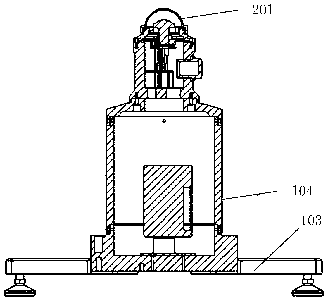
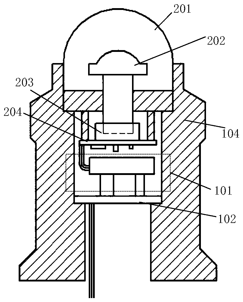
[0036] Such as Figure 1-2 As shown, a ground-based all-sky cloud parameter inversion system includes an imaging module for collecting sky images, a calculation module 102 for receiving sky images acquired by the imaging module and performing image cloud analysis, an environment adjustment module 101, and a support 103 , the housing 104 is disposed on the bracket 103 . The calculation module 102 is arranged on the bracket 103, the imaging module and the environment adjustment module 101 are arranged above the bracket 103, and the calculation module 102, the imaging module, and the environment adjustment module 101 are arranged on the bracket 103 and the housing 104 to form a in the cavity. The computing module 102 is connected with the imaging module, and the computing module 102 is a microcomputer motherboard based on ARM, and its system is based on Linux.
[0037] The system adopts the method of shooting sky image upwards.
[0038] Such as figure 2 As shown, the imaging...
Embodiment 2
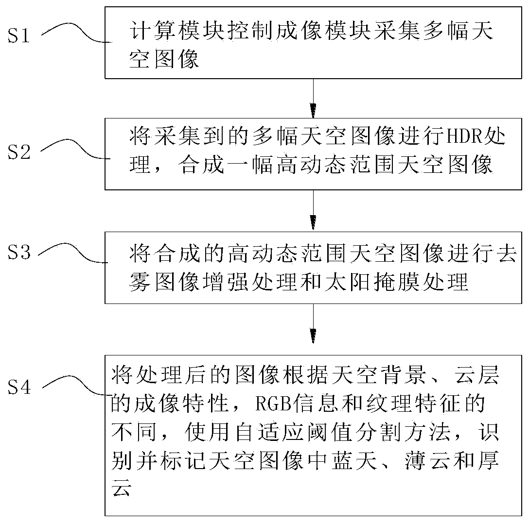
[0045] Such as image 3 As shown, the method of using a ground-based all-sky cloud parameter inversion system in Embodiment 1 includes the following steps:
[0046] S1. The calculation module 102 controls the imaging module to collect multiple sky images, and obtains multiple sky images with different exposure values; wherein the imaging module periodically collects photos, and the minimum collection period is 1 minute.
[0047] S2. Use high dynamic rendering technology to perform HDR processing on multiple collected sky images to synthesize a high dynamic range sky image; the synthesized image combines sky image information obtained under different exposure values to obtain a more detailed and clear image ,Such as Figure 4 Shown is the synthetic high dynamic range sky image.
[0048] S3. Perform dark channel defogging image enhancement processing and sun mask processing on the synthesized high dynamic range sky image; The turbidity phenomenon caused by light etc. on the i...
PUM
| Property | Measurement | Unit |
|---|---|---|
| Length | aaaaa | aaaaa |
Abstract
Description
Claims
Application Information
 - R&D
- Intellectual Property
- Life Sciences
- Materials
- Tech Scout
- Unparalleled Data Quality
- Higher Quality Content
- 60% Fewer Hallucinations
Browse by: Latest US Patents, China's latest patents, Technical Efficacy Thesaurus, Application Domain, Technology Topic, Popular Technical Reports.
© 2025 PatSnap. All rights reserved.Legal|Privacy policy|Modern Slavery Act Transparency Statement|Sitemap|About US| Contact US: help@patsnap.com


