Method for reconstructing three-dimensional tree model based on airborne laser radar tree point cloud

An airborne lidar and three-dimensional reconstruction technology, applied in the field of computer science, can solve the problems of inaccurate segmentation and difficulty in preserving tree branch details, and achieve the effect of effective reconstruction, avoiding inaccurate segmentation problems and good detail features.

Active Publication Date: 2020-09-01
NORTHWEST A & F UNIV
View PDF4 Cites 6 Cited by
  • Summary
  • Abstract
  • Description
  • Claims
  • Application Information

AI Technical Summary

Problems solved by technology

[0009] The spatial colonization algorithm can realize the reconstruction of sparse point cloud, but it is difficult to preserve the branch details of the tree
[0010] Aiming at the shortcomings of the existing technology, the present invention proposes a new method for reconstructing a three-dimensional tree model from the airborne radar point cloud, and extracts a single tree point cloud

Method used


Image

  • Method for reconstructing three-dimensional tree model based on airborne laser radar tree point cloud
  • Method for reconstructing three-dimensional tree model based on airborne laser radar tree point cloud
  • Method for reconstructing three-dimensional tree model based on airborne laser radar tree point cloud

Examples


Embodiment Construction

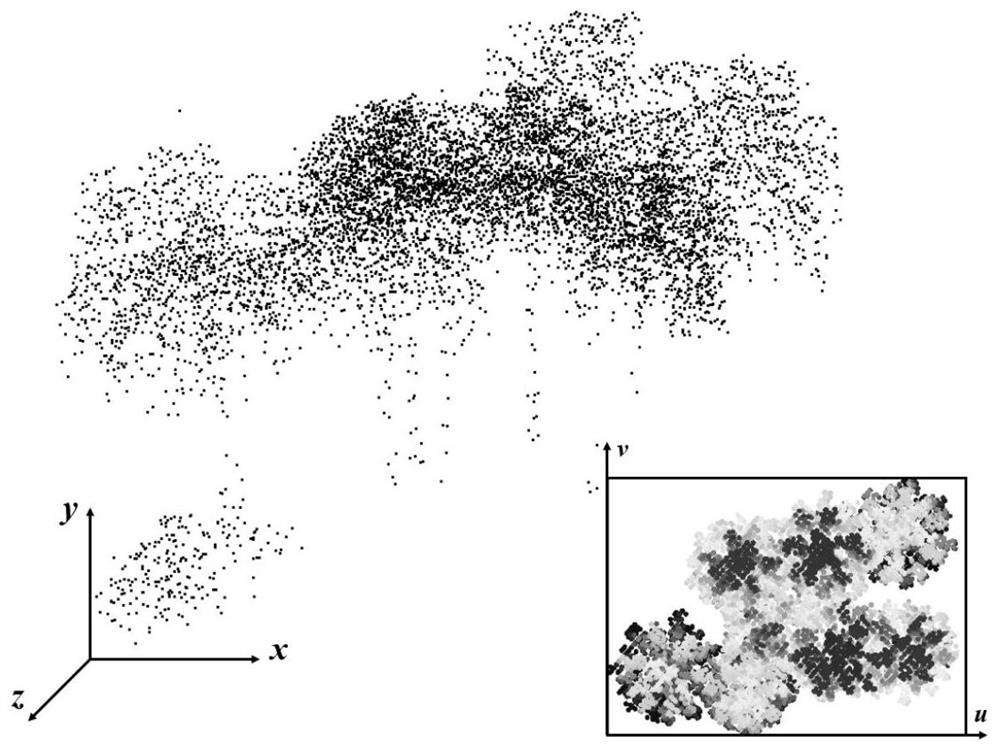
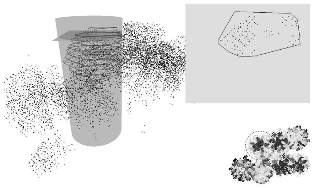
[0063] Attached below Figure 1-14 , a specific embodiment of the present invention is described in detail, but it should be understood that the protection scope of the present invention is not limited by the specific embodiment.

[0064] 1. Interactive tree point cloud hierarchical segmentation method based on height map

[0065] Point cloud segmentation algorithms can be divided into automatic segmentation algorithms and interactive segmentation algorithms. Automatic segmentation algorithms such as segmentation based on watershed, segmentation based on region growth, segmentation based on minimum spanning tree, and segmentation based on minimum cut can efficiently realize large-area The segmentation of tree point clouds, but the low density of airborne radar tree point clouds and the intricate crossing of branches and leaves lead to low automatic segmentation accuracy. Therefore, this invention proposes an interactive segmentation method. Each slice generates a single tree ...


PUM


Abstract

The invention relates to the technical field of computer science, and discloses a method for reconstructing a three-dimensional tree model based on airborne laser radar tree point cloud, which comprises the following steps: S1, projecting airborne laser radar tree point cloud to a plane to form a height map; S2, performing interactive separation by adopting a slicing method to obtain point cloudsof a single tree; S3, constructing a connected graph based on the point cloud of the single tree; S4, constructing a direction field of the tree point cloud based on botanical rules; s5, generating atree skeleton based on a greedy algorithm; and S6, reconstructing a three-dimensional geometric model of the tree based on the pipeline model and the generalized cylinder. The method for reconstructing the three-dimensional tree model realizes effective reconstruction of the sparse tree point cloud, and the reconstructed tree model can well reserve detail features of the original point cloud.

Description

technical field [0001] The invention relates to the technical field of computer science, in particular to a method for reconstructing a three-dimensional tree model based on an airborne lidar tree point cloud. Background technique [0002] Trees are indispensable plants on the earth, and the three-dimensional reconstruction of trees has extensive research and application value in the fields of computer animation, virtual reality, forestry, and agronomy. On the one hand, the reconstructed three-dimensional tree model can provide information on phenotypic parameters such as tree biomass, leaf area index, and yield, providing new tools for forest management and decision-making; Displaying complex models in agricultural and forestry scientific research can also provide important spatial information for robotic spraying. However, due to the complex structure and variety of tree branches, how to realize the 3D reconstruction of real-world trees has always been a difficult point i...

Claims


Application Information

Patent Timeline
IPC IPC(8): G06T17/00G06T17/10
CPCG06T17/005G06T17/10G06T2210/12
Inventor 胡少军李峥嵘董苏营周远山张志毅
Owner NORTHWEST A & F UNIV
Why Eureka
Try Eureka