
Typhoon elliptical wind field parametric simulation method based on remote sensing image features
A remote sensing image and simulation method technology, applied in the application field of satellite meteorological remote sensing information technology, can solve the problems of complex calculation of the maximum wind speed radius of typhoon, large uncertainty of calculation results, and large amount of calculation.
- Summary
- Abstract
- Description
- Claims
- Application Information
AI Technical Summary
Problems solved by technology
Method used
Image

Examples
Embodiment Construction
[0087] In order to make the object, technical solution and advantages of the present invention clearer, the present invention will be described in detail below with reference to the accompanying drawings and specific embodiments.
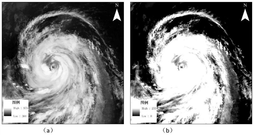
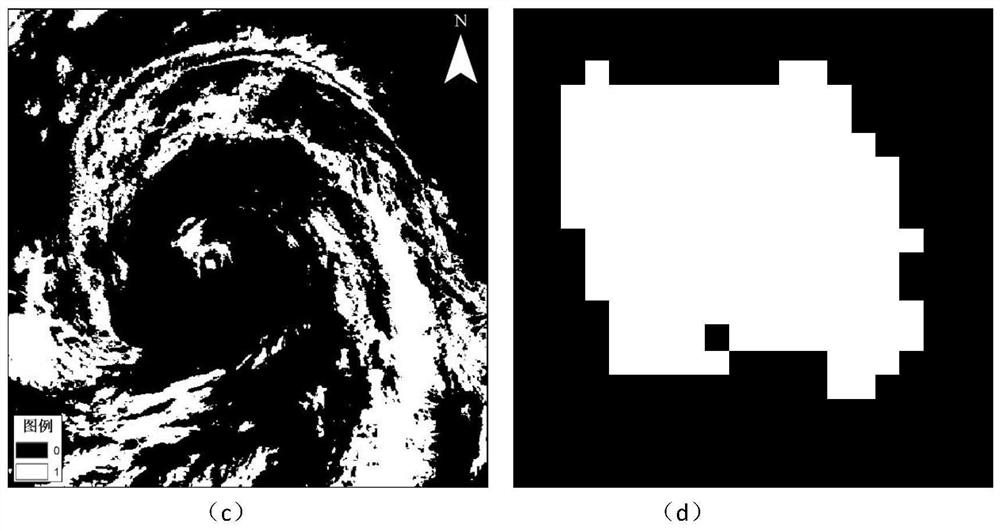
[0088] This specific embodiment selects the Himawari-8 meteorological satellite images of the three phases of typhoon "Mangosteen" in 2018 as the remote sensing data source, and the image imaging time is 23:50 on September 15, 2018, and 00:00 on September 16, 2018. 00 minutes and 00:10 minutes, use ENVI IDL5.3 to write remote sensing image processing algorithm, matlab to write ellipse fitting algorithm, ArcGIS10.2 as vector data processing tool, use C# to develop executable program framework, carry out algorithm integration, and complete sea surface wind Remote sensing simulation of field anisotropy for maximum wind speed range.
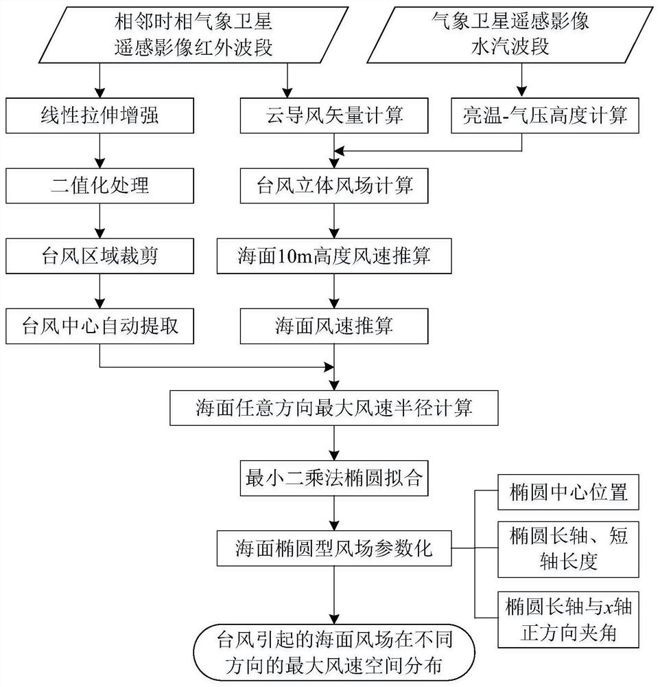
[0089] A typhoon elliptical wind field parametric simulation method based on remote sensing image features, such as fig...
PUM
 Abstract
Description
Claims
Application Information