Smart city road video continuous coverage method based on key area perception
A technology in key areas and cities, applied in the fields of computer vision and artificial intelligence, it can solve the problems of high power consumption of equipment, incomplete information collection, and information integration, etc., to avoid losses, achieve continuous video coverage, and reduce losses.
- Summary
- Abstract
- Description
- Claims
- Application Information
AI Technical Summary
Problems solved by technology
Method used
Image
Examples
Embodiment
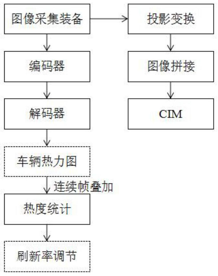
[0029] Select a road section in the urban road, collect the image of the road section through the image acquisition equipment, analyze the image collected by the image acquisition equipment based on the neural network, and obtain the vehicle thermal map; specifically, the neural network includes an encoder and a decoder, and the encoding The input of the device is the collected images of different road sections, and the feature extraction is performed to obtain the feature map; the decoder performs decoding operation on the feature map to obtain the vehicle thermal map.
[0030] Select road images including various types of vehicles as the training data set, randomly select 80% of them as the training set, and the remaining 20% as the verification set, and use a point projected from the center point of the vehicle to the ground through a hot spot generated by Gaussian blurring. Feature labeling, using the mean square error loss function, stochastic gradient descent method to ...
PUM
 Abstract
Description
Claims
Application Information
 - R&D
- Intellectual Property
- Life Sciences
- Materials
- Tech Scout
- Unparalleled Data Quality
- Higher Quality Content
- 60% Fewer Hallucinations
Browse by: Latest US Patents, China's latest patents, Technical Efficacy Thesaurus, Application Domain, Technology Topic, Popular Technical Reports.
© 2025 PatSnap. All rights reserved.Legal|Privacy policy|Modern Slavery Act Transparency Statement|Sitemap|About US| Contact US: help@patsnap.com


