Airborne multispectral LiDAR data segmentation method based on multivariate Gaussian mixture model

A Gaussian mixture model and data segmentation technology, which is applied to computer parts, character and pattern recognition, instruments, etc., can solve the problem of less application of point cloud segmentation

Pending Publication Date: 2021-01-08
LIAONING TECHNICAL UNIVERSITY
View PDF0 Cites 2 Cited by
  • Summary
  • Abstract
  • Description
  • Claims
  • Application Information

AI Technical Summary

Problems solved by technology

The model-based clustering algorithm applies the knowledge of statistics to model the data as a probability generation process, because this method has a rigorous derivation proof and solution algorithm (the expected maximum (EM) algorithm proposed by Dempster), e

Method used


Image

  • Airborne multispectral LiDAR data segmentation method based on multivariate Gaussian mixture model
  • Airborne multispectral LiDAR data segmentation method based on multivariate Gaussian mixture model
  • Airborne multispectral LiDAR data segmentation method based on multivariate Gaussian mixture model

Examples


Embodiment Construction

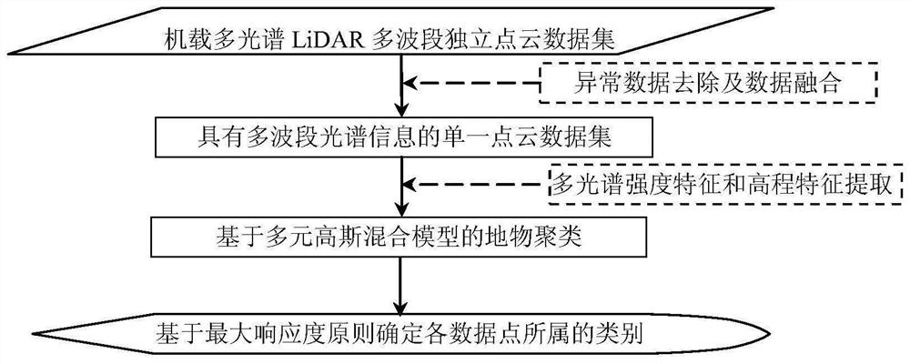
[0050] The specific implementation manners of the present invention will be further described in detail below in conjunction with the accompanying drawings and embodiments. The following examples are used to illustrate the present invention, but are not intended to limit the scope of the present invention.

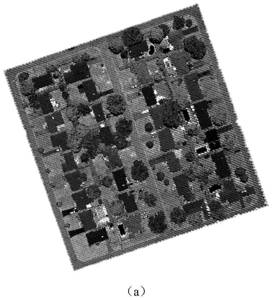
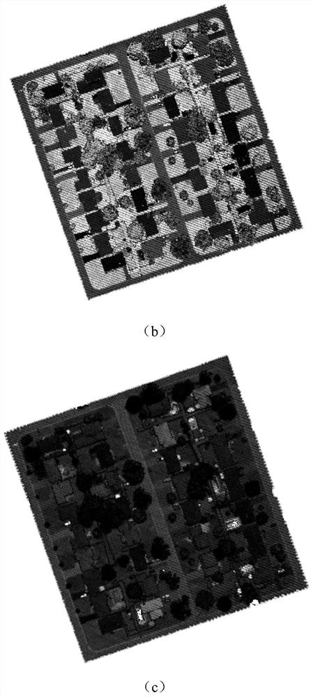
[0051] Such as figure 1 As shown, the method of this embodiment is as follows.

[0052] The present invention proposes a kind of airborne multispectral LiDAR data segmentation method based on multivariate Gaussian mixture model, comprises the following steps:

[0053] Step 1: Read the independent point cloud datasets of each band of the original airborne multispectral LiDAR data to obtain the original airborne multispectral LiDAR independent point cloud datasets;

[0054] In this embodiment, the clipping area in the data collected by the Titan airborne multispectral LiDAR system of a Canadian company is used as the experimental area to test the effectiveness and feasibil...


PUM


Abstract

The invention provides an airborne multispectral LiDAR data segmentation method based on a multivariate Gaussian mixture model, and relates to the technical field of remote sensing data processing. The method comprises the following steps: reading original airborne multispectral LiDAR multiband independent point cloud data to form an original airborne multispectral LiDAR multiband independent point cloud data set; performing abnormal data removal and data fusion on the original airborne multispectral LiDAR independent point cloud data set to form a single point cloud data set with multiband spectral information; extracting multispectral intensity features and elevation features reflecting ground object type differences from the single-point cloud data set with multiband spectral information; and finally, inputting the classification features of the airborne multispectral LiDAR data into the multivariate Gaussian mixture model to realize ground object clustering, obtaining a responsivity value of each data point, determining a category label to which each data point belongs according to a maximum responsivity principle, and finally obtaining a point cloud segmentation result.

Description

technical field [0001] The invention relates to the technical field of remote sensing data processing, in particular to an airborne multispectral LiDAR data segmentation method based on a multivariate Gaussian mixture model. Background technique [0002] Airborne LiDAR (Light Detection And Ranging, LIDAR) point cloud data segmentation is a prerequisite for the application of point cloud data, and automatic, high-precision point cloud data segmentation will greatly expand the application field of point cloud data. Currently, the collected point cloud data mainly comes from single-band airborne LiDAR systems, but since the backscatter energy from LiDAR depends on the target material, target surface roughness, and laser wavelength, single-band LiDAR is limited in its ability to distinguish land cover. limit. The existing segmentation methods based on single-band LiDAR point cloud data can be mainly divided into: (1) convert point cloud data into multiple target recognition and...

Claims


Application Information

Patent Timeline
IPC IPC(8): G06K9/00G06K9/62
CPCG06V20/13G06F18/23G06F18/24
Inventor 王丽英马旭伟汪远
Owner LIAONING TECHNICAL UNIVERSITY
Why Eureka
Try Eureka