Eureka AIR delivers breakthrough ideas for toughest innovation challenges, trusted by R&D personnel around the world.

Efficient and rapid occultation forecasting method based on near space floating platform

A floating platform, near space technology, applied in satellite radio beacon positioning systems, measuring devices, instruments, etc., can solve problems such as large data volume and long calculation time

Pending Publication Date: 2021-02-09
XIAN INSTITUE OF SPACE RADIO TECH
View PDF0 Cites 6 Cited by
  • Summary
  • Abstract
  • Description
  • Claims
  • Application Information

AI Technical Summary

Problems solved by technology

[0009] The technical problem solved by the present invention is: an efficient and fast occultation prediction method based on a near-space floating platform provided by the present invention can efficiently and quickly predict occultation events, and solve the problem of large amount of data in traditional ephemeris calculations The problem of long time improves the accuracy of occultation event prediction

Method used


Image

  • Efficient and rapid occultation forecasting method based on near space floating platform
  • Efficient and rapid occultation forecasting method based on near space floating platform
  • Efficient and rapid occultation forecasting method based on near space floating platform

Examples


Embodiment

[0118] In order to verify the validity of the method proposed by the present invention, it is assumed that the flying height of the stratospheric airship is 10 km from the ground surface, and the ground altitude is 580 meters. The geodetic coordinates of the airship are (34.1423012, 108.9641853, 10580). The wide-beam occultation receiving antenna is placed horizontally, pointing to the south, and the beam width of the elevation plane and the azimuth plane is 60 degrees. What the receiver receives is the broadcast ephemeris at 00:00 on April 21, 2020.

[0119] The first step, through the user algorithm described in step 1, according to the reference time of 1 orbital element contained in the ephemeris, 6 Kepler orbital elements and 9 perturbation parameters, as shown in Table 1, calculate the satellite The coordinates at the interpolation time nodes are shown in Table 2 and Table 3.

[0120] Table 1 GPS satellite broadcast ephemeris parameters

[0121]

[0122] Table 2 PG...


PUM


Abstract

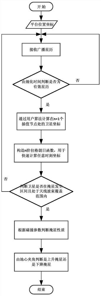
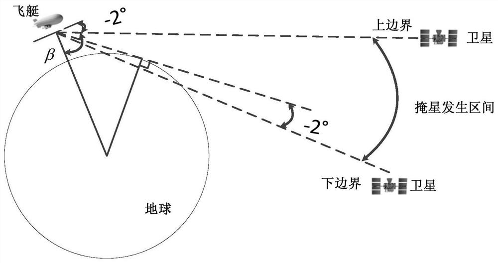
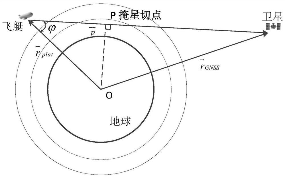
An efficient and rapid occultation forecasting method based on a near space floating platform comprises the following steps that firstly, satellite coordinates at an interpolation time node are calculated through a broadcast ephemeris; secondly, a Lagrange interpolation function is constructed, and the coordinate value of a satellite at each moment within the effective time of the ephemeris is calculated; whether the satellite is located in an occultation generation interval is judged according to the spatial position, and whether the satellite is located in an occultation antenna beam coverage range is calculated; after it is determined that an occultation event happens to a certain satellite at the current moment, the occultation duration is calculated according to an interpolation polynomial; whether the occultation is neutral atmosphere occultation or ionospheric occultation is judged according to the collision parameters; finally, in the effective ephemeris time, the geocentric angle changes at the current moment and the next moment are calculated to judge whether the occultation is ascending or descending occultation; and all satellites in the constellation are traversed. According to the method, an occultation event is efficiently and quickly estimated, the problems of large data volume and long calculation time during traditional ephemeris calculation are solved, and the occultation event forecasting precision is improved.

Description

technical field [0001] The invention relates to a fast forecast method for GNSS radio occultation events. Background technique [0002] As a natural signal source, GNSS navigation satellites continuously emit L-band microwave signals, and receivers can effectively use the signals to observe the earth's surface, atmosphere, and ionosphere. This technique of obtaining information related to the Earth's atmosphere and ionosphere by receiving GNSS signals refracted by the atmosphere and ionosphere is called GNSS-RO (GNSS-Radio Occultation), which is GNSS occultation technology. [0003] GNSS radio occultation observation technology, as an emerging technology for navigation satellite applications, is an important means of space detection technology. GNSS radio occultation neutral atmospheric retrieval technology can retrieve high-precision, all-weather neutral atmospheric parameters through global observation data provided by occultation observation satellites. This technology i...

Claims


Application Information

Patent Timeline
Patent Type & Authority Applications(China)
IPC IPC(8): G01S19/20G01S19/27G06F17/15
CPCG01S19/20G01S19/27G06F17/15Y02A90/10
Inventor 李栋禹旭敏范晓彦井成牛新亮王延光韩星远
Owner XIAN INSTITUE OF SPACE RADIO TECH
Why Eureka
Eureka Blog
Learn More