Unmanned aerial vehicle positioning method based on image registration

A technology of image registration and positioning method, which is applied in image analysis, image data processing, computer components, etc., can solve problems such as inability to obtain homography matrix, difficult to match points correctly, large-scale differences and rotation angles, etc., to achieve Improve stability and accuracy, good significance, reduce the effect of scale difference and rotation difference

Active Publication Date: 2021-02-26
BEIHANG UNIV
View PDF8 Cites 5 Cited by
  • Summary
  • Abstract
  • Description
  • Claims
  • Application Information

AI Technical Summary

Problems solved by technology

[0005] Problems solved by the present invention: Since there is a large scale difference and rotation angle between the image taken by the UAV and the satellite map image, and the rich texture contained in the satellite map image introduces a lot of noise, the traditional key point feature directly When the image captured by the man-machine is registered with the satellite map image of the whole area, it is difficult for the algorithm to

Method used


Image

  • Unmanned aerial vehicle positioning method based on image registration
  • Unmanned aerial vehicle positioning method based on image registration
  • Unmanned aerial vehicle positioning method based on image registration

Examples


Embodiment Construction

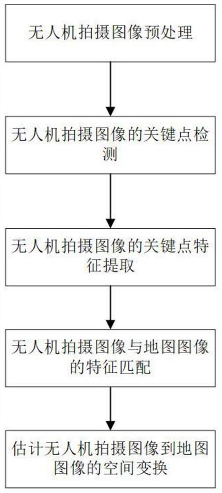
[0017] In order to make the purpose, technical solution and advantages of the method more clear, further detailed description will be given below in conjunction with the accompanying drawings and embodiments.

[0018] Such as figure 1 As shown, the UAV positioning method based on image registration of the present invention includes the following steps:

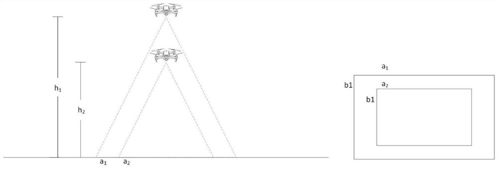
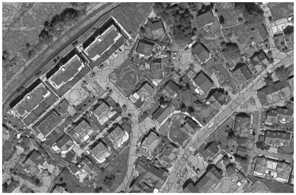
[0019] (1) UAV image preprocessing, obtain the flight height of the UAV from the height sensor carried by the UAV, and obtain the flight direction of the UAV from the course sensor carried by the UAV, according to the marking information of the satellite map image Obtain the spatial resolution difference and direction difference between the UAV image and the satellite map, and perform rotation transformation and scale transformation on the UAV image to make it have the same direction and scale as the map image;

[0020] (2) The key point detection of the image taken by the UAV, using the SEEDS superpixel segmentation algorith...


PUM


Abstract

The invention provides an unmanned aerial vehicle positioning method for image registration, which comprises the following steps: (1) preprocessing an image shot by an unmanned aerial vehicle, obtaining the flight height of the unmanned aerial vehicle from a height sensor carried by the unmanned aerial vehicle, and obtaining the flight direction of the unmanned aerial vehicle from a carried heading sensor, obtaining a spatial resolution difference and a direction difference between the unmanned aerial vehicle photographed image and the satellite map according to the marking information of thesatellite map image, and performing rotation transformation and scale transformation on the photographed image to enable the photographed image to have consistent direction and scale with the map image; (2) detecting key points of an image shot by the unmanned aerial vehicle; (3) extracting SIFT features of the key points detected in the images shot by the unmanned aerial vehicle; (4) matching thefeatures of the images shot by the unmanned aerial vehicle with the features of the map images to obtain a corresponding relationship between key point image coordinates in the two images; and (5) estimating the spatial transformation from the unmanned aerial vehicle shot image to the satellite map image, and combining the geographic information of the map to obtain the longitude and latitude ofthe central point of the unmanned aerial vehicle shot image as the current longitude and latitude coordinates of the unmanned aerial vehicle.

Description

technical field [0001] The invention relates to a vision-based positioning method for unmanned aerial vehicles under the condition of GPS failure, in particular to a positioning method for unmanned aerial vehicles through the registration of the perspective image of the unmanned aerial vehicle and the satellite map image. Background technique [0002] UAVs have the advantages of low power consumption, low cost, flexibility, and scalability, and have been widely used in tasks such as photography, aerial mapping, agriculture, rescue, and logistics. In the process of performing specific tasks, the positioning of the UAV is the basis for the control and decision-making of the UAV. Most of the current UAV platforms are equipped with onboard cameras and GPS chips. At the same time, they can be equipped with sensors such as IMU, onboard compass, and barometer, which are used for UAVs to perceive the environment and detect their own status. Under normal circumstances, drones can be...

Claims


Application Information

Patent Timeline
IPC IPC(8): G06T7/33G06T7/73G06K9/62G06K9/46G06K9/00
CPCG06T7/337G06T7/74G06V20/13G06V20/10G06V10/443G06F18/22
Inventor 百晓张鹏程张亮刘祥龙
Owner BEIHANG UNIV
Why Eureka
Try Eureka