Planning method suitable for emergency refuge fastest walking paths in mountainous area complex terrains

A complex terrain and path technology, which is applied in the planning of the fastest walking path for emergency evacuation in complex terrain in mountainous areas, can solve the problem of not meeting the shortest time requirement for emergency evacuation path planning.

Active Publication Date: 2021-03-26
ZHEJIANG UNIV
View PDF9 Cites 5 Cited by
  • Summary
  • Abstract
  • Description
  • Claims
  • Application Information

AI Technical Summary

Problems solved by technology

However, the traditional A* algorithm can only plan the route with the shortest spatial distance. Due to the influence of ground type and slope change, the route is not necessarily the shortest route. Therefore, the traditional A* algorithm does not meet the shortest time requirement for emergency evacuation route planning.
[0005] So far, there is no report on the application of this algorithm in the planning of the fastest walking path for emergency evacuation in complex mountainous terrain

Method used


Image

  • Planning method suitable for emergency refuge fastest walking paths in mountainous area complex terrains
  • Planning method suitable for emergency refuge fastest walking paths in mountainous area complex terrains
  • Planning method suitable for emergency refuge fastest walking paths in mountainous area complex terrains

Examples


Embodiment Construction

[0043] The present invention will be described in further detail below in conjunction with the accompanying drawings. The following specific implementation steps can enable those skilled in the art to understand the present invention more comprehensively, but do not limit the present invention in any form.

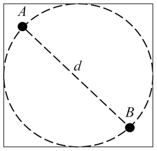
[0044] The first thing to note is that using A * Algorithm planning path belongs to the prior art, and its definition or concept belongs to the content known or mastered by those skilled in the art. Therefore, unless there is a specific meaning or the present invention makes a special statement, other meanings that are consistent with the existing known meanings will not be expressed one by one in the present invention.

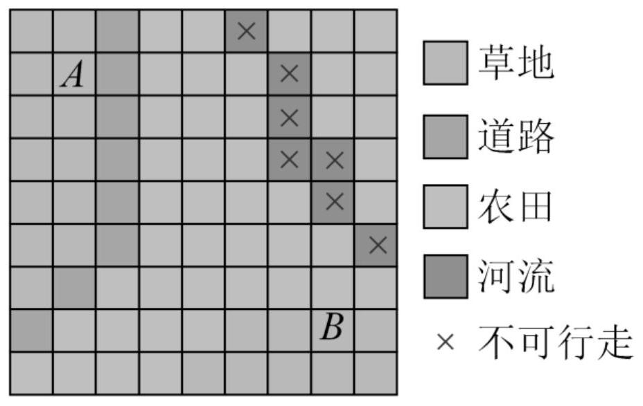
[0045] The planning method for the fastest walking path suitable for emergency refuge in complex terrain in mountainous areas described in the present invention comprises the following steps:

[0046] (1) Select the planning area:

[0047] Calculate th...


PUM


Abstract

The invention relates to the field of emergency refuge path planning, and aims to provide a planning method suitable for emergency refuge fastest walking paths in mountainous area complex terrains. According to the method, an A* algorithm is used for carrying out shortest-time emergency risk avoiding path planning on a two-dimensional elevation grid topographic map of a planning area; on the basis, the influence coefficient of the local common ground type on the walking speed of the person is further measured through a unified standard, the influence of the gradient and the ground type on thewalking speed of the person is considered, and the A* algorithm is corrected. And a connecting line between paths with smaller G values formed by the grid with the smallest F value is used as an emergency evacuation route with the shortest time from the starting point to the terminal point. Based on the improvement of the traditional A* algorithm, the influence of the ground type and gradient change on path planning is increased, and the emergency refuge path planning result is more suitable for the practical application situation of complex areas in mountainous areas.

Description

technical field [0001] The invention relates to the field of emergency evacuation path planning, in particular to a planning method suitable for the fastest walking path of emergency evacuation in complex terrain in mountainous areas. Background technique [0002] As a country with frequent natural disasters, it is an important means for social emergency management agencies to formulate reasonable emergency refuge routes in advance to reduce casualties and property losses. The existing route planning methods mainly include static route planning methods and dynamic route optimization, and the planning basis is based on the local traffic network. For example, static route planning refers to determining the shortest route between two points based on the existing traffic network, and dynamic route optimization is based on static route planning combined with real-time traffic conditions to determine the shortest route between two points. [0003] For mountainous areas with compl...

Claims


Application Information

Patent Timeline
Patent Type & Authority Applications(China)
IPC IPC(8): G01C21/34
CPCG01C21/3407G01C21/343
Inventor 郑俊王炯超吕庆黄伟民田哲祺郭吉超
Owner ZHEJIANG UNIV
Why Eureka
Try Eureka