Watershed unit water consumption division method based on geographic information data

A technology of geographic information data and water consumption, which is applied in the field of water resources management and can solve problems such as inapplicable measurement of water consumption

Pending Publication Date: 2021-04-23
SUN YAT SEN UNIV
View PDF1 Cites 4 Cited by
  • Summary
  • Abstract
  • Description
  • Claims
  • Application Information

AI Technical Summary

Problems solved by technology

[0003] In the prior art, such as the Chinese patent disclosed on 2018-04-06, a distributed runoff calculation method in plain areas under urbanization, the publication number is CN107886444A, compared with traditional technical methods, it can directly use spatial data (land use, Sub-basin boundary, administrative region boundary) to realize the calculation of production flow, but not suitable for calculating the water consumption of administrative regions in the watershed

Method used


Image

  • Watershed unit water consumption division method based on geographic information data
  • Watershed unit water consumption division method based on geographic information data
  • Watershed unit water consumption division method based on geographic information data

Examples


Embodiment 1

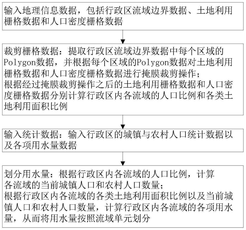
[0064]Such asfigure 1 As shown, a water volume division method for the basin unit based on geographic information data, including the following steps:

[0065]S1: Enter geographic information data;

[0066]The geographic information data includes border data, land utilization raster data and population density grid data;

[0067]Among them, the origin boundary data of the administrative region stream border data is read according to the origin of the administrative region stream border data according to the origin of the administrative region Basin boundary by the Python Third Party Library GeoPandas, and the Open function in the Rasterio is read according to the land utilization and population density. The storage path of the file reads the raster data to realize the input of geographic information data;

[0068]The vector graphic file of the administrative region stream border is. SHP, land-use grid data file file format is .TIF, population density grid data file for Grid file;

[0069]S2: Crop ...

Embodiment 2

[0080]More specifically, in step S2, a mask is cropped by the following formula:

[0081]

[0082]Among them, RRaster For the raster data,For the administrative region Basin Border Vector Graphics I = 1, 2, ..., N, N is the total number of objects in the administrative area basin boundary vector graphics, miFor RRaster useRegional grid data for mask cutting operations, if there is no overlapping area, then miIs empty.

[0083]More specifically, in step S2, the ratio ratios of various land utilization area in each watershed in the administrative area include the proportion of cultivated land area, forest area ratio, and construction area ratio in the administrative area.

[0084]More specifically, in step S4, the current urban population and rural population of each basin is calculated by the following formula:

[0085]PBa Sin = KBa Sin × Pdistrict

[0086]Where PBa Sin For the current urban population or rural population of the administrative area, KBa Sin For the population ratio of the population ...

Embodiment 3

[0115]In the present embodiment, the water volume division method of the basin unit based on the geographic information data is used to divide the water volume of the county-level administrative district in China, Guangdong, China:

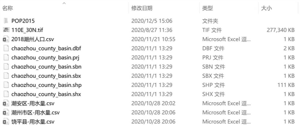
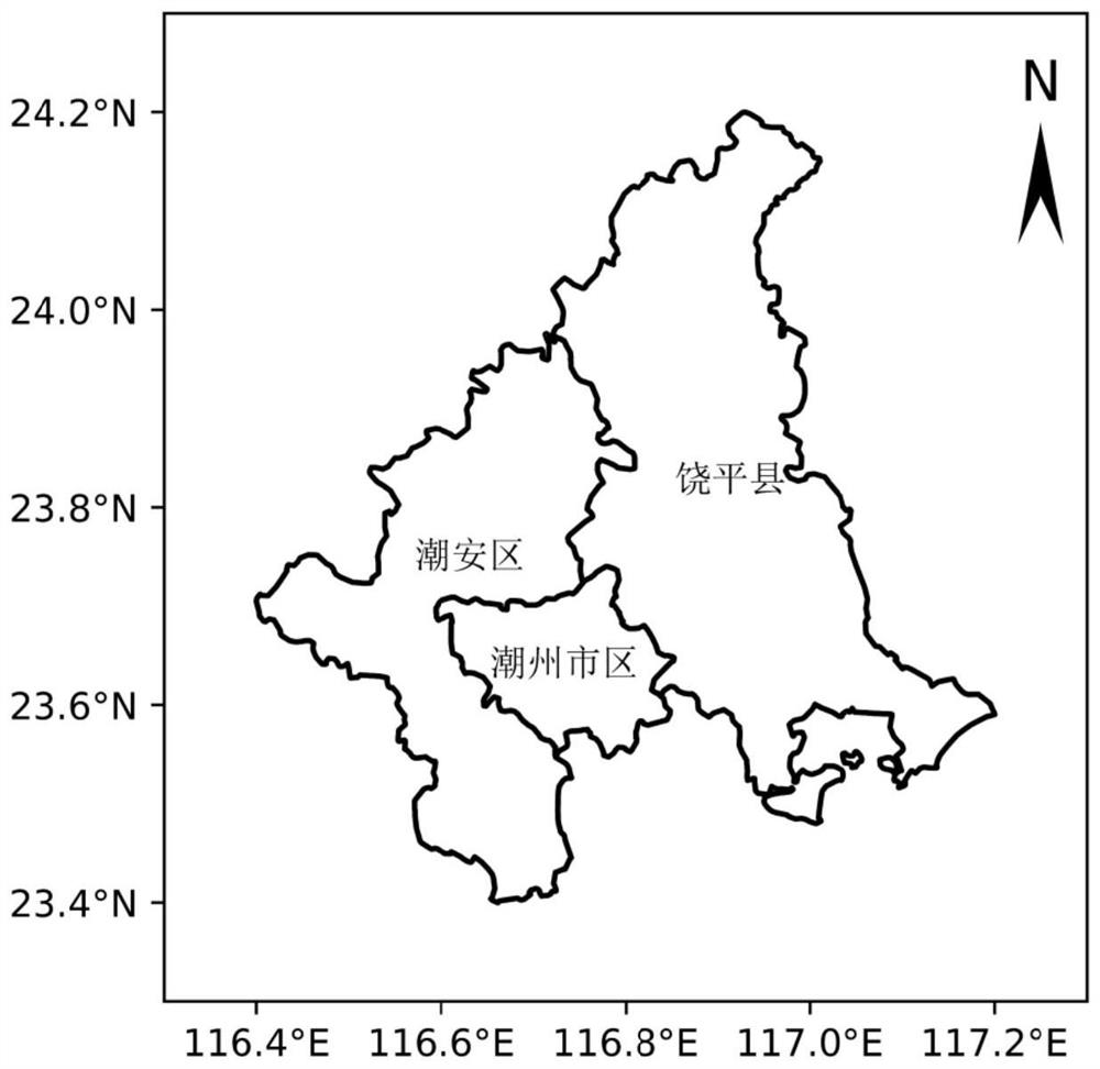
[0116]S1: The vector graphic file of the Chaozhou Municipal Administrative Region of the Divided Division in the administrative region, the land use raster data and the Chinese population density grid data in the folder, such asFigure 2-4As shown, pass the vector graphic file through the from_file function in the GeodataFrame module of GeoPandas, the Open function in the rasterio reads the raster data file;

[0117]S2: Cut operation by Python third-party library Rasterio, and calculate the proportion of population ratios and various land use area of ​​each basin:

[0118]Use the for loop to read each graphic object of the administrative department stream boundary, using Mask.mask in RasterIo to mask the grid data;

[0119]Use the Open function in RasterIo to create...


PUM


Abstract

The invention provides a watershed unit water consumption division method based on geographic information data. The watershed unit water consumption division method comprises the following steps: S1, inputting the geographic information data; S2, cutting the raster data: extracting Polycon data of each region, and performing mask cutting operation on the land utilization raster data and the population density raster data; respectively calculating the population proportion of each drainage basin in the administrative region and the utilization area proportion of each type of land; S3, inputting statistical data: inputting urban and rural demographic data and various water consumption data of an administrative region; S4, dividing water consumption: calculating the current urban population and rural population of each drainage basin; and calculating each water consumption of each drainage basin in the administrative region so as to divide the water consumption according to drainage basin units. The invention provides the watershed unit water consumption division method based on geographic information data, and solves the problems that a main means for measuring and calculating the water consumption of administrative regions in watersheds at present is an empirical method, and a universal method is not formed yet.

Description

Technical field[0001]The present invention relates to the field of water resources management, and more particularly to a water volume division method for a ribbon unit based on geographic information data.Background technique[0002]Water distribution can effectively promote the improvement of water resources utilization efficiency, in the formulation of water distribution programs, need to consider the current situation of water in the basin of the administrative area in the basin. At present, my country is only statistics on the water volume of the large basin, and the water resources publication of the relevant basin is announced, while the water volume of the administrative units in the small basin is not announced. Therefore, in the development of the water quantity distribution scheme in the small watershed, it is necessary to reasonably measure the amount of water in the basin of the basin, as the basis for the water distribution scheme. At present, the main means of calculati...

Claims


Application Information

Patent Timeline
Patent Type & Authority Applications(China)
IPC IPC(8): G06Q10/06G06Q50/06
CPCG06Q10/06312G06Q50/06
Inventor 赵铜铁钢陈泽鑫
Owner SUN YAT SEN UNIV
Why Eureka
Try Eureka