

Planetary surface navigation landmark matching method based on contour point set
A matching method and contour point technology, applied in the field of deep space detection, to achieve the effects of easy processing, high matching rate, and high accuracy of detector pose determination
- Summary
- Abstract
- Description
- Claims
- Application Information
AI Technical Summary
Problems solved by technology
Method used
Image

Examples
Embodiment Construction
[0060] In order to better illustrate the purpose and advantages of the present invention, the content of the invention will be further described below in conjunction with the accompanying drawings and examples.
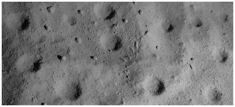
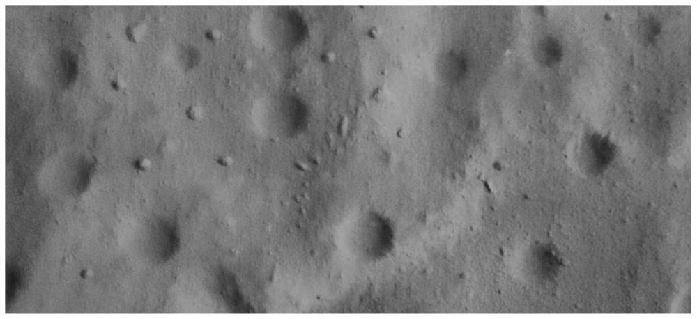
[0061] In order to verify the feasibility of the present invention, use the deep space autonomous navigation and control the planetary surface sand table of the key laboratory of the Ministry of Industry and Information Technology, take pictures from different angles through the camera, and simulate the database map (such as image 3 ) and the image to be matched after affine transformation (such as figure 2 ).
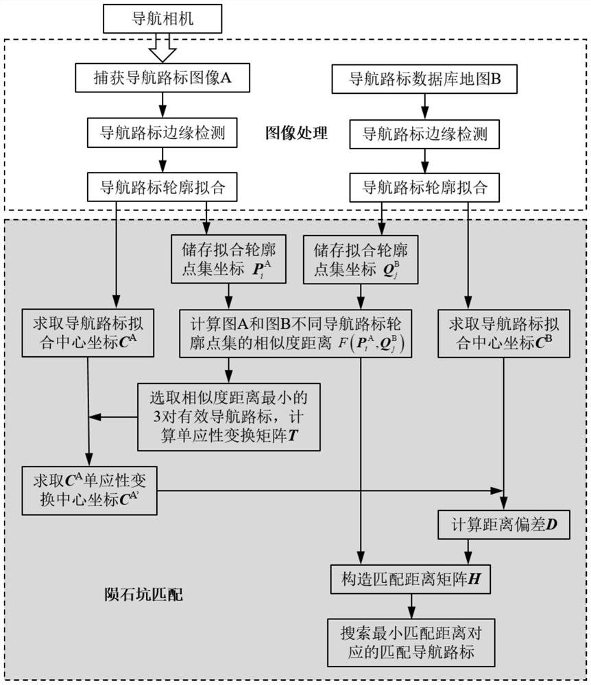
[0062] The planetary surface navigation landmark matching method based on the outline point set disclosed in this embodiment, such as figure 1 As shown, the specific implementation steps are as follows:
[0063] Step 1: The probe uses the carried optical camera to take directional photos of the target area of the sand table on the surface of the planet,...
PUM
 Abstract
Description
Claims
Application Information