A kind of aerial seeding bioremediation method in coal mining subsidence area
A coal mining subsidence area and bioremediation technology, applied in fertilization methods, seeding, aircraft, etc., can solve the problems of wasting seeds, restricting the application and promotion of drone aerial sowing technology, and large fluctuations, so as to ensure safety, accurate sowing, The effect of saving labor cost
- Summary
- Abstract
- Description
- Claims
- Application Information
AI Technical Summary
Problems solved by technology
Method used
Image
Examples
Embodiment 1
[0051] Embodiment 1. Design of aerial seeding test in the coal mining subsidence area of Ningtiaota Coal Mine
[0052] 1. Overview of the test area
[0053] The test site is located in Ningtiaota Coal Mining Area, Shenmu City, Yulin City, Shaanxi Province, which belongs to the Loess Plateau area, where underground coal mining causes surface subsidence.
[0054] 2. Materials and equipment
[0055] (1) Design the tested seeds: alfalfa.
[0056] (2) The UAV used in the test is Tiantu M8A PRO, with a maximum payload of 20kg.
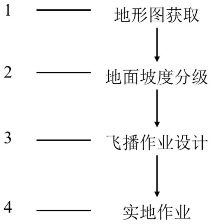
[0057] 3. Processing flow
[0058] (1) Obtain topographic map
[0059] The topographic map is measured by digital mapping method, the design area is 2100 mu (1400007 square meters), and the ground slope is between 1.94° and 59.04°.
[0060] (2) Ground slope classification
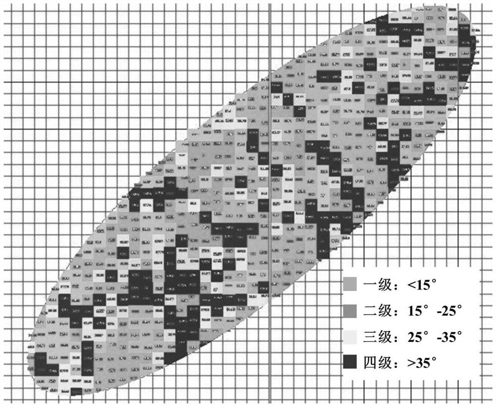
[0061] Using AutoCAD drawing software to analyze the gridded topographic map of the mining area with an accuracy of 50m, the slope classification results ( image 3), the first g...
Embodiment 2
[0069] Embodiment 2, Zhangjiamao Coal Mine Coal Mining Subsidence Area Aerial Seeding Test Design
[0070] 1. Overview of the test area
[0071] The test site is located in Miaoqu Village, Ningtiaota Coal Mining District, Shenmu City, Yulin City, Shaanxi Province, which belongs to the Loess Plateau area, where underground coal mining causes surface subsidence.
[0072] 2. Materials and equipment
[0073] (1) Design the tested seeds: alfalfa.
[0074] (2) The UAV used in the test is Tiantu M8A PRO, with a maximum payload of 20kg.
[0075] 3. Process flow
[0076] (1) Obtain topographic map
[0077] The topographic map is measured by digital mapping method, the design area is 1000 mu (666667 square meters), and the slope range is between 0° and 54.21°.
[0078] (2) Ground slope classification
[0079] Using AutoCAD drawing software to analyze the gridded topographic map of the mining area with an accuracy of 50m, the slope classification results ( Figure 4 ), the first g...
Embodiment 3
[0084] Example 3. Aerial sowing test of alfalfa seeds in the coal mining subsidence area of Zhangjiamao Coal Mine
[0085] 1. Overview of the test area
[0086] The test site is located in Muguashu Village, Zhangjiamao Coal Mining District, Shenmu City, Yulin City, Shaanxi Province. It belongs to the Loess Plateau area. Underground coal mining causes surface subsidence and cracks.
[0087] 2. Materials and equipment
[0088] (1) Seeds tested: alfalfa.
[0089] (2) The UAV used in the test is Tiantu M8A PRO, with a maximum payload of 20kg.
[0090] 3. Process flow
[0091] (1) Obtain topographic map
[0092] The topographic map is measured by digital surveying method, and the design area is 15 mu (10000.05 square meters).
[0093] (2) Ground slope classification
[0094] The slope of the aerial seeding test area is between 25° and 35°, which is the third grade in the ground slope classification.
[0095] (3) Aerial seeding operation design
[0096] The ground coverage...
PUM
 Abstract
Description
Claims
Application Information
 - R&D
- Intellectual Property
- Life Sciences
- Materials
- Tech Scout
- Unparalleled Data Quality
- Higher Quality Content
- 60% Fewer Hallucinations
Browse by: Latest US Patents, China's latest patents, Technical Efficacy Thesaurus, Application Domain, Technology Topic, Popular Technical Reports.
© 2025 PatSnap. All rights reserved.Legal|Privacy policy|Modern Slavery Act Transparency Statement|Sitemap|About US| Contact US: help@patsnap.com


