
Inertial navigation initial attitude resolving method based on solidification carrier coordinate system

A carrier coordinate system, initial attitude technology, applied in the direction of measuring devices, instruments, etc., can solve the problems of inability to know the precise geographical latitude, low rough alignment accuracy, etc., to reduce the number of chain multiplications, improve the level of alignment accuracy, The effect of eliminating alignment errors

Pending Publication Date: 2021-07-23
中国人民解放军火箭军工程大学
View PDF4 Cites 0 Cited by
  • Summary
  • Abstract
  • Description
  • Claims
  • Application Information

AI Technical Summary

Problems solved by technology

[0003] Traditional alignment methods include two-vector attitude determination, solidified coordinate system alignment, multi-vector alignment, etc. The idea is to observe different representations of different vectors in two coordinate systems to complete initial alignment. Vector selection usually includes a single The gravity vector at any time, the superposition integral of the gravity vector at different time periods, and the angular velocity of the earth's rotation, etc., all need to know the precise geographic latitude in the alignment process, so as to obtain the expression of the gravity vector at different times in the geographic coordinate system, but in practice, The precise geographic latitude is often not known
In the normal gravity model, we usually think that the expression of the gravity vector in the geographic coordinate system is [0 0 -g], where the size of g is calculated according to the normal gravity model, but the expression of the real gravity vector in the geographic coordinate system is often not Equal to [0 0 -g], there is a gravity anomaly between the two, and therefore an error is introduced in the initial alignment process, which can be equivalent to the bias error of the accelerometer, resulting in low coarse alignment accuracy

Method used


Image

  • Inertial navigation initial attitude resolving method based on solidification carrier coordinate system
  • Inertial navigation initial attitude resolving method based on solidification carrier coordinate system
  • Inertial navigation initial attitude resolving method based on solidification carrier coordinate system

Examples


Embodiment

[0039] Step 1: Set the simulation time of the shaking base to 1min, the sampling rate to 10hz, the constant zero drift of the gyro to 0.01° / h, and the random walk coefficient to The constant offset of the acceleration is 5×10 -4 g, the random walk coefficient is The attitude angle change state is:

[0040]

[0041] According to the attitude angle change sequence, a set of inertial group simulation data is obtained.

[0042] Step 2: Utilize the gyroscope output value to update the attitude rotation matrix Add meter measurement value at b 0 projection within the department;

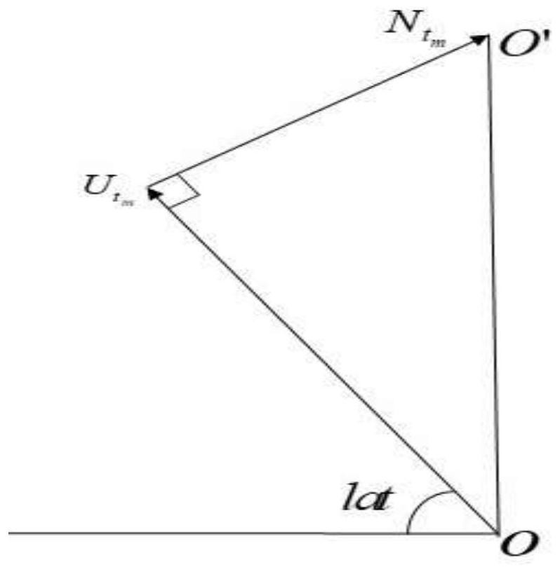
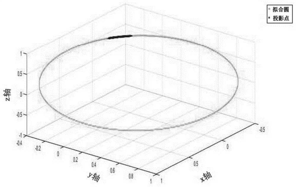
[0043] Step 3: In order to obtain a better fitting effect, a certain data extension is carried out on the projection vector, and points are taken at equal intervals during fitting, and finally the center of the fitting circle is [0.3575 0.3277 0.2846], which is unitized, That is, the fitting vector of the earth's axis under the solidification carrier. According to the triangular relationship bet...


PUM


Abstract

The invention relates to an inertial navigation initial attitude resolving method based on a solidification carrier coordinate system, spatial circle fitting is performed on a projection point in a carrier coordinate system at an initial moment by projecting meter measurement data according to a motion law that a gravity vector rotates around an earth axis under a solidification carrier system and gyro output, the circle center vector of the space circle is the expression of the earth axis under the solidification load system, a geographic coordinate system of the corresponding moment is obtained according to the triangular relation among the earth axis, the gravity vector and the geographic north direction, and therefore a rotation matrix between a navigation coordinate system and a carrier coordinate system is obtained, and coarse alignment of the shaking base is achieved. Compared with the prior art, the method has the advantages that accurate latitude and longitude can be obtained without knowing an alignment point; through data fitting, the error influence caused by angle shaking is relieved by fully utilizing alignment data, and the alignment precision level is greatly improved; the chain multiplication times of an attitude matrix are reduced, description of gravity in a normal gravity field is not used in the algorithm, and alignment errors caused by disturbance of the gravity can be eliminated.

Description

technical field [0001] The invention belongs to the technical fields of geophysics, geodesy, and autonomous orientation, and relates to a method for calculating the initial attitude of inertial navigation based on a solidified carrier coordinate system. Background technique [0002] The initial alignment is the process of determining the relative spatial orientation between the carrier coordinate system and the reference navigation coordinate system. For interstellar navigation), the accuracy of the initial alignment is directly related to the accuracy of subsequent navigation and positioning. [0003] Traditional alignment methods include two-vector attitude determination, solidified coordinate system alignment, multi-vector alignment, etc. The idea is to observe different representations of different vectors in two coordinate systems to complete initial alignment. Vector selection usually includes a single The gravity vector at any time, the superposition integral of the ...

Claims


Application Information

Patent Timeline
Patent Type & Authority Applications(China)
IPC IPC(8): G01C25/00
CPCG01C25/005
Inventor 张志利周召发赵军阳冯磊管世印梁哲
Owner 中国人民解放军火箭军工程大学
Learn More