

Laser three-dimensional point cloud-based autonomous pose estimation method for soft landing end segment of detector
A laser three-dimensional, pose estimation technology, applied in the field of space science, achieves the effect of realizing redundant output, balancing operation speed and accuracy requirements, and high accuracy of the method
- Summary
- Abstract
- Description
- Claims
- Application Information
AI Technical Summary
Problems solved by technology
Method used
Image

Examples
Embodiment Construction
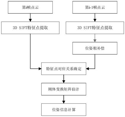
[0029] The following will combine Figure 1 to Figure 7 The method for estimating the autonomous pose and orientation of the soft landing stage of the detector based on the laser three-dimensional point cloud of the present invention will be further described in detail.
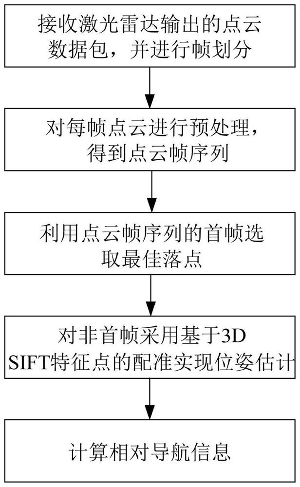
[0030] figure 1 Shown is a flow chart of the method for estimating the autonomous pose of the detector at the end of soft landing based on the laser three-dimensional point cloud of the present invention.
[0031] see figure 1 , the method for estimating the autonomous pose and attitude of the detector based on the laser three-dimensional point cloud at the end of the soft landing of the present invention, including:
[0032] 1) Receive the point cloud data packet output by the lidar, and perform frame division;
[0033] 2) Preprocessing each frame of point cloud to obtain a sequence of point cloud frames;
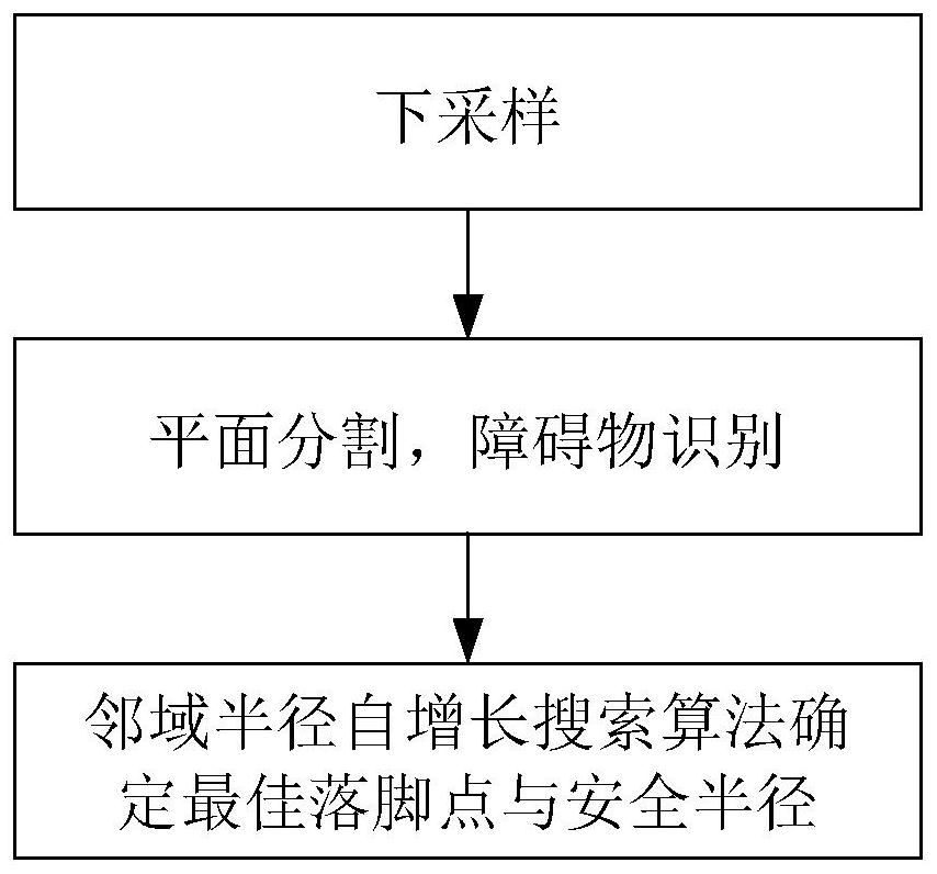
[0034] 3) Utilize the first frame of the point cloud frame sequence to select the best landing point...
PUM
 Abstract
Description
Claims
Application Information