
Vehicle driving path and driving speed collaborative planning method and system and storage medium

A driving speed and path technology, applied in vehicle position/route/altitude control, control/regulation system, motor vehicles, etc., can solve the problem of no planning path and planning speed coordinated optimization, without considering vehicle fuel consumption, etc., to achieve improvement The effect of fuel economy, reduced transportation costs and pollution

Pending Publication Date: 2021-12-17
GUANGZHOU AUTOMOBILE GROUP CO LTD
View PDF0 Cites 1 Cited by
  • Summary
  • Abstract
  • Description
  • Claims
  • Application Information

AI Technical Summary

Problems solved by technology

[0006] The technical problem to be solved by the present invention is to provide a method, system, and computer-readable storage medium for collaborative planning of vehicle driving path and driving speed, so as to solve the problem of not performing collaborative optimization on the planned path and planning speed in the prior art, and not considering Vehicle Fuel Consumption Defects

Method used

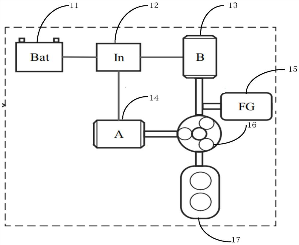
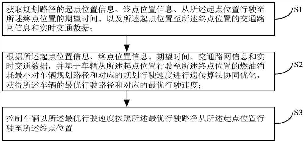
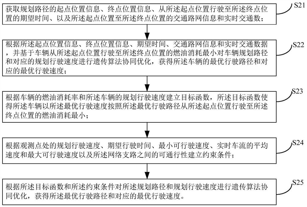

Image

  • Vehicle driving path and driving speed collaborative planning method and system and storage medium
  • Vehicle driving path and driving speed collaborative planning method and system and storage medium
  • Vehicle driving path and driving speed collaborative planning method and system and storage medium

Examples


Embodiment 1

[0238] Based on Embodiment 1 of the present invention, Embodiment 2 of the present invention provides a collaborative planning system for vehicle travel paths and travel speeds, such as Figure 7 As shown, the system 2 includes: an acquisition unit 21, which is used to acquire the start position information, end position information, expected time from the start position to the end position, and the start position to the end position information of the planned route. The traffic road network information and real-time traffic data of the terminal position, the optimal driving route and the optimal driving speed determination unit 22, are used for according to the starting position information, terminal position information, expected time, traffic road network information and real-time traffic data , and based on the minimum fuel consumption of the vehicle traveling from the initial position to the end position, the genetic algorithm collaborative optimization is performed on the...


PUM


Abstract

The invention provides a vehicle driving path and driving speed collaborative planning method and system and a storage medium. According to the method, a global optimization problem of a coupling path and speed is built based on driver demands, traffic network information and vehicle longitudinal dynamic characteristics; a multivariable collaborative optimization method for path, speed and power transmission system control based on a genetic algorithm is provided, so that an economical driving path and a reference vehicle speed can be provided for a driver; in addition, the running path and the reference vehicle speed are tracked through a hybrid power system real-time optimization control strategy combining a global power distribution strategy and rolling linear quadratic tracking control, and therefore economical self-adaptive cruise control is achieved. The method can effectively improve the fuel economy of the vehicle and reduce the transportation cost and pollution.

Description

technical field [0001] The present invention relates to the technical field of collaborative planning of vehicle driving paths and driving speeds, in particular to a method, system and storage medium for collaborative planning of vehicle driving paths and driving speeds. Background technique [0002] The existing navigation system has two functions of positioning and navigation, and can provide the shortest and fastest driving routes according to the driver's given start-end point and current road network information. The driving path is generally obtained by the following method: according to the electronic map, define the directed weighted graph of the traffic network, the shortest (or fastest) path can be expressed as an ordered sequence of nodes, and the distance (time) corresponding to the sequence is the smallest. The weights (distance or time) between nodes are independent of each other and can be calculated from traffic network data and traffic flow data (such as veh...

Claims


Application Information

Patent Timeline
Patent Type & Authority Applications(China)
IPC IPC(8): G05D1/02G01C21/34
CPCG05D1/0223G05D1/0221G05D1/0276G01C21/3446
Inventor 苗成生卜祥津修彩靖郭继舜尹杨
Owner GUANGZHOU AUTOMOBILE GROUP CO LTD
Learn More