Method for inverse computing digital surficial height from image of synthetic aperture radar in all polarization by one time of flight
A terrestrial digital and inversion technology, applied in the direction of reflection/re-radiation of radio waves, utilization of re-radiation, measurement devices, etc., can solve the problem of high technical difficulty of INSAR
- Summary
- Abstract
- Description
- Claims
- Application Information
AI Technical Summary
Problems solved by technology
Method used
Image
Examples
Embodiment 1
[0104] Embodiment 1, Guangdong Huizhou area.
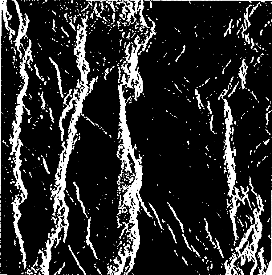
[0105] Using the L-band data observed by SAR SIR-C on Guangdong Province, China on October 4, 1994 provided by the Jet Propulsion Laboratory (JPL) of the California Institute of Technology, the center of the image is about (114.561°E, 22.815°N), and every The size of a pixel is 12.5×12.5m 2 . The incident angle of the SAR at the center of the image is 32.85°. image 3 It is a backscattered vv, hh, hv total power image with a size of 512×512 pixels intercepted from the original image, and its center is located at (114.7826°E, 23.1359°N), located in Huizhou, Guangdong Province, China.
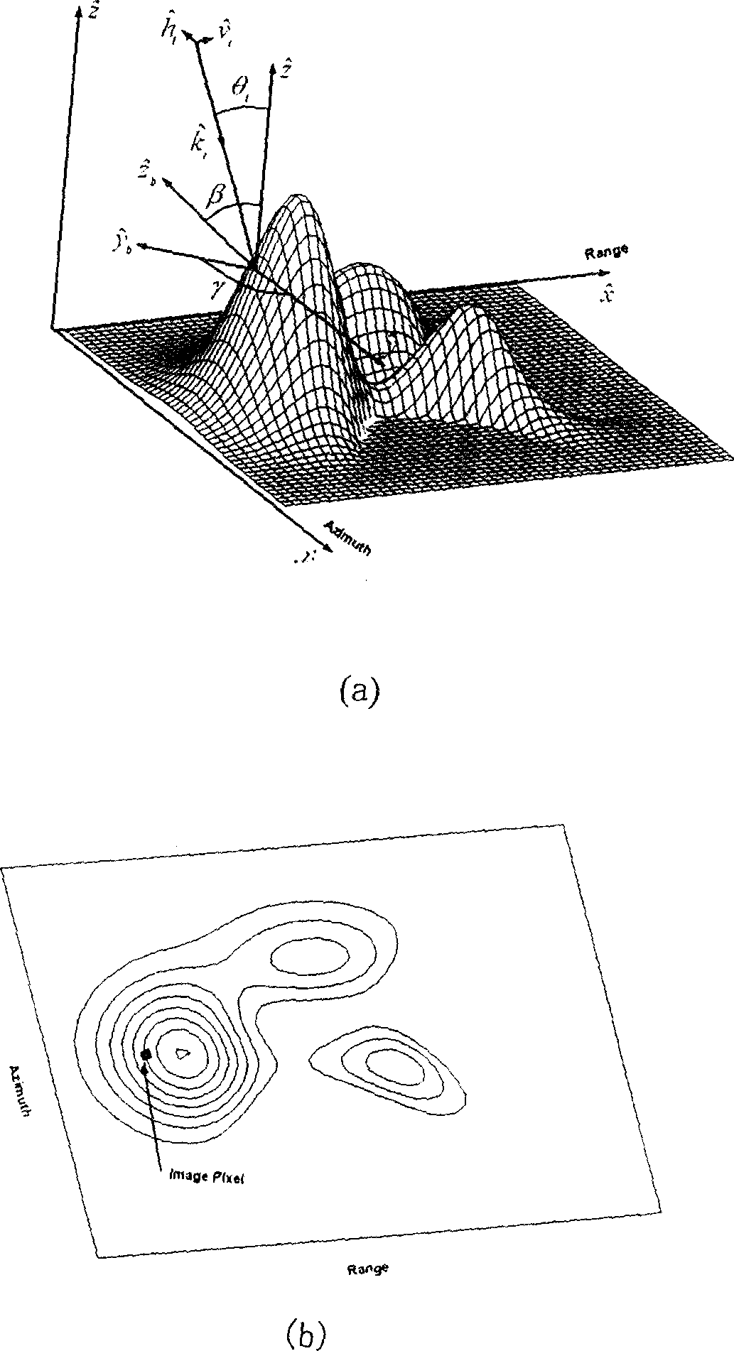
[0106] From image 3 You can see the undulating hills running north-south. In order to highlight the main trend of the terrain, we have omitted some more subtle local undulations. Note that the horizontal azimuth γ defined here is the slope trend and orientation angle (such as figure 1 (a) shown).
[0107] S A and S R The calculation res...
Embodiment 2
[0109] Embodiment 2, Alishan area, Taiwan
[0110] Using the L-band data observed by SAR SIR-C on Taiwan, China on October 4, 1994 provided by the Jet Propulsion Laboratory (JPL) of the California Institute of Technology, the center of the image is about (120.964°E, 23.487°N), each The pixel size is 12.5×12.5m 2 . The incident angle of the SAR at the center of the image is 32.85°. Figure 8 It is a backscattered vv, hh, hv total power image with a size of 512×512 pixels intercepted from the original image, and its center is (120.8626°E, 23.6659°N), located in the Alishan area of Taiwan, China.
[0111] Intuitive terrain structure and very simple ground elevation map reflected by inverted DEM and original SAR image [13] It is basically the same, and the direction of its main terrain is also consistent with the light and dark texture of the SAR image.
PUM
 Abstract
Description
Claims
Application Information
 - R&D
- Intellectual Property
- Life Sciences
- Materials
- Tech Scout
- Unparalleled Data Quality
- Higher Quality Content
- 60% Fewer Hallucinations
Browse by: Latest US Patents, China's latest patents, Technical Efficacy Thesaurus, Application Domain, Technology Topic, Popular Technical Reports.
© 2025 PatSnap. All rights reserved.Legal|Privacy policy|Modern Slavery Act Transparency Statement|Sitemap|About US| Contact US: help@patsnap.com


