
Magnetic bearing navigation digital integration system

An integrated system and magnetic orientation technology, applied in ground navigation, navigation calculation tools, etc., can solve the problems of inconvenient operation, poor comprehensive complementarity, low efficiency of navigation safety, etc., achieve easy installation, safe and convenient driving, and overcome cumbersomeness Effect

Inactive Publication Date: 2007-03-21
童明 +1
View PDF2 Cites 0 Cited by
  • Summary
  • Abstract
  • Description
  • Claims
  • Application Information

AI Technical Summary

Problems solved by technology

Since most of the various devices work alone, the comprehensive complementarity is poor, the operation is inconvenient, and there are errors caused by the observation time difference, and the efficiency of ensuring navigation safety is low, so we all want to seek a safe and reliable integrated navigation system

Method used


Image

  • Magnetic bearing navigation digital integration system
  • Magnetic bearing navigation digital integration system
  • Magnetic bearing navigation digital integration system

Examples


Embodiment Construction

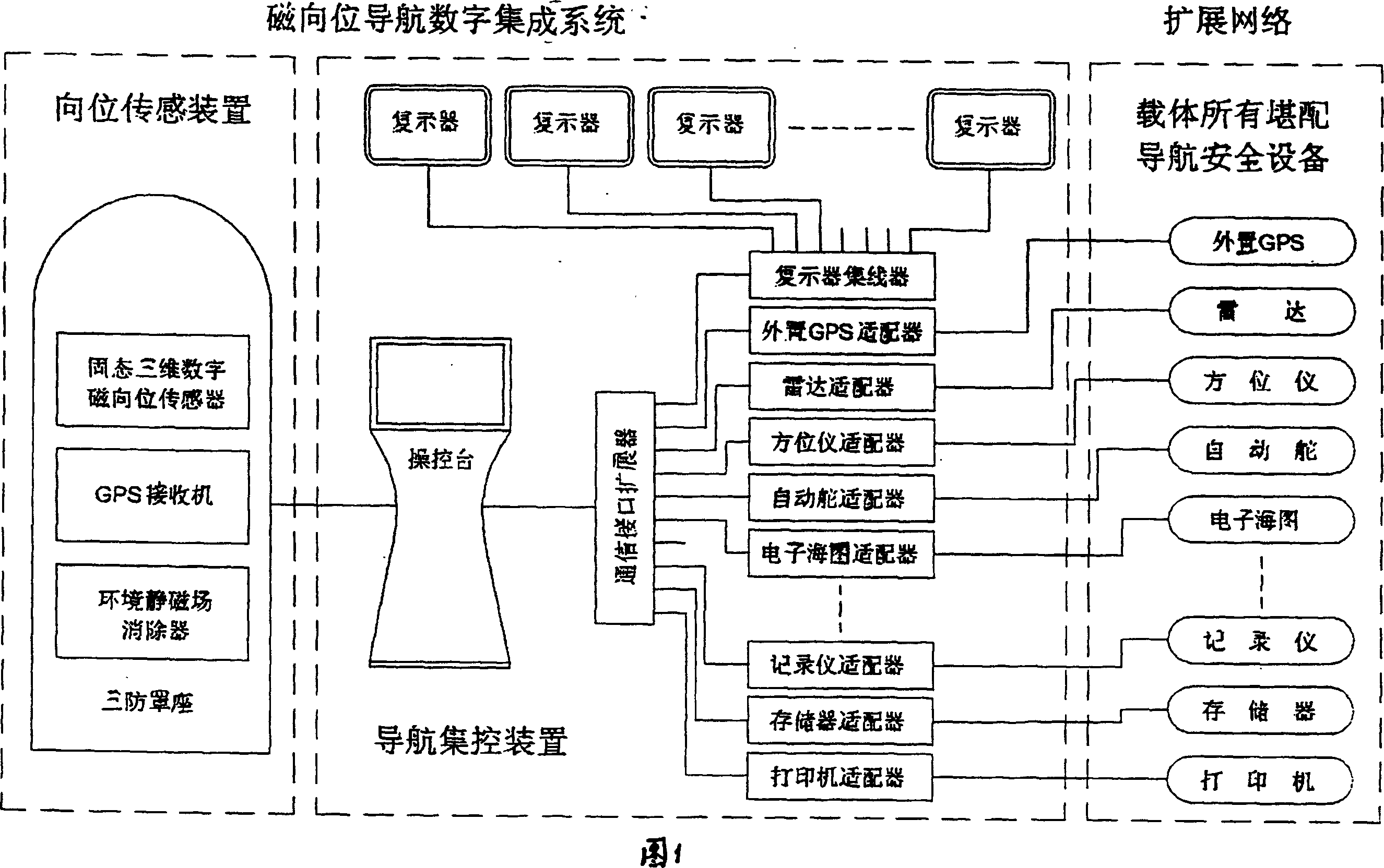
[0018] The overall block diagram of the system is shown in Figure 1, which consists of two parts: the system and the extended network. This system is composed of "solid-state three-dimensional digital magnetic orientation sensor", GPS, and "orientation sensing device" composed of environmental static magnetic field eliminator, which are connected through console, communication interface expander, communication adapter and repeater.

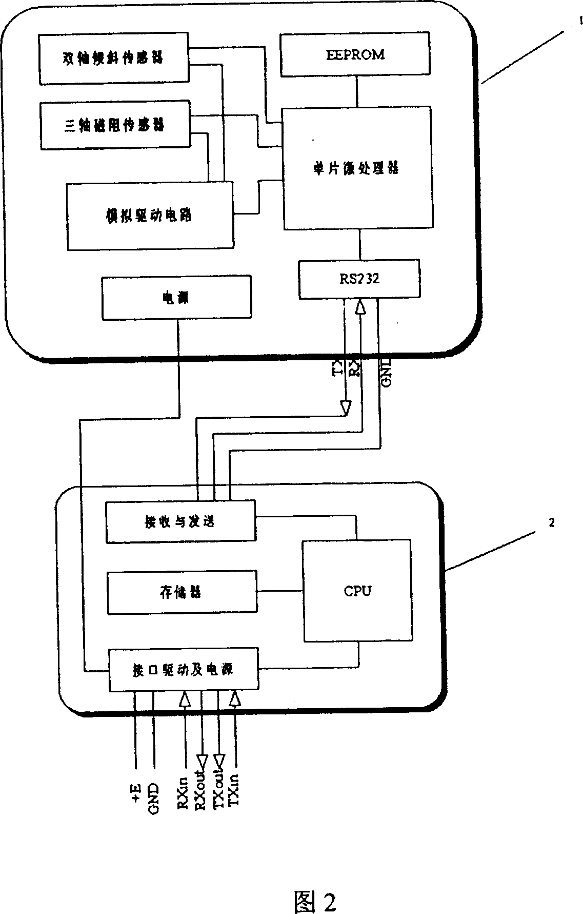
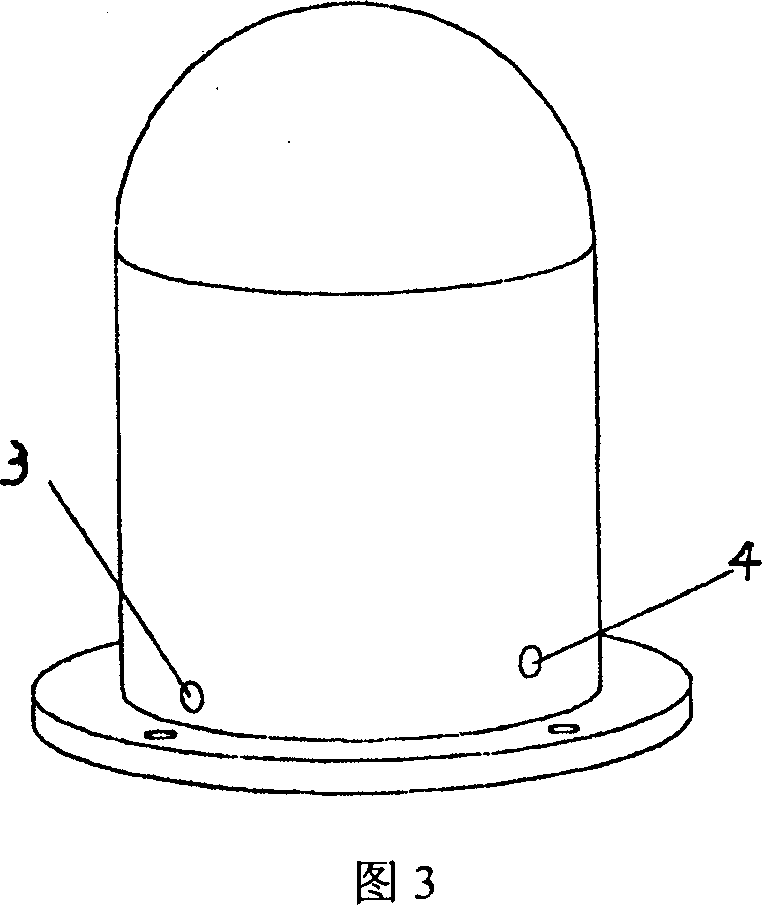
[0019] The solid-state three-dimensional digital magnetic orientation sensor is shown in Figure 2. It includes an orientation sensor 1 and an interface adapter 2. The orientation sensor 1 is composed of a biaxial tilt sensor, a three-axis magnetoresistive sensor, an analog drive circuit, an RS232 interface, and an EEPROM and The microprocessors are connected together, and the interface adapter 2 includes a CPU, an interface driving circuit, a power supply and a buffer memory. As shown in Figure 3, the solid-state three-dimensional digital magnetic...


PUM


Abstract

The invention relates to a magnetic bearing navigation digital integration system comprising a solid state three dimensional digital magnetic bearing sensing device, a GPS, an environment static magnetic field eliminator which form a directional sensing device and operation desk, a communication spreading apparatus, a communication adapter and a multiple display device which form a navigation centralized control equipment. The invention can overcome the problem of unstable reading as the result of the carrier swing of the dynamic magnetic rotor.

Description

technical field [0001] The invention relates to a digital centralized control system for magnetic azimuth navigation, which is a digital integrated navigation system for carrier (vehicle) pointing and positioning. Background technique [0002] At present, most of the pointing navigation devices used by vehicles are magnetic compass or gyro compass. The magnetic compass is safe and reliable, but its main disadvantage is that the installation environment conditions are limited, and the driver needs to perform complicated orientation conversions during use, and it is inconvenient to combine with other navigation equipment, which restricts the integration and automation of navigation equipment. However, the gyrocompass has complex structure, high cost, high-power power supply, many faults, and short life. Once the power supply fails or loses power, it will not work. The positioning navigation equipment is the Global Positioning System (GPS), which is more popular, but it can on...

Claims


Application Information

Patent Timeline
Patent Type & Authority Patents(China)
IPC IPC(8): G01C21/08G01C21/20
Inventor 童明庄钠
Owner 童明
Learn More