Geograph positioning encoding technique for city area and member

A technology for urban components and urban areas, applied in electrical digital data processing, special data processing applications, maps/plans/charts, etc., to achieve the effects of simple technology, manpower saving, significant economic and social benefits

Inactive Publication Date: 2005-08-10
北京市东城区信息中心
View PDF1 Cites 10 Cited by
  • Summary
  • Abstract
  • Description
  • Claims
  • Application Information

AI Technical Summary

Problems solved by technology

[0006] The object of the present invention is to provide a kind of geolocation coding technology of urban areas and components, so as to solve the deficiencies in the existing methods for the geographic positioning and addressing of urban areas and components. The geographic positioning of the present invention is simple, accurate and intuitive, making the Regions and components can be quickly addressed, so as to realize an accurate, fast, efficient, and all-round urban management model; save manpower and material resources, and achieve significant economic and social benefits

Method used


Image

  • Geograph positioning encoding technique for city area and member
  • Geograph positioning encoding technique for city area and member
  • Geograph positioning encoding technique for city area and member

Examples


Embodiment

[0033]The geolocation coding technology of the city part of the present invention comprises the following steps:

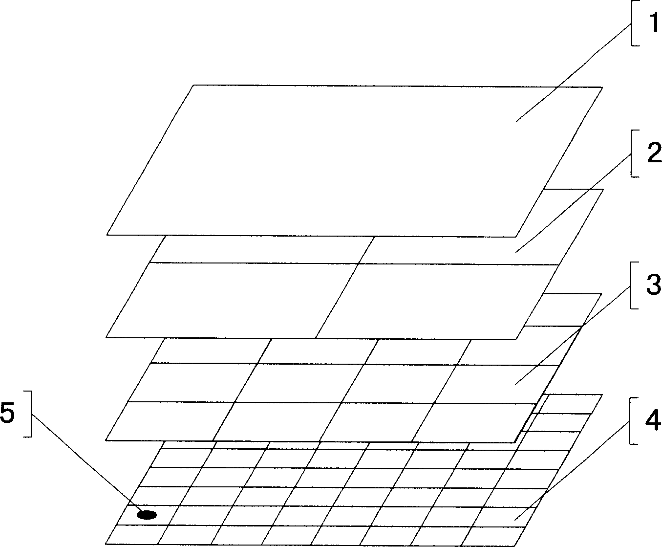
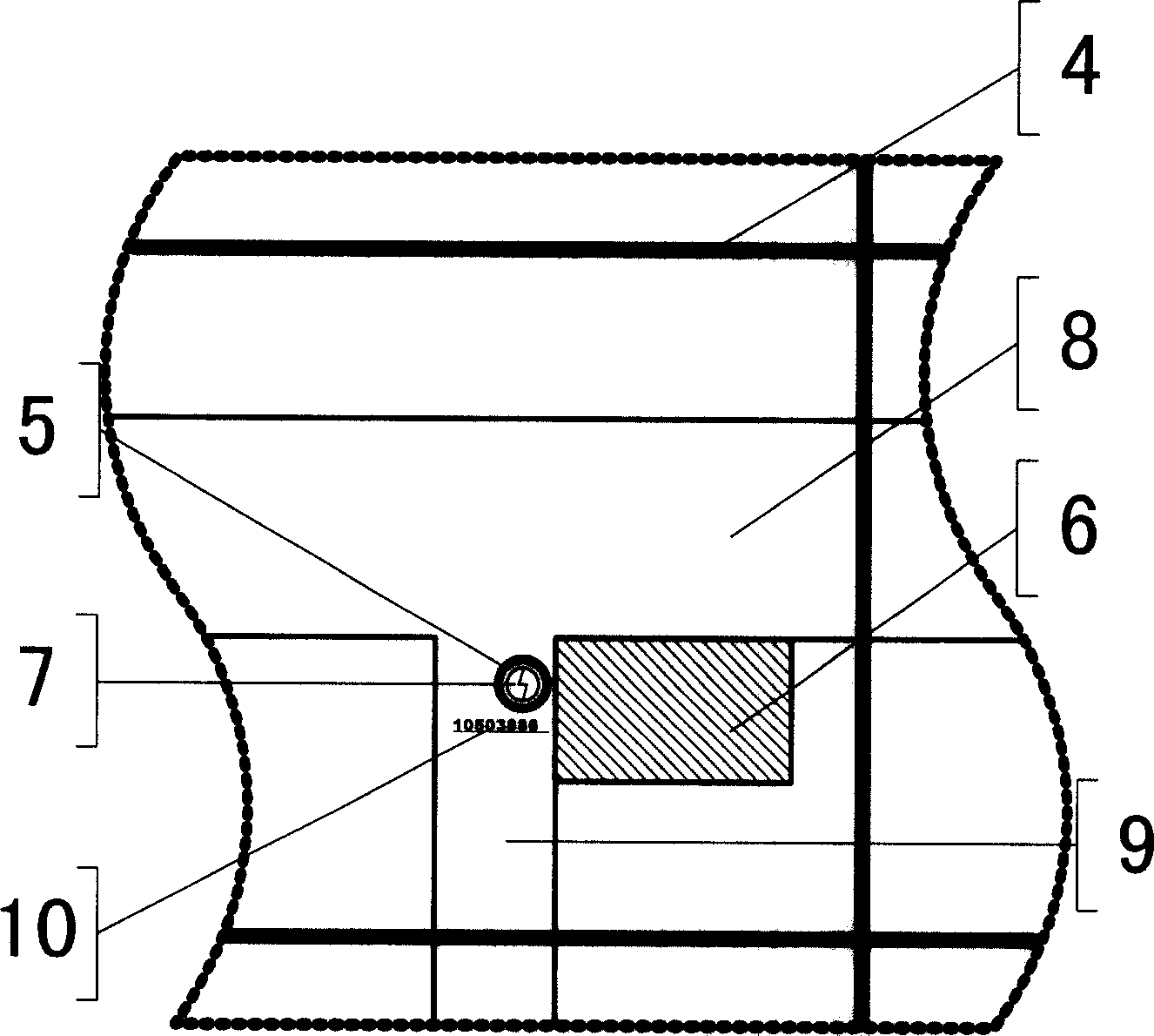
[0034] Step 1) as in figure 1 , the region 1 is divided into several levels of grids, and the grids at all levels are coded, that is, the street office is 2, the community is 3, and the unit grid is 4, forming a grid coding map to determine the position of each grid , figure 1 The areas of the grids at all levels shown are equal to the square shape. When actually dividing, according to the terrain and the convenience of management (divided according to the principles of territorial management, current situation management, convenient management, and management objects), the area is roughly divided into Equal irregular polygons, the area of ​​each unit grid 4 is about 10,000 square meters.

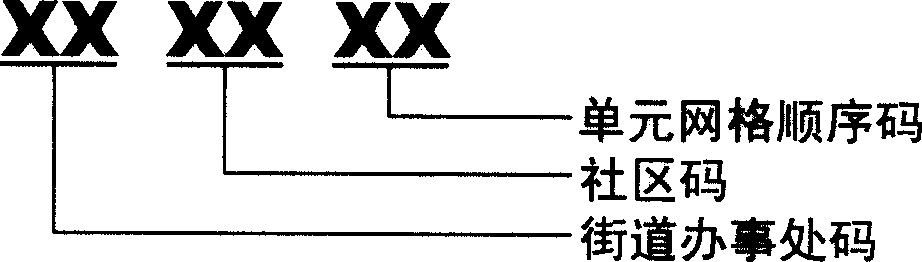
[0035] Such as image 3 It is a schematic diagram of regional grid coding. The method of regional grid coding is: use 6 digits to represent; the 1st and 2nd digits represent...


PUM


Abstract

The present invention relates to a geographic positioned coding technique of city region and component. It is characterized by that it includes the following steps: 1. dividing city region into several levels of grids, coding every-level grid and forming grid code map; 2. coding every city component in the city and forming city component code; 3. marking every city component code on the place nearby the position of city component in correspondent unit grid of grid code map so as to form city component grid code map. Said invention also provides the application range of said city component grid code map.

Description

technical field [0001] The invention relates to the technical field of geographic information identification and positioning, in particular to a geographic positioning coding technology for urban areas and components. Background technique [0002] In the "digital city" technology, the geocoding system is one of the digital city spatial information engineering infrastructures, and it is an adapter that associates construction resource information with geographic location coordinates. The digital city geocoding system provides a way to assign geographic coordinates to information resources with geographic locations, which can then be calculated by computers. Therefore, using geographic data as the basic link, the purpose of integrating various socio-economic, resource environment, and urban public facilities information in a unified geographic reference frame is achieved, and the basic data exchange and sharing of various departments is realized. Through geocoding, the addres...

Claims


Application Information

Patent Timeline
Patent Type & Authority Applications(China)
IPC IPC(8): G06F17/30G06F19/00G09B29/00
Inventor 陈平
Owner 北京市东城区信息中心
Why Eureka
Try Eureka