Digital camera for integrated satellite electron geographical information application
A technology of digital cameras and geographic information, applied in the field of digital cameras, to achieve the effects of rich functions, easy and convenient travel process, great economic benefits and social benefits
- Summary
- Abstract
- Description
- Claims
- Application Information
AI Technical Summary
Problems solved by technology
Method used
Image

Examples
Embodiment Construction
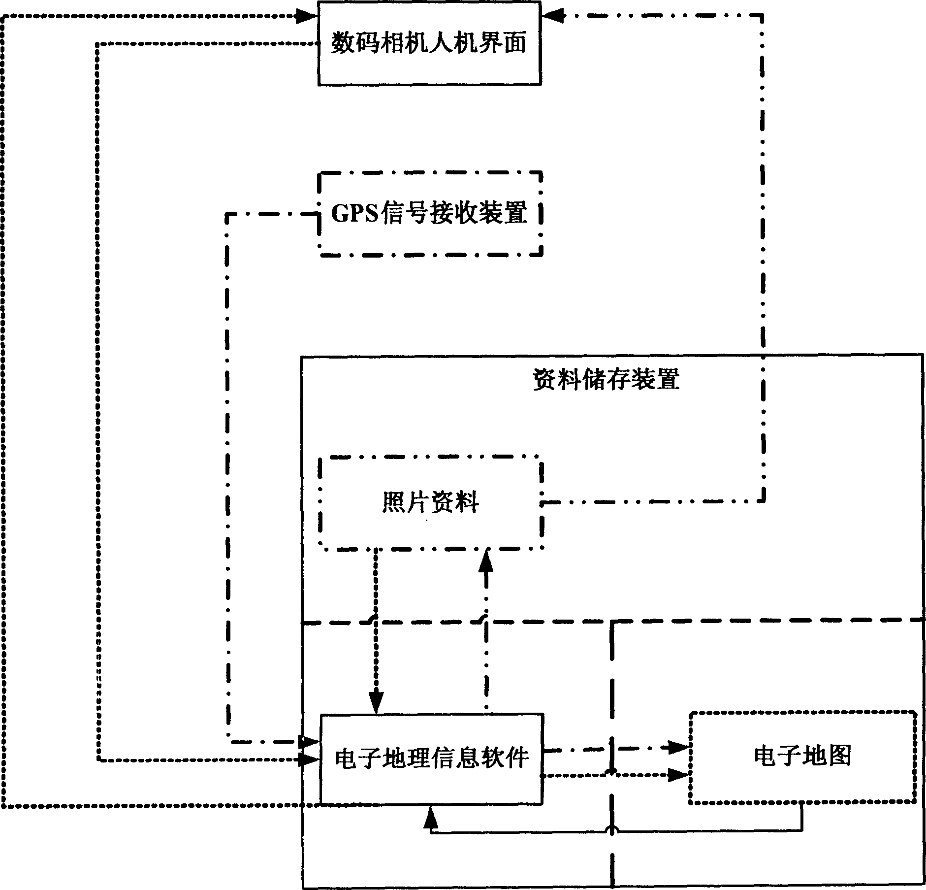
[0018] see figure 1 A digital camera integrating satellite electronic geographic information application includes a digital camera man-machine interface, a data storage device and a GPS signal receiving device. The data storage device stores photo data, electronic geographic information software and electronic maps. The man-machine interface of the digital camera is combined with electronic geographic information software, GPS signal receiving device and other data in the data storage device to realize multiple satellite electronic geographic information applications. The data storage device is built into the digital camera, or connected to the digital camera through a wired or wireless method, or exists as a stream file in a wired or wireless network environment, or consists of a combination of the above forms. The GPS signal receiving device is built into the digital camera, or connected with the digital camera in a wired or wireless manner.
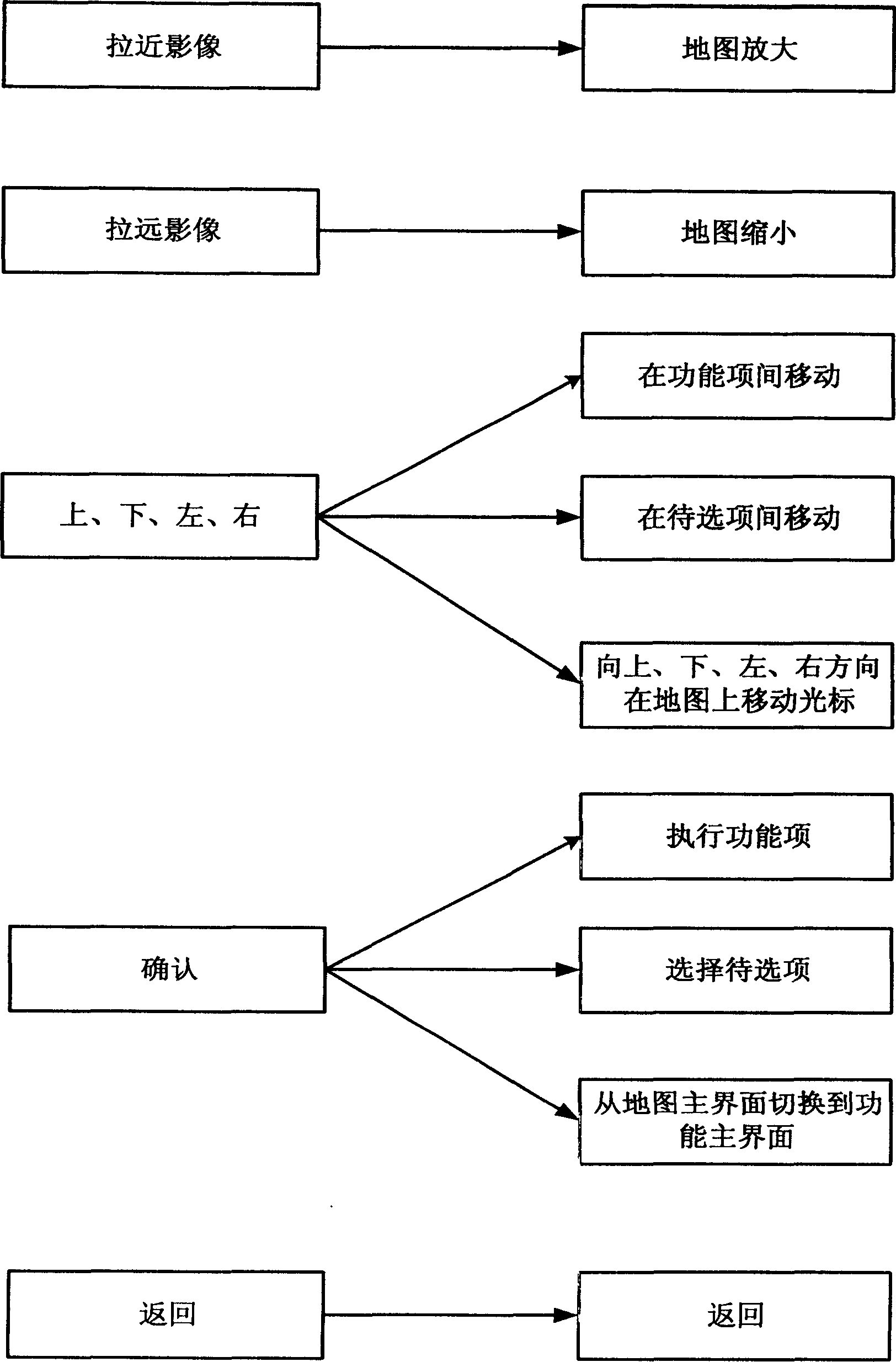
[0019] 1. Electronic map oper...
PUM
 Abstract
Description
Claims
Application Information
 - Generate Ideas
- Intellectual Property
- Life Sciences
- Materials
- Tech Scout
- Unparalleled Data Quality
- Higher Quality Content
- 60% Fewer Hallucinations
Browse by: Latest US Patents, China's latest patents, Technical Efficacy Thesaurus, Application Domain, Technology Topic, Popular Technical Reports.
© 2025 PatSnap. All rights reserved.Legal|Privacy policy|Modern Slavery Act Transparency Statement|Sitemap|About US| Contact US: help@patsnap.com