Geofencing and route adherence in global positioning system with signals from fewer than three satellites

Active Publication Date: 2008-10-02
2201028 ONTARIO
View PDF5 Cites 16 Cited by
  • Summary
  • Abstract
  • Description
  • Claims
  • Application Information

AI Technical Summary

Benefits of technology

[0010]In addition to covering the basic techniques for computing the distance from a base point of interest to the solution surface, some geofencing and route adherence applications are discussed and explored. Application of those algorithms would provide better availability of geofence monitoring and route adherence testing in limited GPS satellite visibility environments.

Problems solved by technology

One of the major problems in the use of satellite navigation is blockage of the view of GPS satellites.
The blockage is often only partial, with only a few satellites visible and the rest being blocked by trees, buildings and other obstacles.
With only two satellites in view, it is impossible to determine the receiver's current location.
In general, knowing the Solution Surface is not very useful, since it is not a bounded area.

Method used


Image

  • Geofencing and route adherence in global positioning system with signals from fewer than three satellites
  • Geofencing and route adherence in global positioning system with signals from fewer than three satellites
  • Geofencing and route adherence in global positioning system with signals from fewer than three satellites

Examples


Embodiment Construction

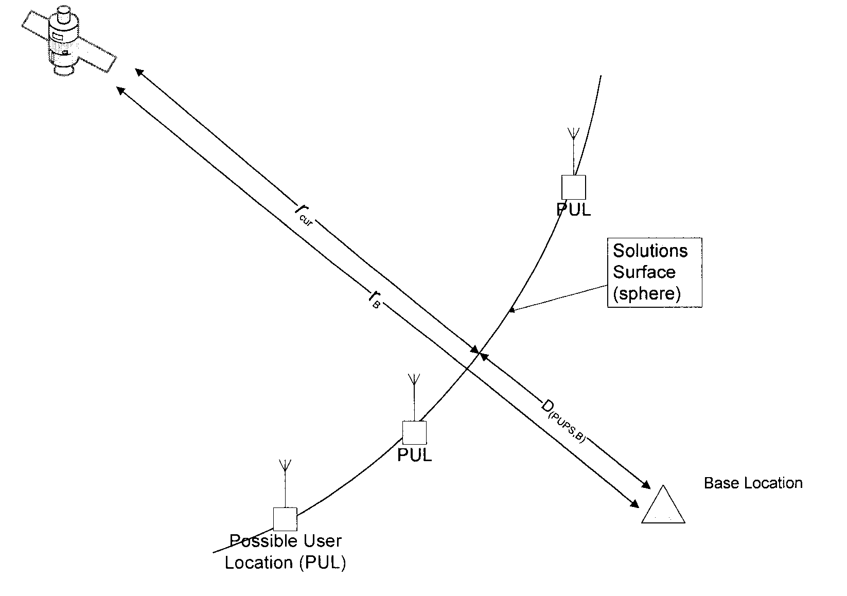
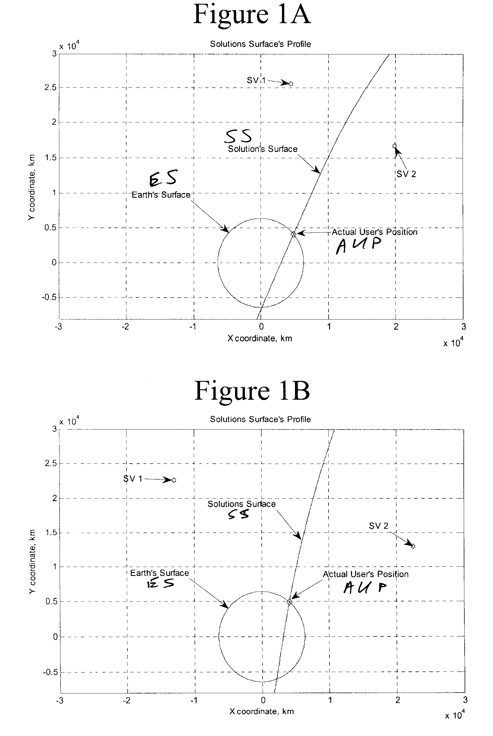
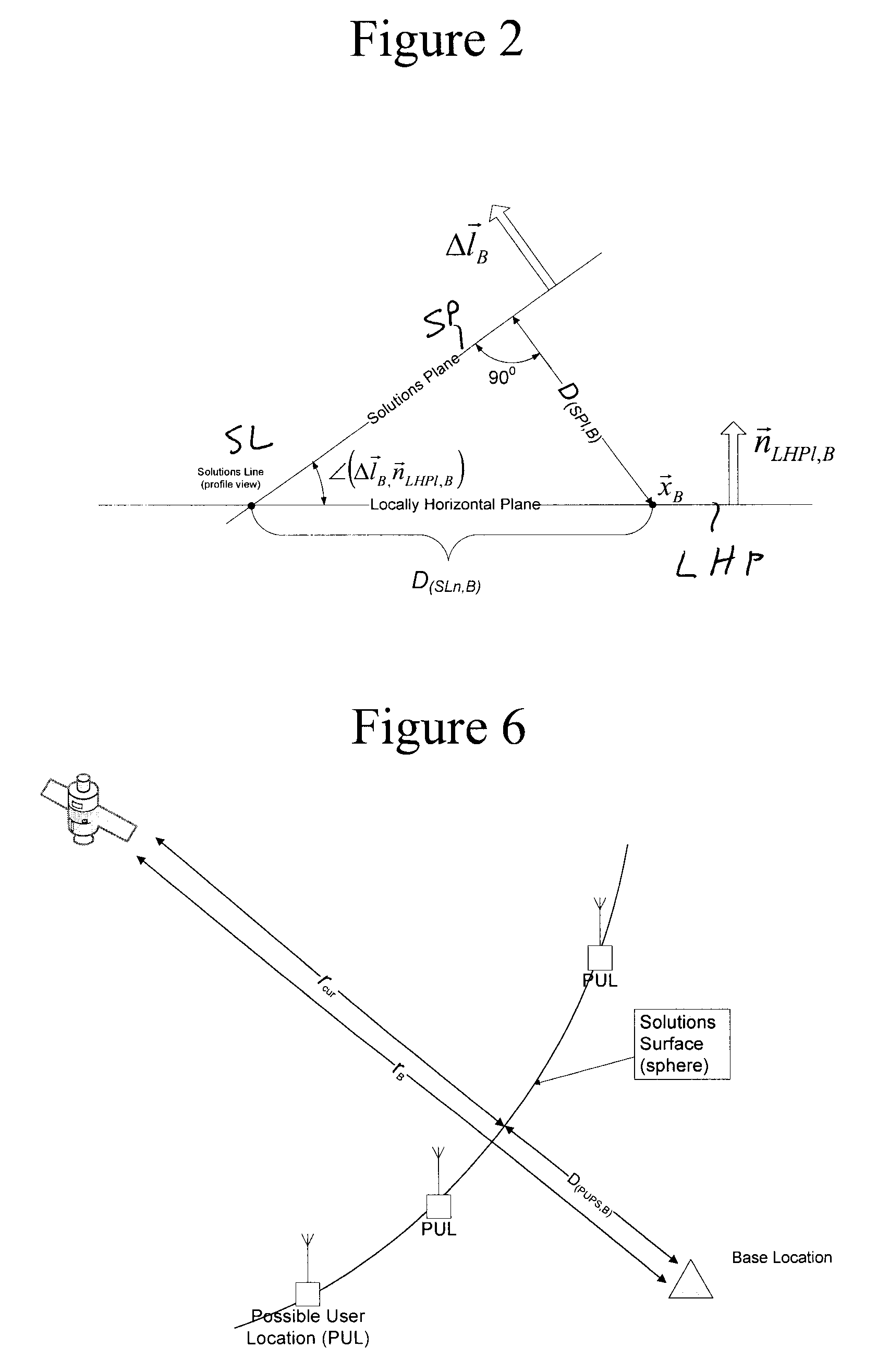
[0054]Preferred embodiments of the invention will now be set forth in detail with reference to the drawings, in which like reference numerals refer to like elements throughout.

[0055]In a first preferred embodiment, the distance is determined to a user position on a plane in the case of two satellites and a GPS receiver with a standard clock. The basic GPS fix equation can be written as:

{ρi+ri+bU|i=1, 2, . . . NS}  (E10)

[0056]where

ri=|{right arrow over (x)}S,i−{right arrow over (x)}U|=√{square root over (({right arrow over (x)}S,i−{right arrow over (x)}U)·({right arrow over (x)}S,i−{right arrow over (x)}U))}  (E20)

[0057]In Cartesian coordinates the equations in (E10) will take the following form:

ρi=(xS,i-xU)2+(yS,i-yU)2+(zS,i-zU)2+bU(E30)

[0058]Here ρi are known measurements, {right arrow over (x)}S,i are computed from GPS navigation and observation data values, and {right arrow over (x)}U and bU are unknowns.

[0059]With two satellites in view, equation (E30) is a pair of dependent equ...


PUM


Abstract

When a global positioning system receiver receives signals from too few satellites to determine its position unambiguously, the receiver determines a solution surface as a set of possible locations determined from the signals received from the satellites. It then determines a minimum possible distance from a base location to that solution surface. If the base location is a geofence anchor, the receiver can determine whether a geofence crossing event has happened. If the base location is on a route, the receiver can determine whether it is following the route. A receiver with an ordinary clock can do so with signals from two satellites; a receiver with an extremely accurate clock can do so with a signal from one satellite.

Description

FIELD OF THE INVENTION[0001]The present invention is directed to a system, method and article of manufacture for GPS location and more particularly to such a system, method and article of manufacture in which a minimum distance from a GPS receiver to a nearby reference location is determined when there are fewer than three GPS satellites in view.DESCRIPTION OF RELATED ART[0002]One of the major problems in the use of satellite navigation is blockage of the view of GPS satellites. The blockage is often only partial, with only a few satellites visible and the rest being blocked by trees, buildings and other obstacles. To obtain a GPS fix, a GPS receiver without an on-board atomic clock generally needs to have at least 4 satellites in view (this is called a 3D GPS fix.). With an assumed receiver altitude (typically from a previous 3D fix), only 3 satellites are necessary (so called 2D fix.)[0003]With only two satellites in view, it is impossible to determine the receiver's current locat...

Claims


Application Information

Patent Timeline
IPC IPC(8): G06F19/00G01S5/14G01S19/50
CPCG01S19/42
Inventor VERECHTCHIAGINE, DIMITRI
Owner 2201028 ONTARIO
Why Eureka
Try Eureka