Marine seismic survey method and system

a technology of seismic acquisition and marine seismic, applied in seismology, seismology, instruments, etc., can solve the problems of not taking into account a broad range none of these systems seek to actively control the spread, and none of these systems relies on or takes into account a broad spectrum of input conditions and parameters. to achieve the effect of reducing non-productive tim

Active Publication Date: 2009-06-04
WESTERNGECO LLC
View PDF51 Cites 152 Cited by
  • Summary
  • Abstract
  • Description
  • Claims
  • Application Information

AI Technical Summary

Benefits of technology

[0049]The drive commands may be validated according geophysical and operational requirements. The geophysical requirements include achieving desired coverage of a subsurface area, duplicating the seismic signal ray paths of a prior survey, and controlling the seismic sensor noise. The operational requirements include defining one or more safe passages for the spread through dangerous areas, determining an optimum time to perform one or more lines of the survey, and reducing non-productive time. Accordingly, alternative drive commands may be calculated for effecting a safe passage between two or more definable locations

Problems solved by technology

None of these systems, however, relies upon or takes into account a broad spectrum of input conditions and parameters that includes the various objectives and constraints of the seismic survey equipment and methods.
Furthermore, none of these systems seeks to actively control the spread with a coordinated suite of steering devices deployed throughout the spread.

Method used


Image

  • Marine seismic survey method and system
  • Marine seismic survey method and system
  • Marine seismic survey method and system

Examples


Embodiment Construction

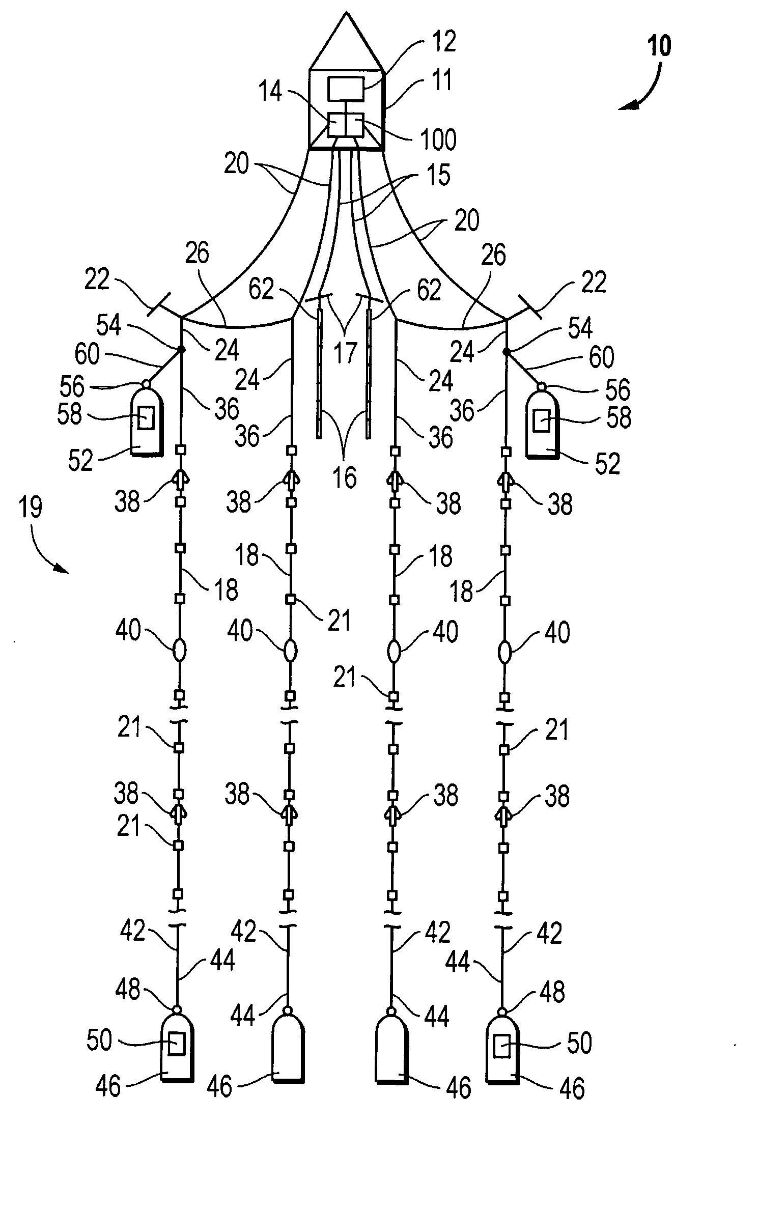
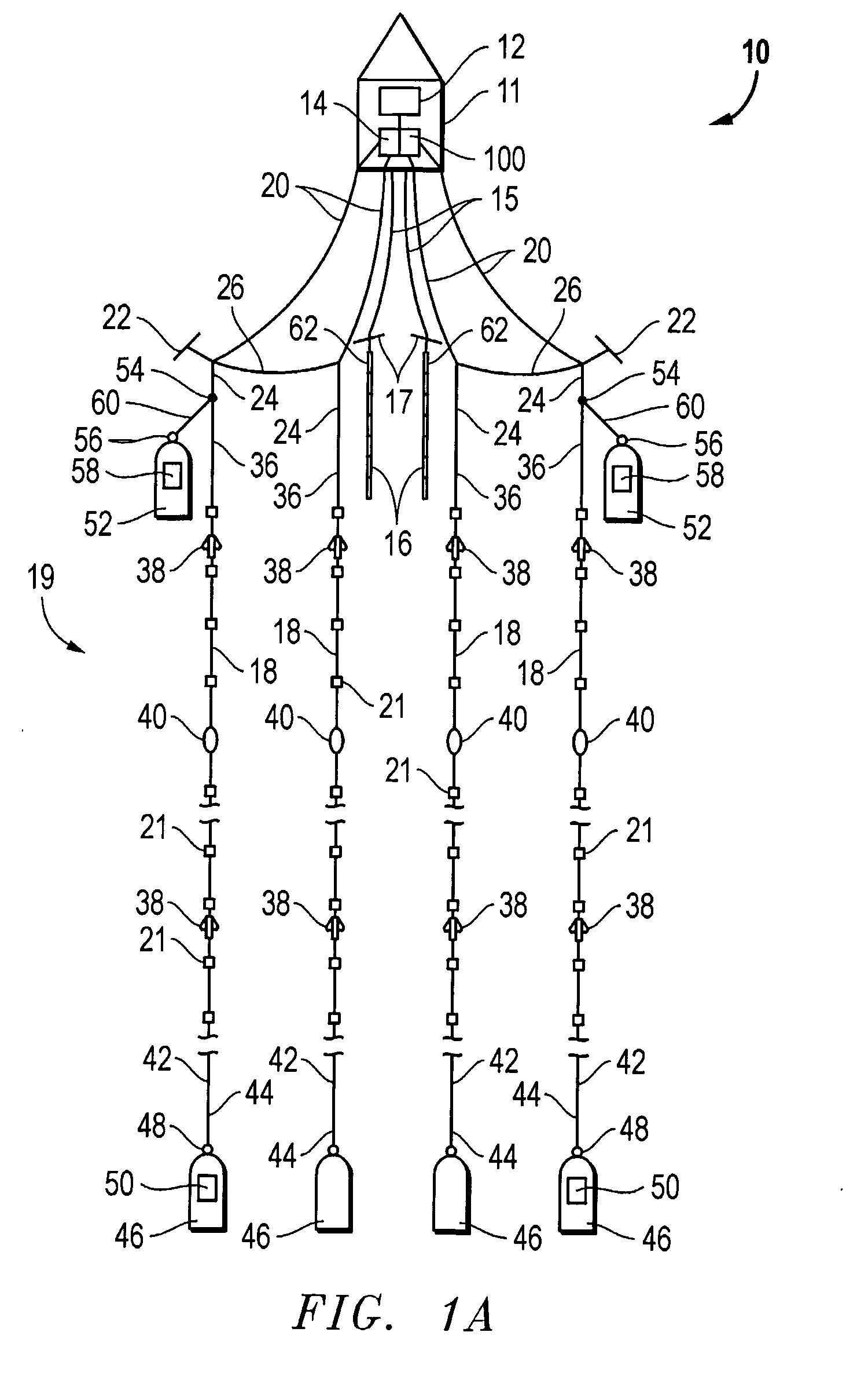
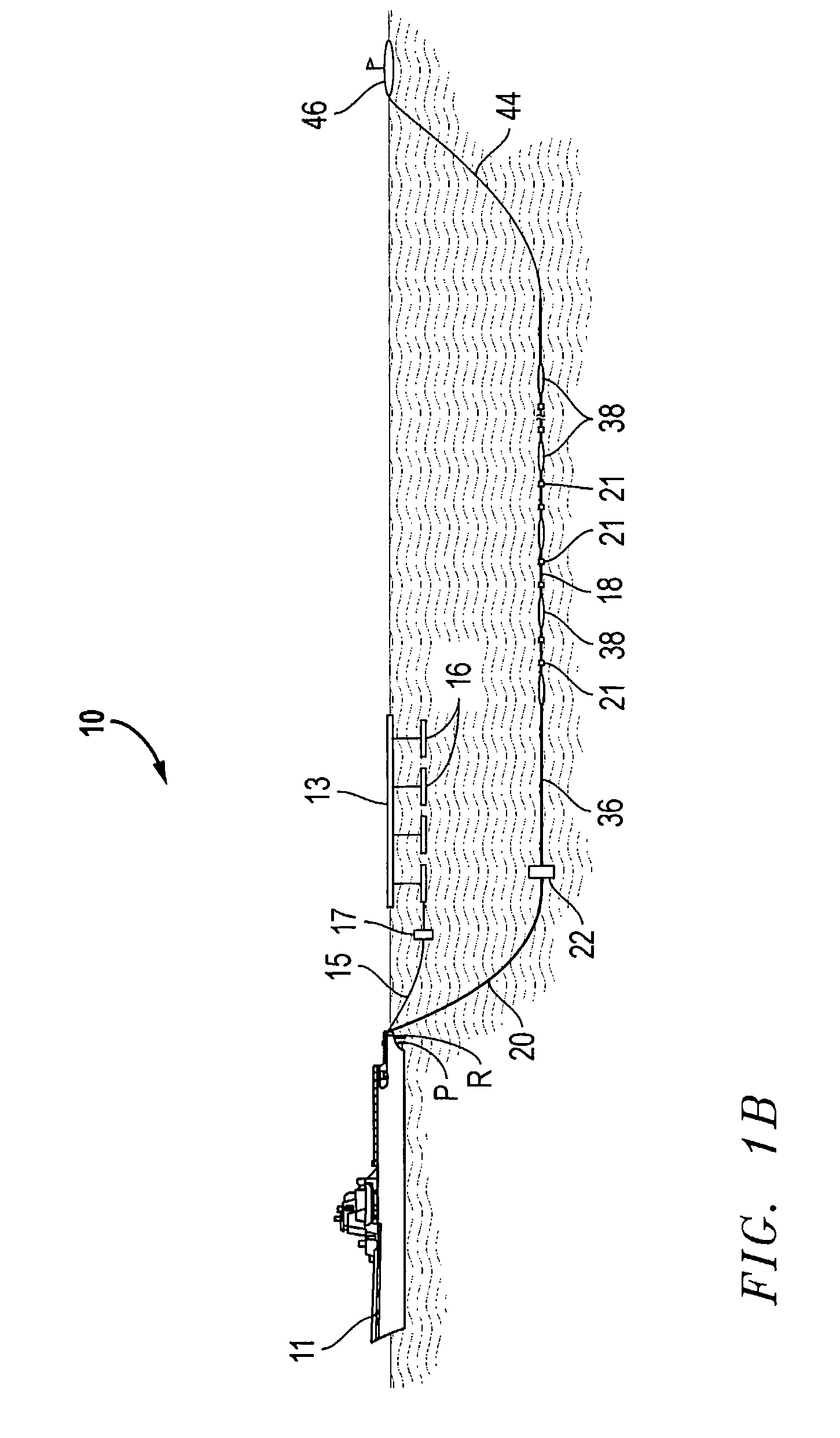
[0079]FIGS. 1A-1B illustrate a typical marine seismic acquisition survey spread (also know simply as “spread”) 10 for performing 3-D surveys. The spread 10 is characterized by a plurality of components, some of which are controllable and known as spread control components. The spread components will typically include one or more marine vessels 11, such as the vessels described in U.S. Pat. No. 6,216,627, and a plurality of components towed by at least one of the vessels. The towed components include cables such as lead-in cables 20, spreader lines 26, streamers 18, and source tow cables and pressure lines (both represented as 15), as well as sources 16, hydrophone sensors 21 within the streamers, and steering devices such as deflectors 22, streamer steering birds 38, and source steering devices 17.

[0080]The spread components may further include one or more vehicles (not shown) not tethered to the one or more vessels, such as the unmanned powered vessel described in U.S. Pat. No. 6,0...


PUM


Abstract

An inventive method provides for control of a seismic survey spread while conducting a seismic survey, the spread having a vessel, a plurality of spread control elements, a plurality of navigation nodes, and a plurality of sources and receivers. The method includes the step of collecting input data, including navigation data for the navigation nodes, operating states from sensors associated with the spread control elements, environmental data for the survey, and survey design data. The positions of the sources and receivers are estimated using the navigation data, the operating states, and the environmental data. Optimum tracks for the sources and receivers are determined using the position estimates and a portion of the input data that includes at least the survey design data. Drive commands are calculated for at least two of the spread control elements using the determined optimum tracks. The inventive method is complemented by an inventive system.

Description

BACKGROUND OF THE INVENTION[0001]1. Field of the Invention[0002]The present invention relates generally to the performance of a marine seismic acquisition survey, and, more particularly, to the control of the seismic survey spread during the survey.[0003]2. Background of the Related Art[0004]The performance of a marine seismic acquisition survey typically involves one or more vessels towing at least one seismic streamer through a body of water believed to overlie one or more hydrocarbon-bearing formations. In order to perform a 3-D marine seismic acquisition survey, an array of marine seismic streamers, each typically several thousand meters long and containing a large number of hydrophones and associated electronic equipment distributed along its length, is towed at about 5 knots behind a seismic survey vessel. The vessel also tows one or more seismic sources suitable for use in water, typically air guns. Acoustic signals, or “shots,” produced by the seismic sources are directed do...

Claims


Application Information

Patent Timeline
Patent Type & Authority Applications(United States)
IPC IPC(8): G01V1/38
CPCG01V1/3817G01V1/3861G01V1/3835G01V1/3826G01V1/26
Inventor WELKER, KENTYLER, PETER
Owner WESTERNGECO LLC
Why Eureka
Try Eureka