

Methods for mapping depth and surface current
a technology of surface current and depth, applied in the field of bathymetry and the measurement of surface current, can solve the problems of not having needing to know the optical properties of water and ocean, and not having achieved much acceptance and commercial success, so as to achieve easy identification and tracking, accurate depth estimates, and good resolution
- Summary
- Abstract
- Description
- Claims
- Application Information
AI Technical Summary
Benefits of technology
Problems solved by technology
Method used
Image

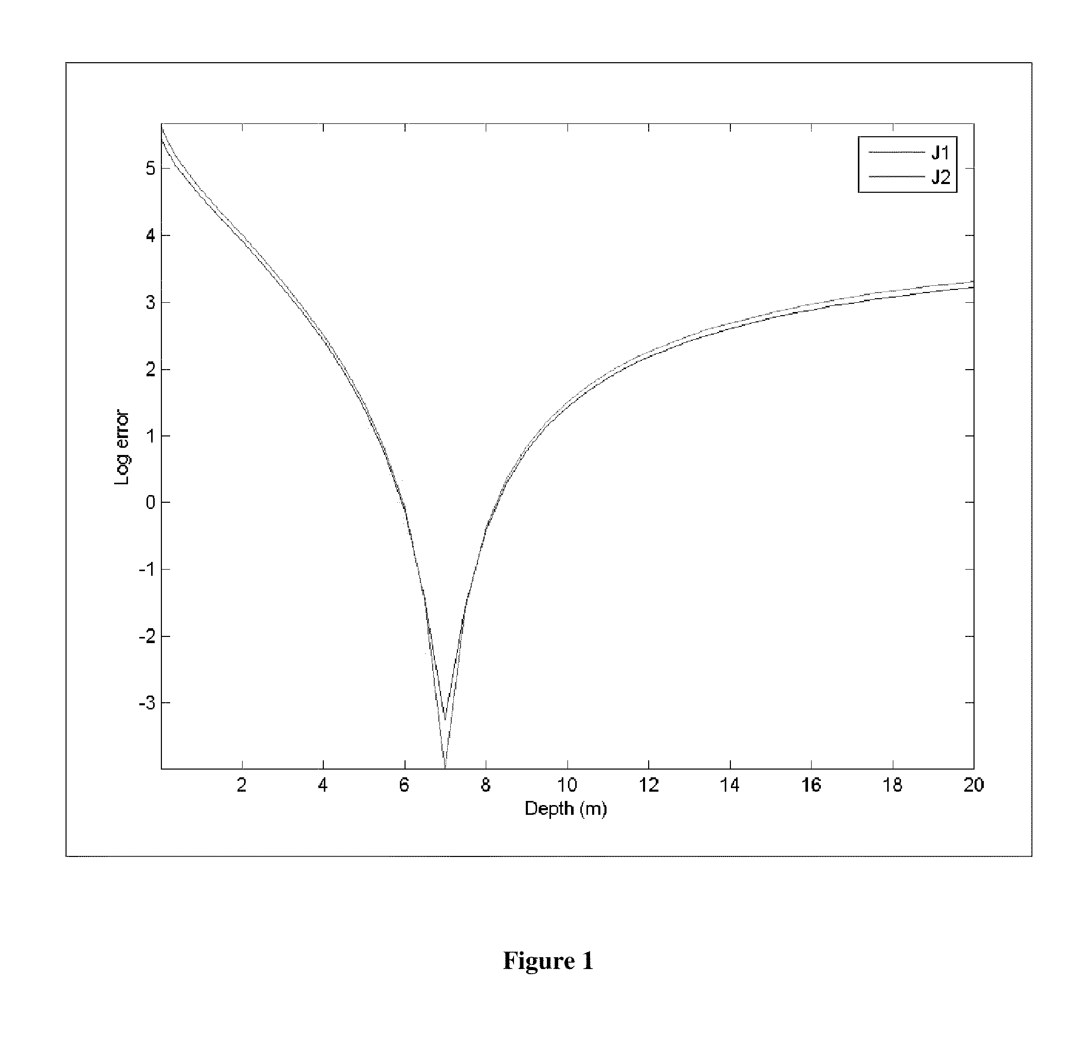
Examples
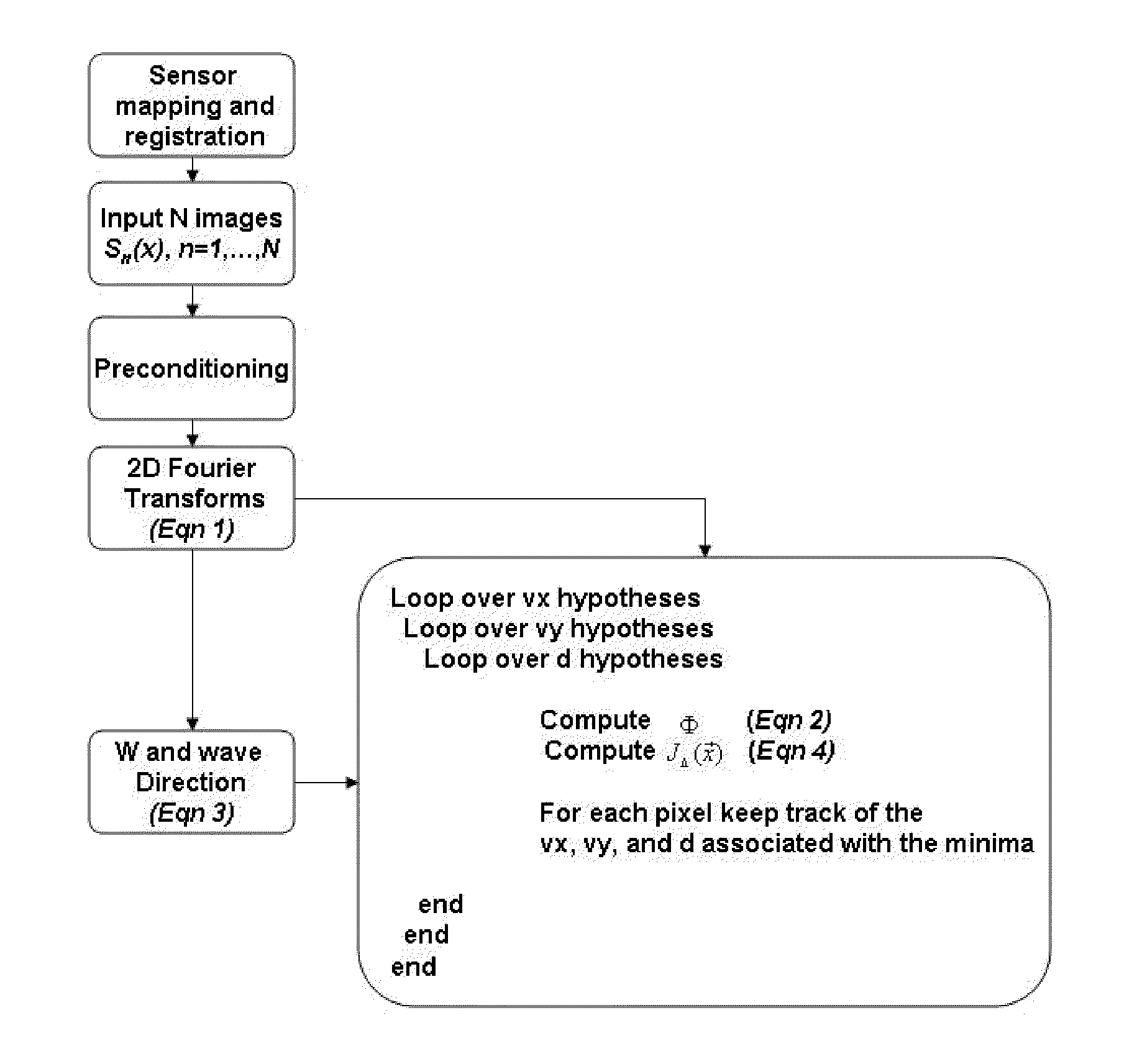
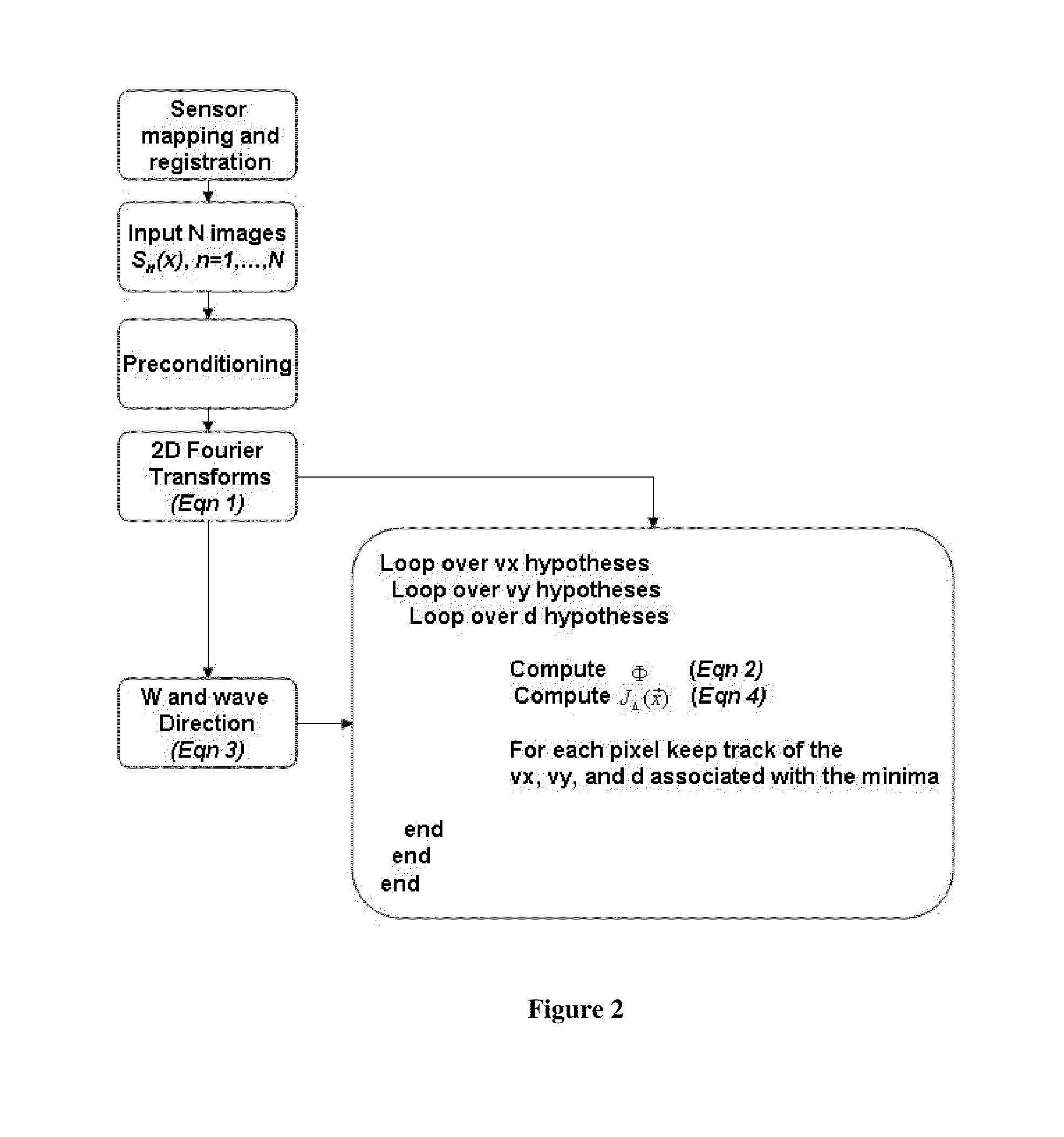
Embodiment Construction
[0044]Before the present invention is described in detail, it is to be understood that unless otherwise indicated this invention is not limited to specific bodies of water or specific imaging modalities. It is also to be understood that the terminology used herein is for the purpose of describing particular embodiments only and is not intended to limit the scope of the present invention.
[0045]It must be noted that as used herein and in the claims, the singular forms “a,”“and” and “the” include plural referents unless the context clearly dictates otherwise. Thus, for example, reference to “a sensor” includes two or more sensors, and so forth.
[0046]Where a range of values is provided, it is understood that each intervening value, to the tenth of the unit of the lower limit unless the context clearly dictates otherwise, between the upper and lower limit of that range, and any other stated or intervening value in that stated range, is encompassed within the invention. The upper and lowe...
PUM
 Abstract
Description
Claims
Application Information