
Information and Guidance System

a technology of information and guidance system and navigation system, applied in the field of navigational and information systems, can solve the problems of not being able to provide turn by turn directions, not taking into account short term events, needing a detour, etc., and achieve the effect of quick resolution of problems, value for sighted individuals, and quick resolution of problems

Inactive Publication Date: 2012-09-13
JACOBS HARLAN
View PDF4 Cites 4 Cited by
  • Summary
  • Abstract
  • Description
  • Claims
  • Application Information

AI Technical Summary

Benefits of technology

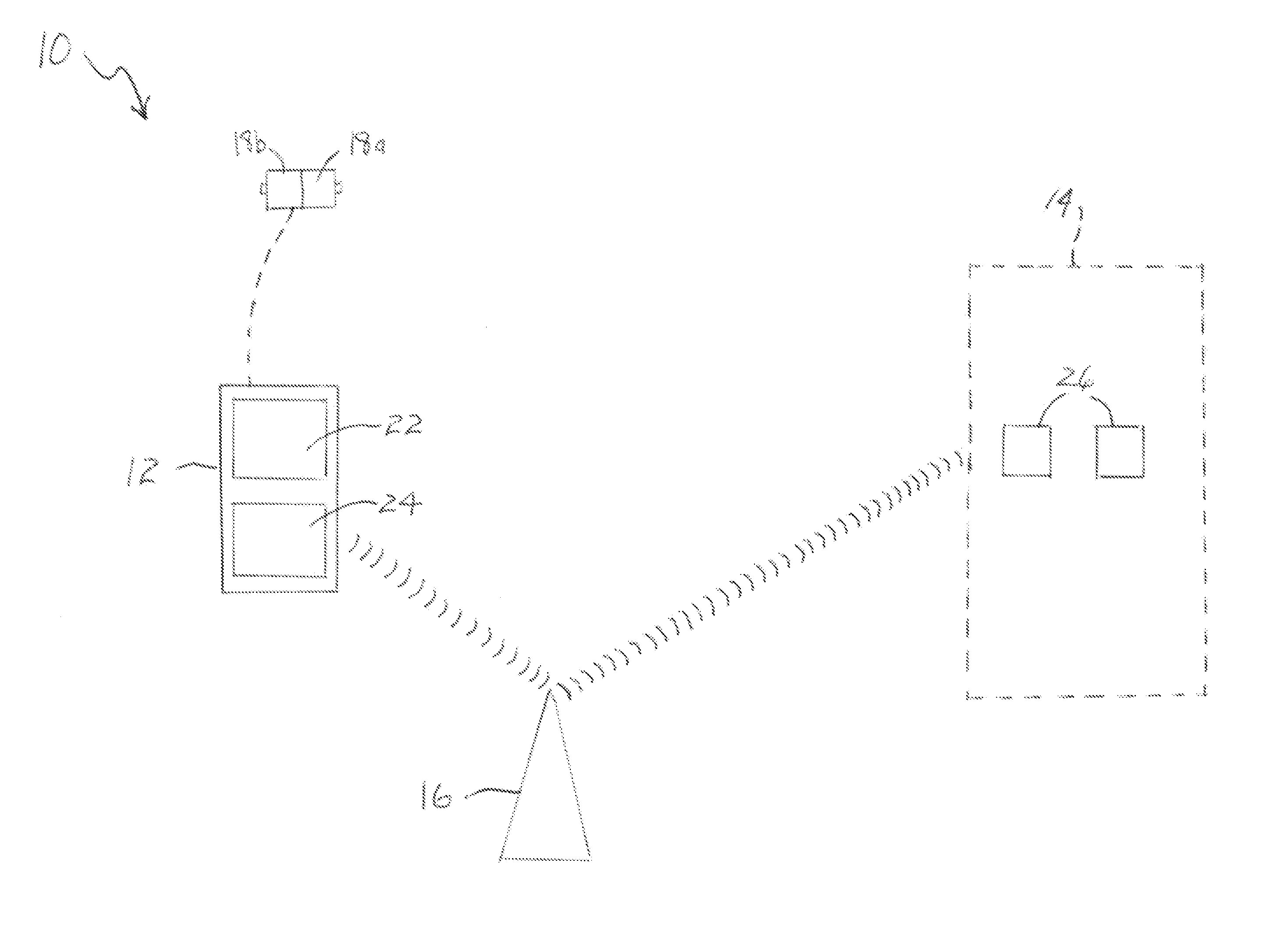
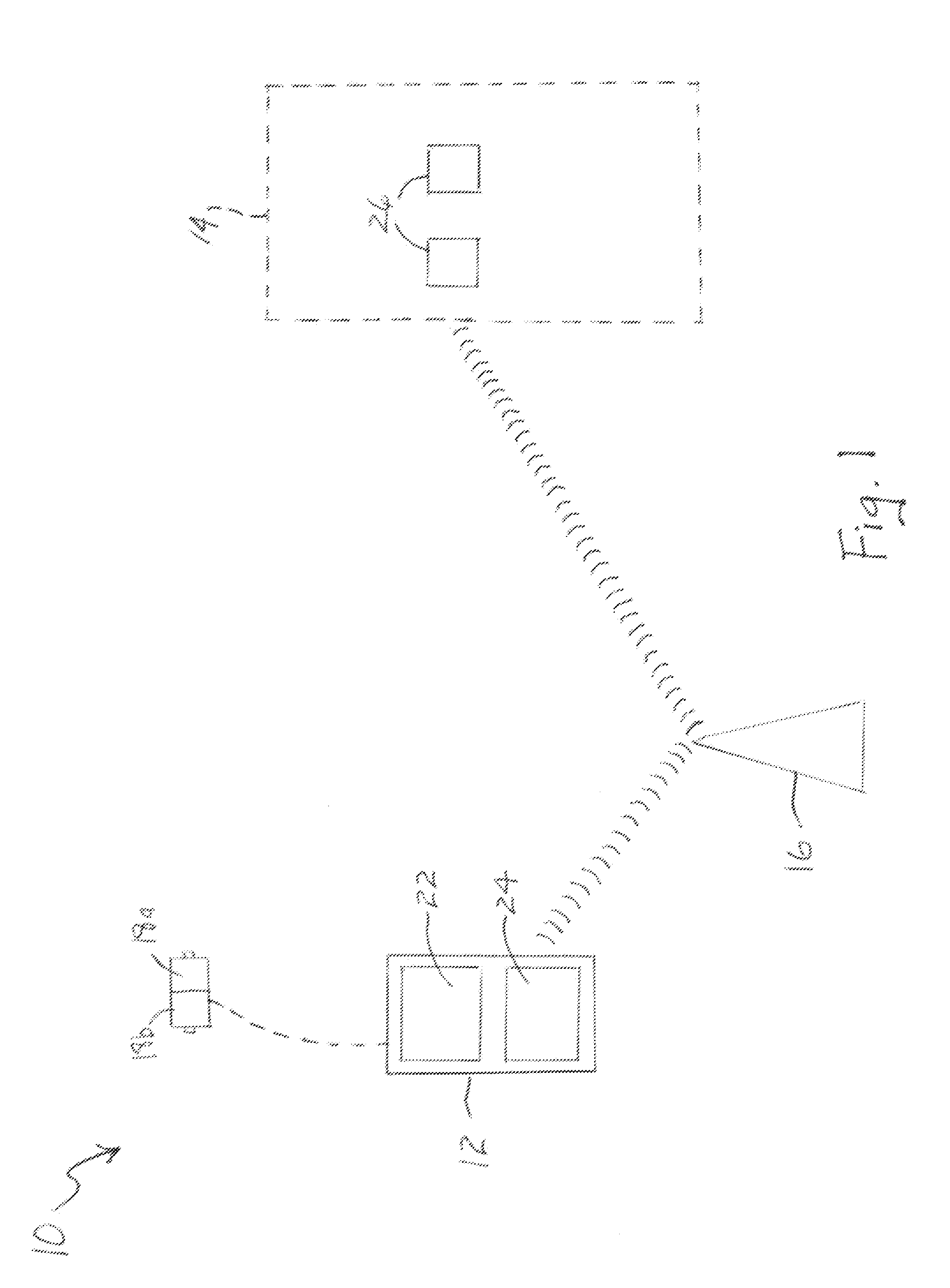
[0008]The present invention is a device for providing real time information about a person's immediate surroundings so they can be safely and accurately guided to their particular destination. The invention herein includes a video camera or cameras that the user carries on their person and that generates streaming video of their environment. The camera or cameras are connected by wire or wirelessly to a transmitting device such as a cell phone. The cell phone is GPS enabled and is used to send the video signal and the GPS location information to a location where guide persons monitor the user's progress by viewing their video feed and GPS coordinates. The guides also have a telephonic connection to the user so they can speak with them.
[0010]Those of skill will understand that certain locations or cities will have a differential GPS system that is coordinated to work with the satellite based system that provides a stronger signal in a local area in order to diminish the signal attenuating effect of being in a building or walking between tall building structures in a downtown area. It will also be understood that the video and voice data will typically be transmitted wirelessly over the user's particular cell phone system which will also be more robust, particularly in urban areas, than is seen with the GPS satellite signals. Thus, once the guide service verifies that it is receiving a video feed the user can begin walking to their destination as the guide service provides real time information to them.
[0012]The present invention also has value for sighted individuals and particularly when they are traveling to area with which they are unfamiliar. Whereas, a constant video feed may not be required in the case of a sighted person, a quick view of the individual's surroundings combined with the GPS information can provide the guide service personnel with information can permit them to quickly resolve a problem, such as in the case where the user is confused as to their location or having trouble finding a particular address. For sighted individuals a body mounted video camera may not be needed and can be substituted by their cell phone. Most cell phones include a photo / video recording capability and could be used to create a handheld video feed to the guide service. Once the user's precise location is determined they can be provided with directions to quickly resolve their problem.
[0013]The present invention could also be of value to people on vacation by providing directions to places of interest based on their present location, interests, ages and the like. It is also contemplated that the present invention could be of value as a security device for persons on foot, e.g. a college student walking on campus in the evening, or even for on-duty police officers. A rear view camera in particular could be used to provide the guide person with information about suspicious activity by individuals behind the user that could then be conveyed to them. The guide person could also at any time immediately contact emergency personnel, for example, campus security in the case of a student, should a threatening situation arise. The video feed could be recorded and provide admissible court evidence should some type of assaults or harassment be perpetrated. Thus, over time, knowledge of such recording capacity itself would be a strong deterrent to crime.

Problems solved by technology

This technology could be used with a direction device but would not be able to provide turn by turn directions as it lacks the GPS and map database information.
A problem with the foregoing technology for visually handicapped individuals is that it can not take into account short term events that might present obstructions to their passage.
It is also possible that construction has caused the need for a detour.
However, transient events like deliveries, vehicle accidents, and so forth can not be dealt with in such a manner.
It is also predicted that with the advent of newer fully electric vehicles, the ability to hear an approaching vehicle and avoid an untimely road crossing will be compromised.
Unfortunately, as referred to above, such systems can not account for information in real time as to what may lie in a sight compromised pedestrian's path.
Additionally, buildings, street signs, street curbs and the like have their own particular designs, sizes, placements, heights and so forth that sighted individuals can immediately take into account and navigate through with ease but that are terribly intimidating to individuals that have diminished vision.

Method used


Image

  • Information and Guidance System
  • Information and Guidance System
  • Information and Guidance System

Examples


Embodiment Construction

[0017]As seen in FIG. 1, a diagrammatic view of an embodiment of the guidance system of present invention is shown and referred to by the numeral 10. System 10 includes a portable communication device such as a cell phone 12 that provides for verbal communication to a remote guidance facility 14 via a communication infrastructure 16. Clearly, the user would have the choice of communicating verbally using a wireless head set, wired head phones or using a speakerphone option, all of which being available on most cell communication devices. Device 12 includes a video display 22 and is GPS enabled so that the location of the user when in possession thereof can be determined. Device 12 can also optionally include a three dimensional / tactile display 24 in addition to or as a replacement of screen 22.

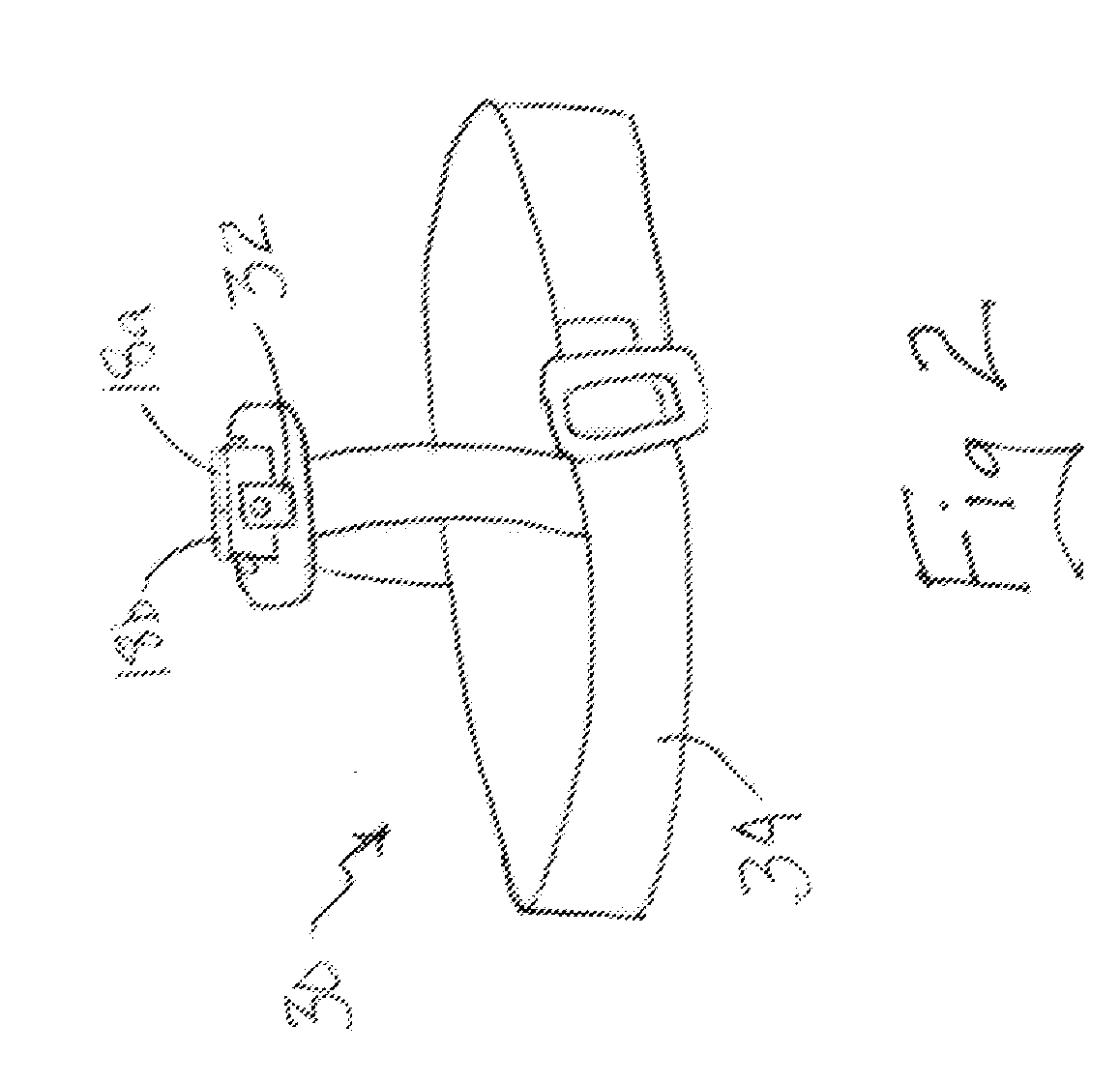
[0018]One or more video cameras 18 can be physically secured to a user, not shown, who is also in possession of the communication device 12. Cameras 18 are connected either by wire or wireless...


PUM


Abstract

The present invention is a navigation and assistance system for individual users traveling from a starting point to a desired destination. A communication device is provided that can communicate the user's GPS location coordinates to a guide person at a remote facility. The communication device also provides for verbal and audio communication between the user and their guide. One or more video cameras are mounted to or held by the user and are connected to the communication device for sending streaming video information from the one or more cameras to the guide person. With the video information regarding the user's immediate surroundings, their GPS location and the verbal and audio communication link with the user the guide person can provide information and directions to the user to as they move one location to another.

Description

FIELD OF THE INVENTION[0001]The present invention is generally related to navigational and information systems and more specifically to navigational and informational systems for pedestrians that use video, audio and GPS information provided to a guide person which person then provides assistance to the user as they move from one location to another.BACKGROUND OF THE INVENTION[0002]With the advent of the US military developed global positioning satellite system (GPS) for determining very precisely one's position at any point on the surface of the earth, navigation took a quantum leap forward. Once that system became available for civilian applications, a wide range of devices were created to assist in personal navigation.[0003]Some of the first devices available to the public were used by private pilots to help them fly with greater confidence as to their position and particularly when flying under instrument conditions. As the price and size of GPS systems came down the use thereof...

Claims


Application Information

Patent Timeline
Patent Type & Authority Applications(United States)
IPC IPC(8): H04N7/18
CPCA61H2201/0153A61H2201/0184A61H3/061G01C21/20A61H2201/5097A61H2201/1607A61H2201/165A61H2201/5046A61H2201/5048A61H2201/0157
Inventor JACOBS, HARLAN
Owner JACOBS HARLAN
Learn More