

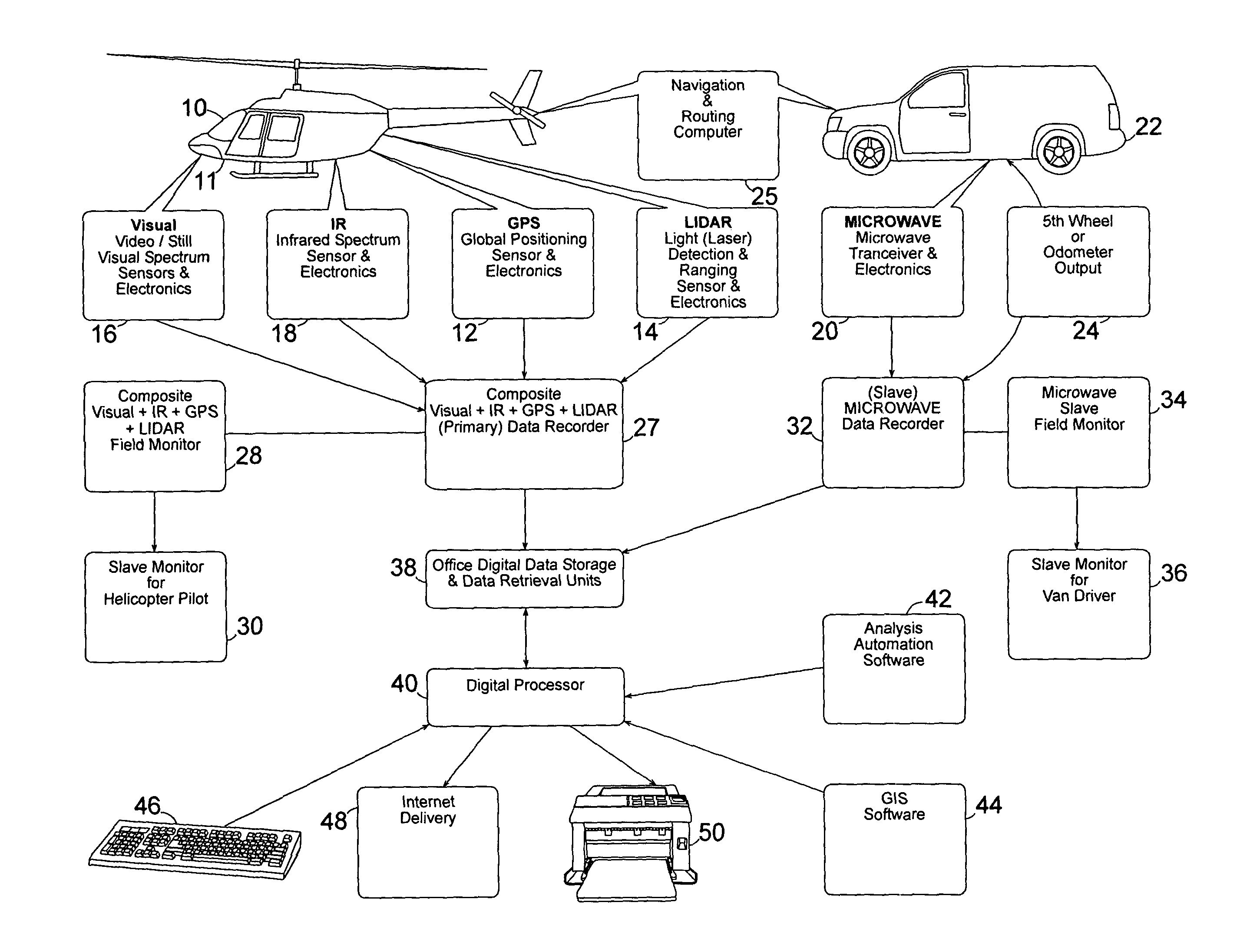
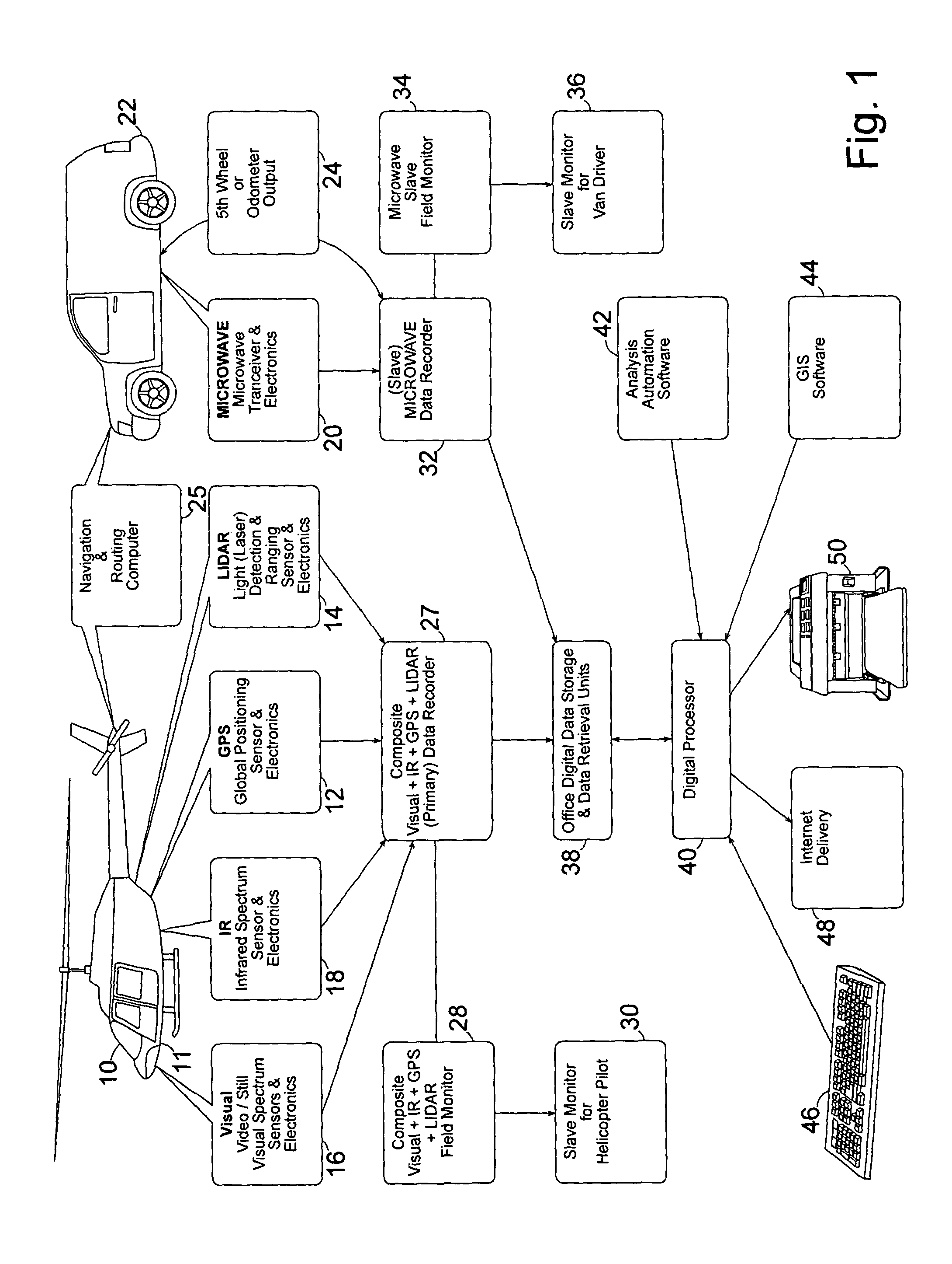
Complete remote sensing bridge investigation system
a remote sensing bridge and investigation system technology, applied in the field of civil engineering, can solve the problems of unfavorable inspection of structural bridges, inability to establish the depth or severity of artifacts, and system abuse, and achieve the effect of less money and high susceptibility to accelerated future reinforcing steel corrosion
- Summary
- Abstract
- Description
- Claims
- Application Information
AI Technical Summary
Benefits of technology
Problems solved by technology
Method used
Image

Examples
Embodiment Construction
OF LIDAR DATA (DATA ZOOMED OUT).
[0025]FIG. 5: EXAMPLE 2 OF LIDAR DATA (DATA ZOOMED IN).
[0026]FIG. 6: EXAMPLE 3 OF LIDAR DATA: (DATA ZOOMED IN ON DOUBLE CURSER BEING USED TO TAKE ON-LINE MEASUREMENTS WITH HIGH ACCURACY).
[0027]FIG. 7: EXAMPLES OF MICROWAVE DATA FOR BOTH DELAMINATION DEPTH MEASUREMENT AND DETECTION OF HIGHLY CONDUCTIVE CONCRETE LOCATIONS:
[0028]FIG. 8: (GIS) GEOGRAPHICAL INFORMATION SYSTEM SETUP.
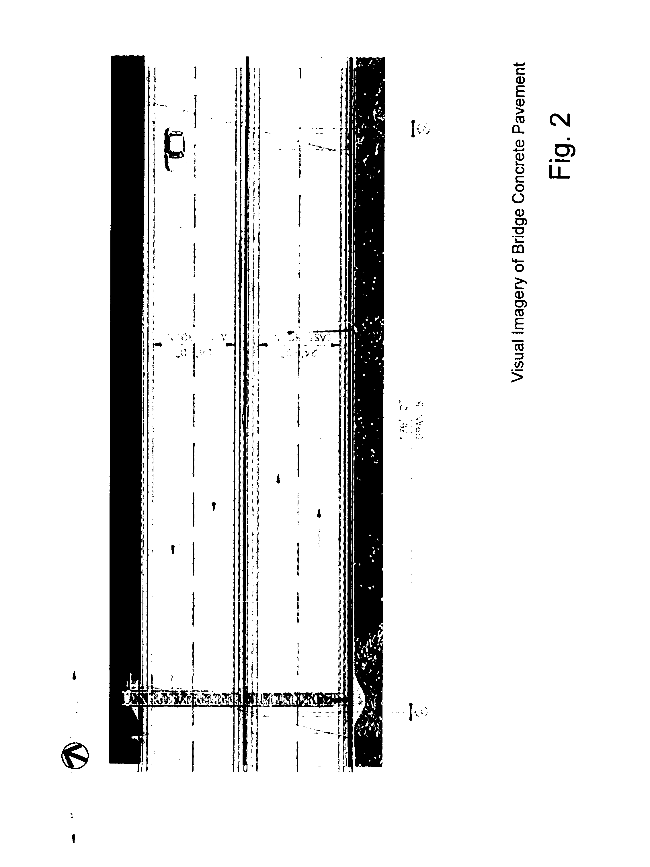
[0029]FIG. 9: EXAMPLE OF ANALYZED VISUAL HD VIDEO DATA OR STILL IMAGE DATA SHOWING PAVEMENT PATCHES & EXISTING DAMAGED AREAS.
[0030]FIG. 10: EXAMPLE OF ANALYZED IR HD VIDEO DATA OR STILL DATA IMAGE SHOWING AREAS OF PAVEMENT PATCHES, AREAS DETECTED AND IDENTIFIED AS HAVING HALF-DEPTH DELAMINATIONS AND AREAS DETECTED AND IDENTIFIED AS HAVING FULL-DEPTH DELAMINATIONS.
[0031]FIG. 11: EXAMPLE REPORT INDIVIDUAL BRIDGE SPAN SUMMARY PAGE ILLUSTRATING PATCH AREAS, HALF-DEPTH DEFECTS & FULL-DEPTH DELAMINATION AREAS
[0032]FIG. 12: EXAMPLE OF MILE LONG BRIDGE DATA OVERALL MASTER EXECUTIVE SUMM...
PUM
 Abstract
Description
Claims
Application Information