
Mobile computing application for roadway pavement data

a technology of mobile computing and roadway pavement, applied in the direction of wireless commuication services, location information based services, instruments, etc., can solve problems such as inability to accurately calculate the accuracy of roadway pavement data, process errors, and inability to accurately calculate the accuracy of roadway pavement,

Inactive Publication Date: 2013-12-19
KATARA SAILESH +2
View PDF8 Cites 11 Cited by
  • Summary
  • Abstract
  • Description
  • Claims
  • Application Information

AI Technical Summary

Benefits of technology

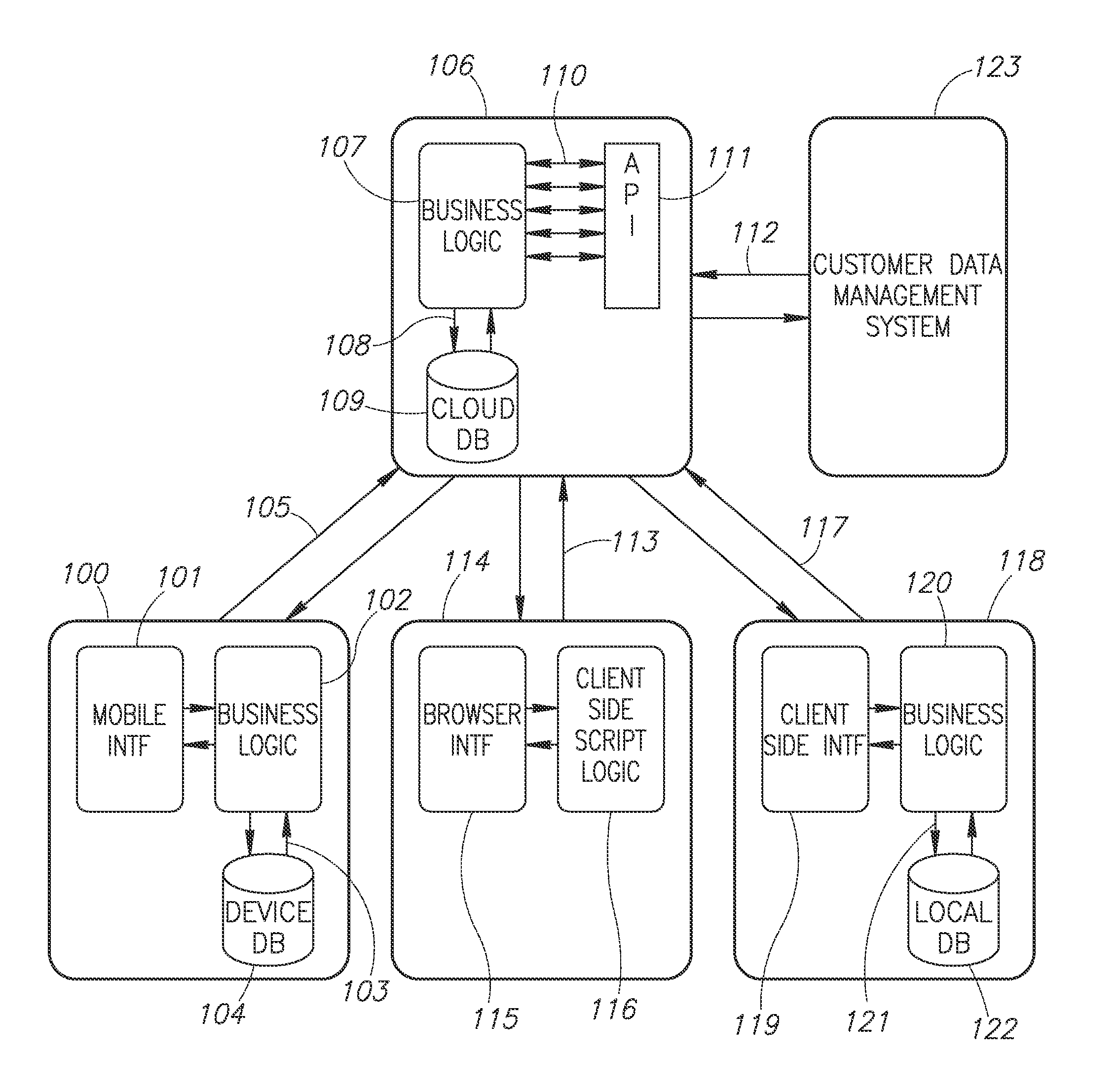
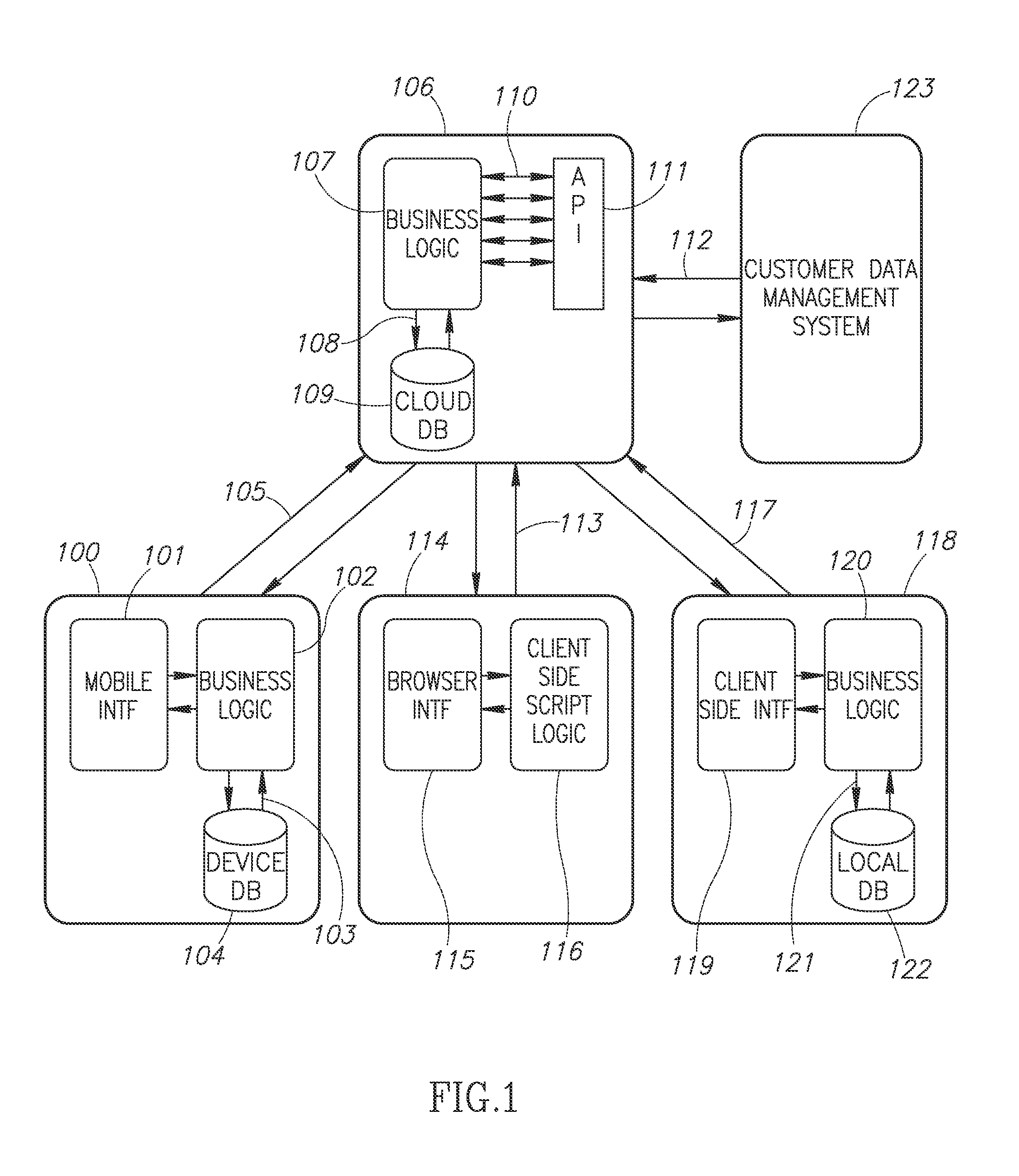
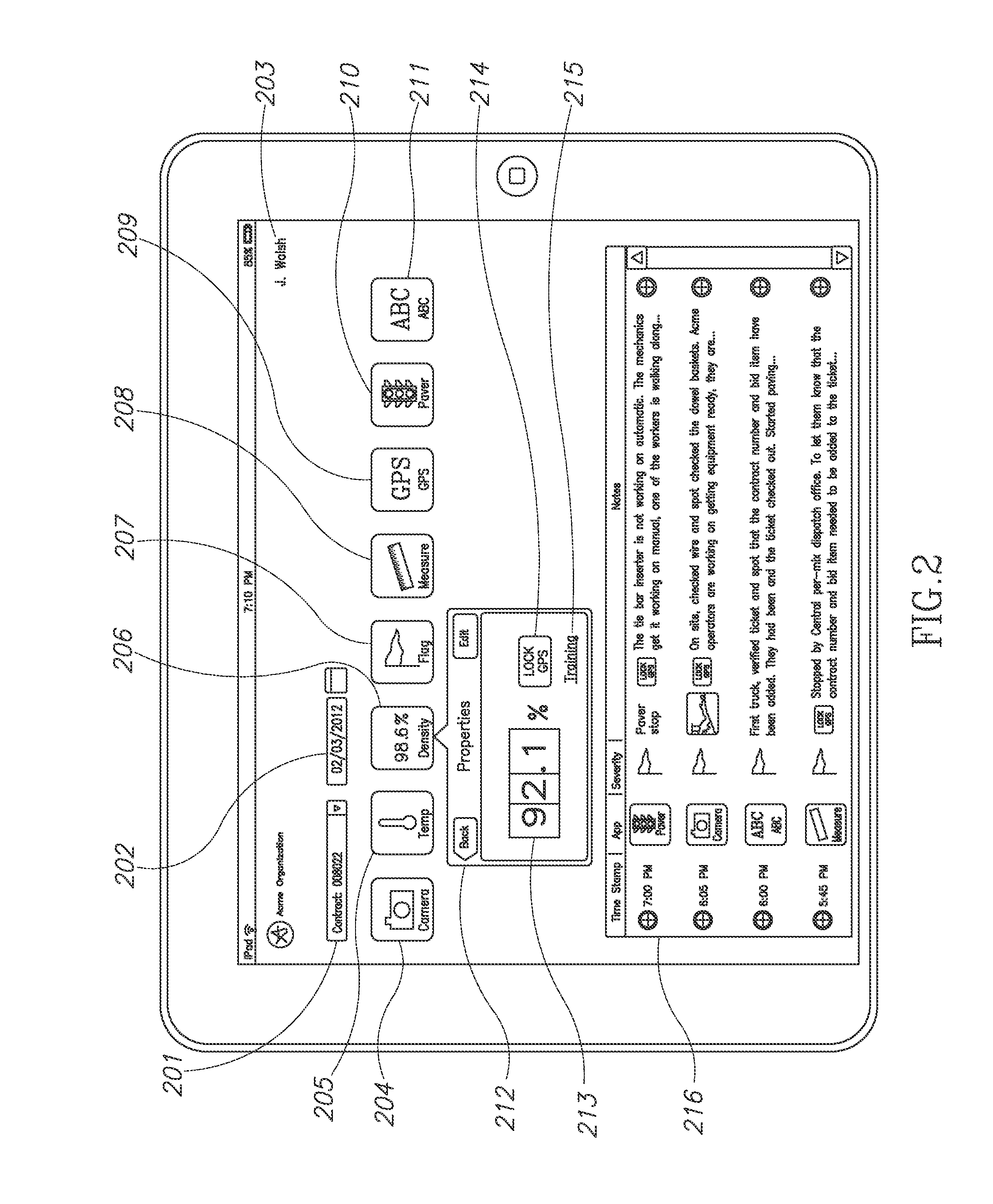
This patent is about a system and method for collecting and disseminating data related to roadway construction using a handheld mobile device. The system leverages the capabilities of the device to collect and correlate data, such as temperature, density, photos, videos, and location information. The data is then synchronized with a cloud-based software service and made available to other users for real-time monitoring of the construction project. The invention also allows for data integration with other systems and protects the data from unauthorized access. Overall, the invention helps streamline the data collection process and facilitates real-time monitoring of roadway construction projects.

Problems solved by technology

This manual process can be error-prone and lead to incorrect information in the computerized databases.
Conventional measuring instruments are self-contained and do not communicate measurement results directly to the computerized databases.
The diversity of systems involved in data collection may also lead to inconsistencies in how data is processed, formatted, and archived.
Currently, data is stored in both paper format and in computerized systems, but there are no means for quick retrieval of the information that is stored.
Moreover, this information is not easily accessible when in a location out in the field.

Method used


Image

  • Mobile computing application for roadway pavement data
  • Mobile computing application for roadway pavement data
  • Mobile computing application for roadway pavement data

Examples


Embodiment Construction

[0013]An application that runs on a portable device with a computer operating system, which allows the user to retrieve data from a computerized database of pavement information, collect new information and update the data in the system. The application allows a person in the field to accurately locate and map large network segments and organize the data in a coordinated and less error prone manner.

[0014]The present invention comprises a system for an application for a device such as a mobile phone or portable computer, comprising a computer software program to retrieve data relating to roadway pavements from a remote server, an input interface for the device user, and the ability to collect data from the site where the device is located, which is used to update and change the data located on the remote server.

[0015]In accordance with some examples of the invention, the application uses a Global Positioning System (GPS) to identify the location of the device when data is collected.

[...


PUM


Abstract

A system configured to collect and disseminate measurements regarding a roadway condition. The numerical measurements may include pavement construction material temperature, material density, photographs, videos, location information (GPS, GIS, station and offset, etc.), timestamp, text, audio, calculated values, detected values (for example roadway ride quality based on calibrated mobile device internal accelerometer). The system may also disseminate information to the mobile devices with construction project / asset specific information. For example, information can include training or educational content on how to perform a specific measurement or procedure to properly acquire a data sample in the field. For example, the information sent to the mobile device can use real-time information such as device location to determine if the system user is near a point of interest where a particular data sample should be measured and recorded. Data uploaded to the cloud-based storage environment may be made immediately available to one or more other credentialed users for real-time project tracking

Description

PRIORITY CLAIM[0001]This application claims priority from U.S. Provisional Patent Application No. 61 / 099,384 filed on Nov. 30, 2011, and the subject matter of which is incorporated herein by reference in its entirety.FIELD OF THE INVENTION[0002]This invention relates generally to measuring and testing of roadways and, more specifically, to determining the relative location of measurements and observations, and to storage and processing of information in a computer program.BACKGROUND OF THE INVENTION[0003]Agencies that own and operate roads typically keep extensive records about their construction, maintenance, and condition. Pavement construction may involve inspection and testing to verify contractor compliance with specifications and ensure that the pavement has the desired characteristics. For proper upkeep, roadway pavements require periodic inspection so the agency can plan, schedule, and prioritize repairs. Throughout the life cycle of the roadway, pavement condition and chara...

Claims


Application Information

Patent Timeline
Patent Type & Authority Applications(United States)
IPC IPC(8): H04W4/04H04W4/38H04W4/021H04W4/60
CPCH04W4/046H04W4/60H04W4/38H04W4/021
Inventor KATARA, SAILESHWHITE, GEORGEMAHONEY, JOE
Owner KATARA SAILESH
Learn More