
Hybrid mobile entity, method and device for interfacing a plurality of hybrid mobile entities with a computer system, and a set for a virtual or augmented reality system

a mobile entity and computer system technology, applied in the field of smart floors, can solve the problems of large errors in the measurement of inertial measurement units, inability to adapt to applications whose duration exceeds a few minutes or even a few seconds, and the operation diverges from the ideal equation, so as to achieve the effect of easy selection of a particular location module and increasing the size of the area

Active Publication Date: 2017-06-29
STARBREEZE PARIS
View PDF3 Cites 28 Cited by
  • Summary
  • Abstract
  • Description
  • Claims
  • Application Information

AI Technical Summary

Benefits of technology

The hybrid mobile entity invention allows a computer system to easily determine the position of a large number of mobile devices, even when some of them are out of range of the interfacing device. Combining an inertial measurement unit and a location module helps avoid data drift over time. The invention also enables a device to control other devices within the same area, increasing the size of the area over which the mobile entities can move. Additionally, the invention includes means for sequentially activating location modules based on their identifier. This makes it easier to select a specific location module. The invention also helps adjust the movement data of the inertial measurement unit using the adjustment data, reducing drift over time and shock experienced by it.

Problems solved by technology

These users may for example move over a playing terrain or within a building Furthermore, these users may perform movements of large amplitude, which imposes particular constraints, in particular in terms of position tracking.
However, in practice, the operation diverges from ideal equations due to errors which affect the measurements of the rotations and of the accelerations (for example bias, noise, scale factors, non-linearity) and which give rise to drift over time in the estimations for example of the velocity and of the position of the mobile entity considered.
Also, shocks suffered by the mobile entity may cause large errors in the measurements by the inertial measurement unit.
Thus, such a solution is not adapted to applications of which the duration exceeds a few minutes or even a few seconds, for example such as virtually or augmented reality applications.
However, this type of location is not adapted to the location of mobile entities situated within a building.
Furthermore, the accuracy of the Differential Global Positioning System is of the order of about ten centimeters, which may be insufficient for certain applications, in particular for virtually reality or augmented reality.
Moreover, this technology is very sensitive to the presence of metal objects, which can cause the position measurements to be false.
These technologies have the drawback of requiring the calibration of the beacons.
Furthermore, the accuracy of the position computed by triangulation is of the order of 15 cm, which may be insufficient for certain applications, for example for virtual reality or for augmented reality.
Furthermore, the triangulation methods used are poorly adapted to the location of a plurality of entities, problems of congestion of the system being rapidly observed.
These technologies are also sensitive to the presence of metal entities (for example partitions with a metal structure, metal beams or for instance metal cabinets) which considerably perturb position measurements on account of the multiple paths of the waves.
The presence of these metal entities strongly reduces the accuracy of the final computation of the position (accuracy of more than 1 m).
However, these solutions require particular installations (e.g. rails of LEDs disposed in the environment, numerous cameras sometimes including computing means for the analysis of images in real time, or for instance constellations of infra-red targets enabling cameras to compute positions) and are often very costly and thus not very realistic for applications for the general public.
Furthermore, these solutions are particularly sensitive to the environment in which the mobile entity moves, in particular to the visual quality of the environment, which may be altered for example by smoke, fog, or for instance low light levels.
They are also sensitive to the masking of the optical means by physical obstacles, typically by another mobile entity, and are thus poorly adapted to tracking a plurality of mobile entities over time.

Method used


Image

  • Hybrid mobile entity, method and device for interfacing a plurality of hybrid mobile entities with a computer system, and a set for a virtual or augmented reality system
  • Hybrid mobile entity, method and device for interfacing a plurality of hybrid mobile entities with a computer system, and a set for a virtual or augmented reality system
  • Hybrid mobile entity, method and device for interfacing a plurality of hybrid mobile entities with a computer system, and a set for a virtual or augmented reality system

Examples


first embodiment

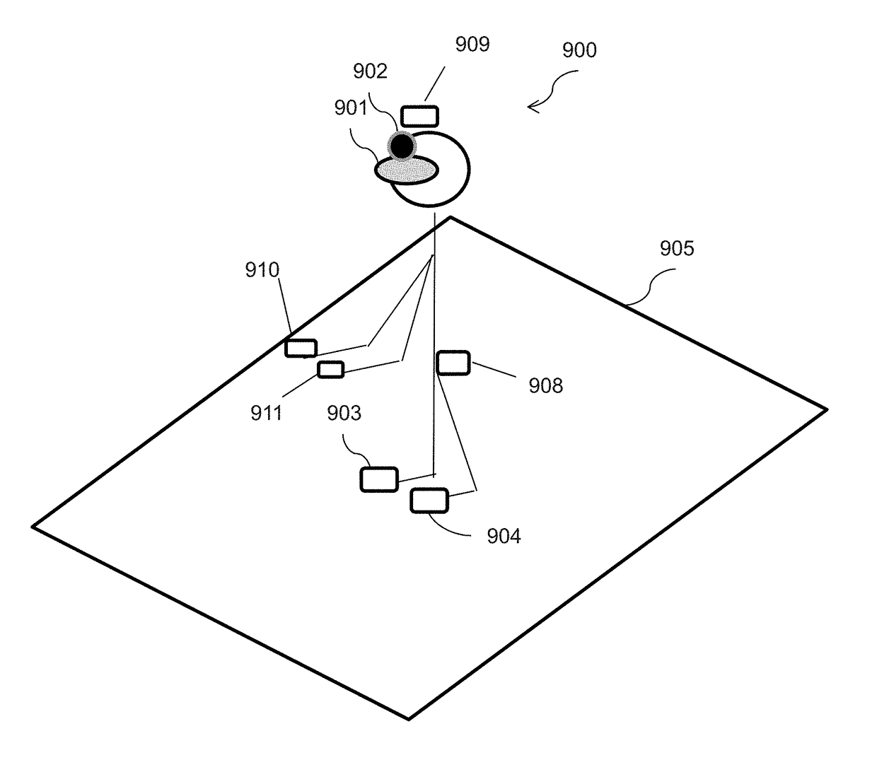
[0090] the hybrid computation is carried out at the location of the detection surface. In this embodiment, movement data measured by the inertial measurement unit are directly transmitted to the detection surface via the communication means. A new position information item is then computed by the detection surface from those movement data and from a position information item computed previously.

second embodiment

[0091] the hybrid computation is carried out at the hybrid mobile entity. In this embodiment, the detection surface sends a previously computed position information item to the hybrid mobile entity. This position information item was typically computed from an electromagnetic signal received from the location module when it was within the detection range of the detection surface. This is for example the last position computed before the hybrid mobile entity leaves the range of the detection surface. The hybrid mobile entity then computes a new position information item using the received position information item and movement data measured by the inertial measurement unit. This hybrid position is then transmitted via the communication means provided on the hybrid mobile entity.

[0092]Thus, the movement data obtained by virtue of the autonomous operation of the inertial measurement unit enable the position tracking of the hybrid mobile entity, even when the location module that it inc...


PUM


Abstract

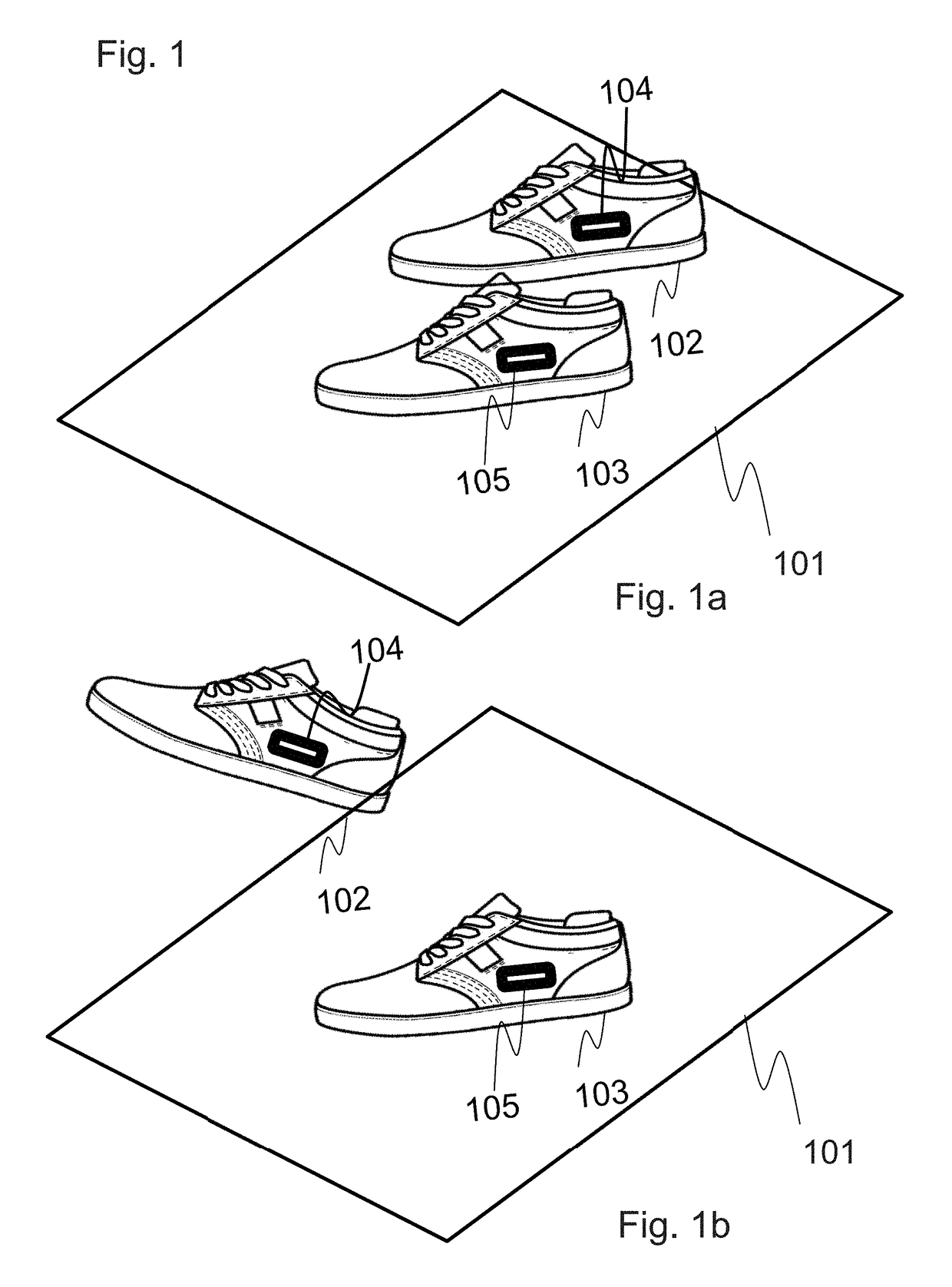
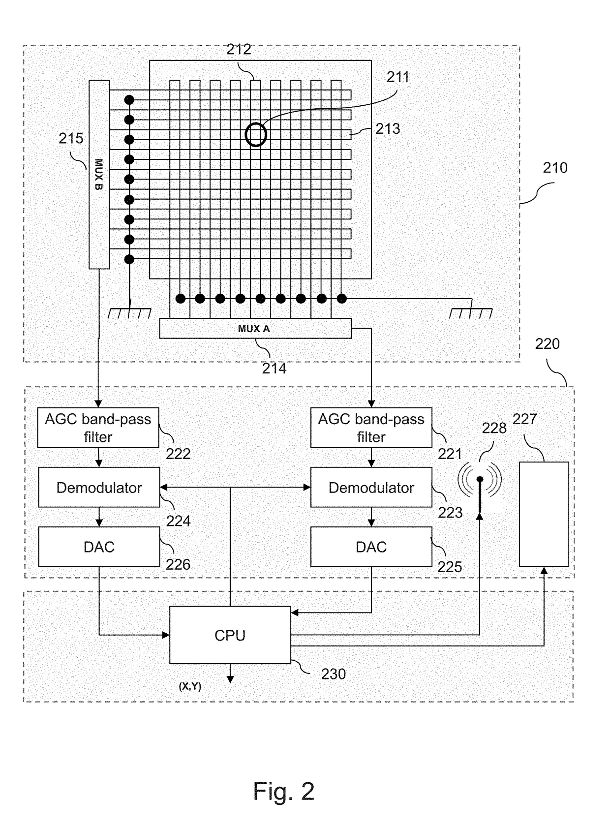
Disclosed is a hybrid mobile entity for a device for interfacing a plurality of mobile entities with a computer system, the hybrid mobile entity including at least one location module including: a unit for emitting an electromagnetic signal making it possible to determine the position of the location module; and a unit for receiving an activation signal and, according to at least one item of information of the activation signal, activating the unit for emitting an electromagnetic signal. The hybrid mobile entity further including: an inertial measurement unit rigidly joined to the location module; and a unit for communication with the device, for transmitting data relative to a movement of the inertial measurement unit.

Description

FIELD OF THE INVENTION[0001]The present invention concerns the location of mobile entities by a computer system, in particular in the field of smart floors. It has applications in particular in the field of virtual reality or augmented reality. The invention particularly relates to a hybrid mobile entity, a device and a method for interfacing a plurality of hybrid mobile entities with a computer system.CONTEXT OF THE INVENTION[0002]In numerous situations, it may be necessary, for a computer system, to detect the location (e.g. position, orientation, altitude) of mobile entities to enable it to react accordingly, and enable the use of these mobile entities as an interface of a computer system.[0003]The present invention is particularly concerned with the detection of mobile entities for example carried by human users or by robots. These users may for example move over a playing terrain or within a building Furthermore, these users may perform movements of large amplitude, which impos...

Claims


Application Information

Patent Timeline
IPC IPC(8): G01B7/004H04W52/02H04W4/02H04W4/029
CPCG01B7/004G01B2210/58H04W52/0229H04W4/02G01S5/0257G06F3/011G06F3/038G06F3/046G06F3/0346Y02D30/70H04W4/029
Inventor LEFEVRE, VALENTINCHABIN, LAURENTDUTEIL, CHRISTOPHE
Owner STARBREEZE PARIS
Learn More