

Grass detection device and method thereof
- Summary
- Abstract
- Description
- Claims
- Application Information
AI Technical Summary
Benefits of technology
Problems solved by technology
Method used
Image

Examples
embodiment 5
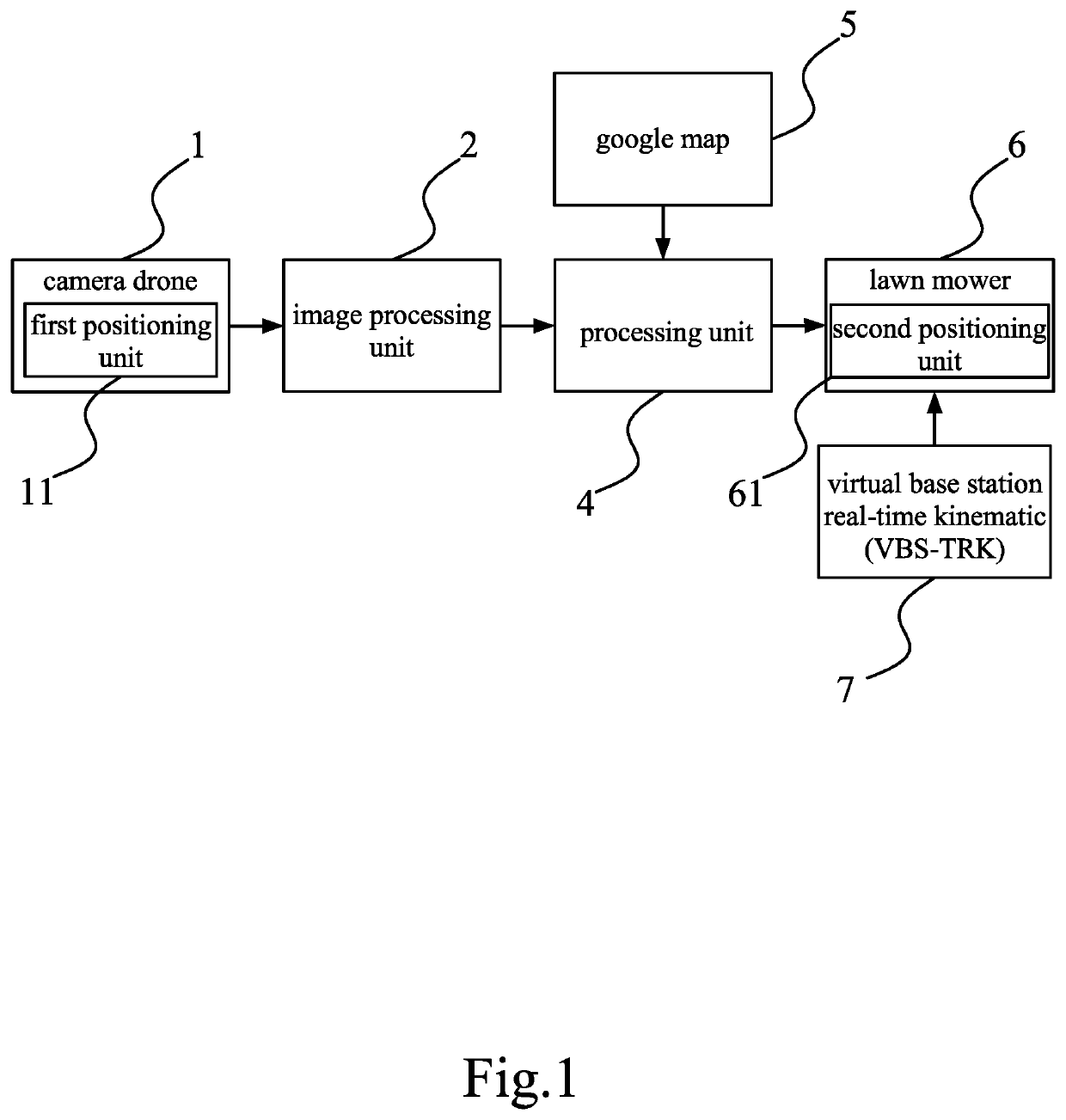
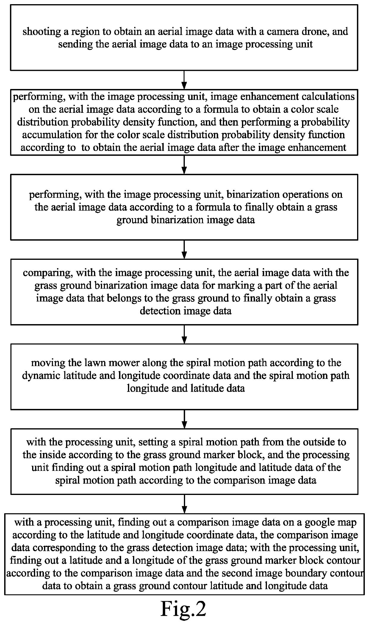
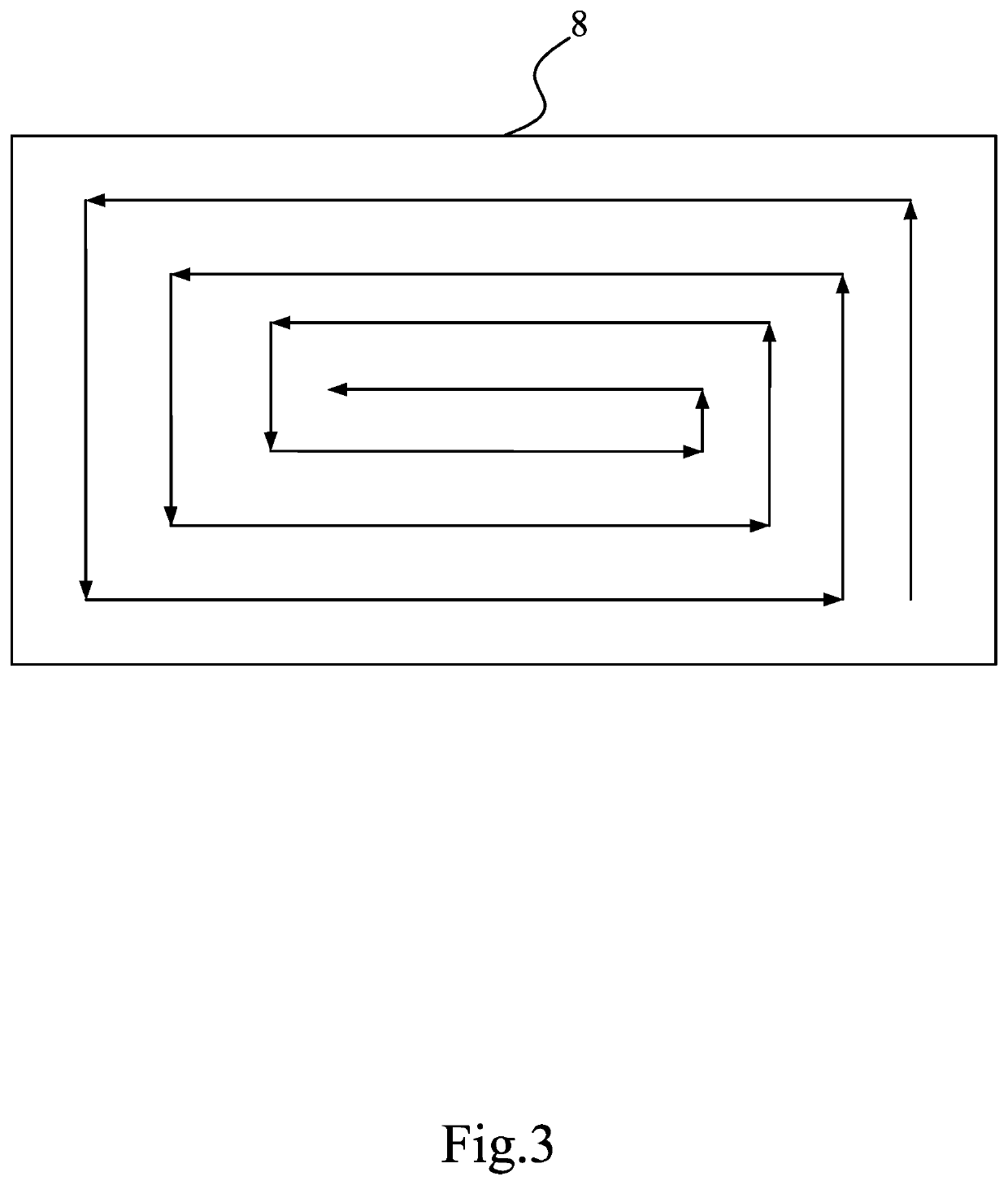
[0032]With reference to FIGS. 1, 2 and 3, the processing unit 4 sets a spiral motion path from the outside to the inside according to the grass ground marker block, and the processing unit 4 finds out a spiral motion path longitude and latitude data of the spiral motion path according to the comparison image data; the lawn mower 6 moves along the spiral motion path according to the dynamic latitude and longitude coordinate data and the spiral motion path longitude and latitude data.
[0033]With reference to FIG. 3, the lawn mower 6 starts mowing grass from the outermost contour in the grass ground marker block, and may effectively mow all the grass in the grass ground marker block without being easily missed with the spiral motion from the outside to the inside; at the same time, with the spiral motion mode, in addition to having the best mowing effect, the time required for mowing may be reduced to improve the overall mowing effect and efficiency as compared to the irregular mowing w...
embodiment 1
[0039]Between the steps (1) and (2), a step (4) of, is further added: performing, with the image processing unit, image enhancement calculations on the aerial image data according to a formula
p(f)=ThenumberofoccurrencesofthegrayscalevalueoftheaerialimageThetotalprimenumberoftheaerialimage
to obtain a color scale distribution probability density function (p(f)), and then performing a probability accumulation for the color scale distribution probability density function according to
s=∫p(f)dfand{s0=p(0)si=p(i)+si-1,whereini=1,2,…,
fmax, and fmax is 2image digits; then, performing operations according to gi=si*fmax to obtain the aerial image data (gi) after the image enhancement.
embodiment 2
[0040]In the step (1), the camera drone is provided with a first positioning unit, the first positioning unit measures latitude and longitude coordinates of the camera drone while the camera drone is shooting for the aerial image data to comprise a latitude and longitude coordinate data; in the step (3), the grass detection image data comprises a grass ground marker block; the step (3) is added with a step (5) of: with a processing unit, finding out a comparison image data on a google map according to the latitude and longitude coordinate data, the comparison image data corresponding to the grass detection image data, the processing unit finding out a latitude and a longitude of the grass ground marker block contour block according to the comparison image data and the grass detection image data to obtain a grass ground contour latitude and longitude data.
PUM
 Abstract
Description
Claims
Application Information