

Navigation assisting apparatus, aircraft in which the navigation assisting system is mounted, navigation assisting method and navigation assist processing program recorded in a storage medium
- Summary
- Abstract
- Description
- Claims
- Application Information
AI Technical Summary
Benefits of technology
Problems solved by technology
Method used
Image

Examples
Embodiment Construction
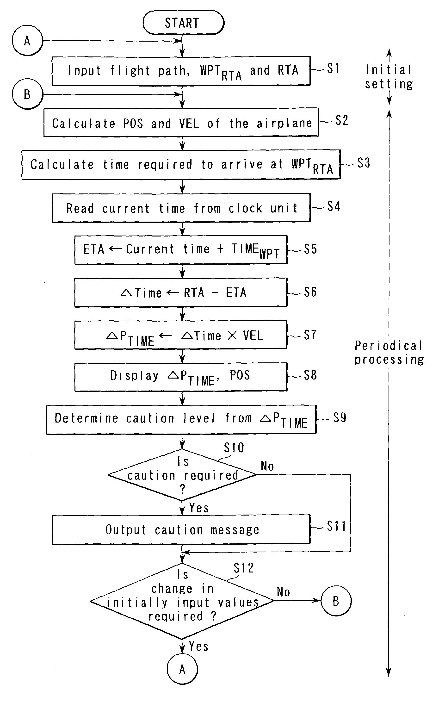
[0028]An embodiment of the present invention will now be described in detail with reference to the accompanying drawings.
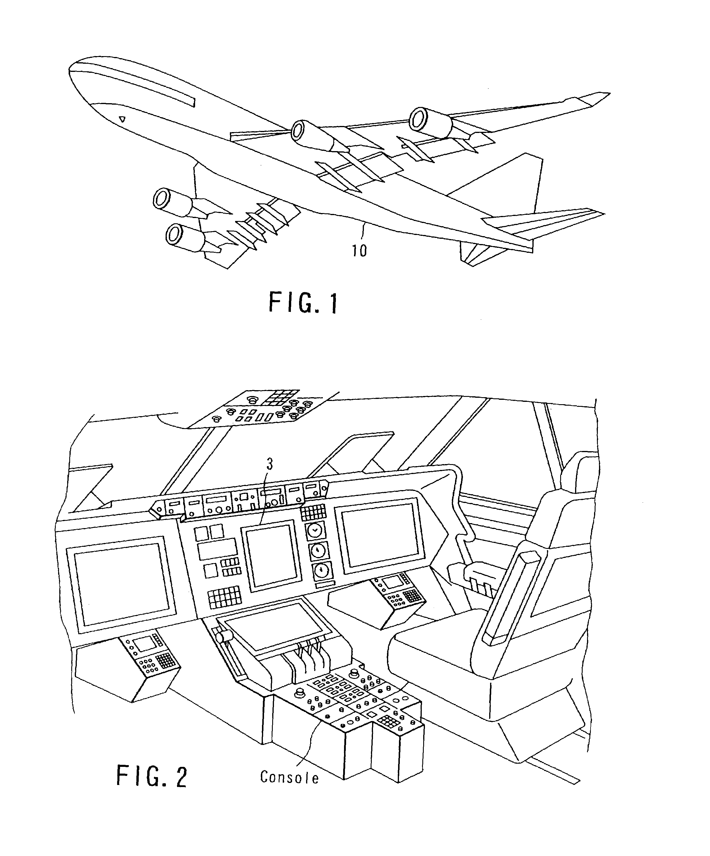
[0029]FIG. 1 is a diagram showing an example of an aircraft 10, in which a navigation assisting apparatus according to the present invention is mounted. The aircraft 10 is equipped with various navigation sensors, such as an INS (inertial navigation system or IRS, inertial reference system), a GPS (Global Positioning System) and a DME (Distance Measuring Equipment), all of which are not shown.
[0030]FIG. 2 is a diagram showing an example of an external view of a cockpit of the aircraft 10 shown in FIG. 1. The cockpit has a display unit 3, which visually displays various items of information; a console, which receives information input by a pilot; and an arithmetic unit, which processes various types of information.
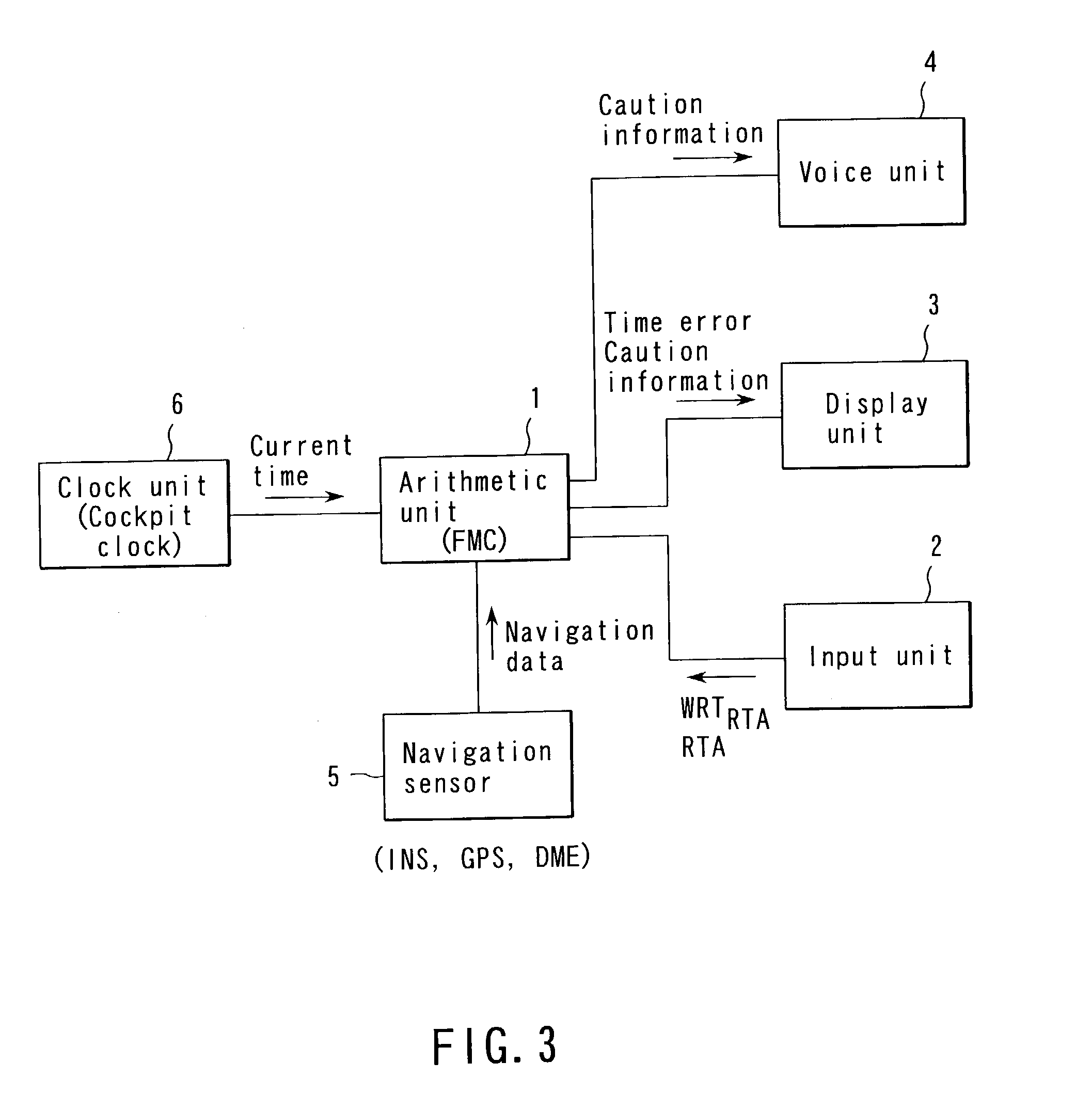
[0031]FIG. 3 is a functional block diagram showing the structure of a navigation assisting apparatus according to this embodiment. This system is mounted...
PUM
 Abstract
Description
Claims
Application Information