

Identification, storage and display of land data on a website
a land and website technology, applied in the field of imagery, can solve the problems that the imaging technique has not been effectively used in identifying property boundaries, and achieve the effects of simple and easy fashion, low cost, and easy customization
- Summary
- Abstract
- Description
- Claims
- Application Information
AI Technical Summary
Benefits of technology
Problems solved by technology
Method used
Image

Examples
Embodiment Construction
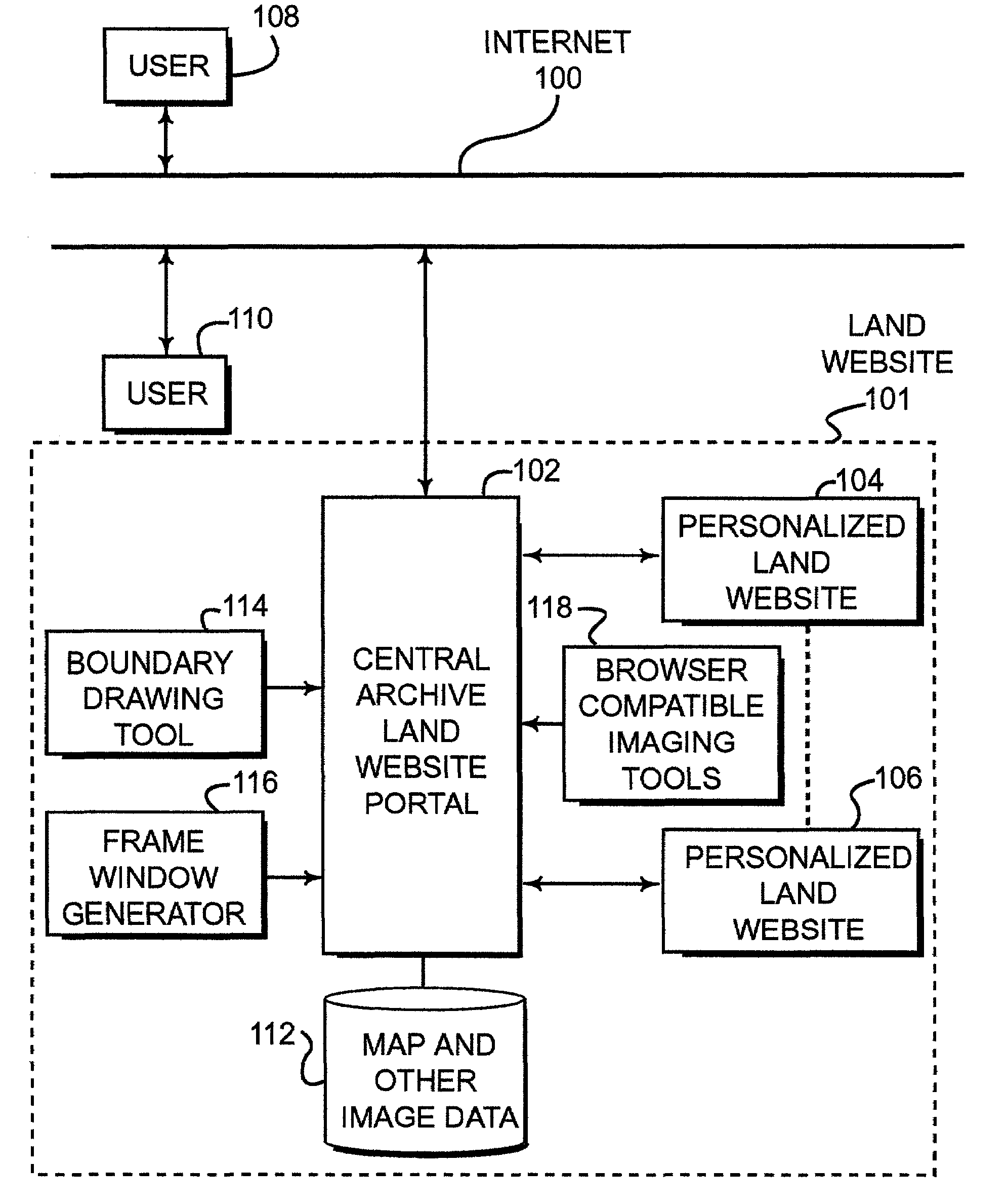
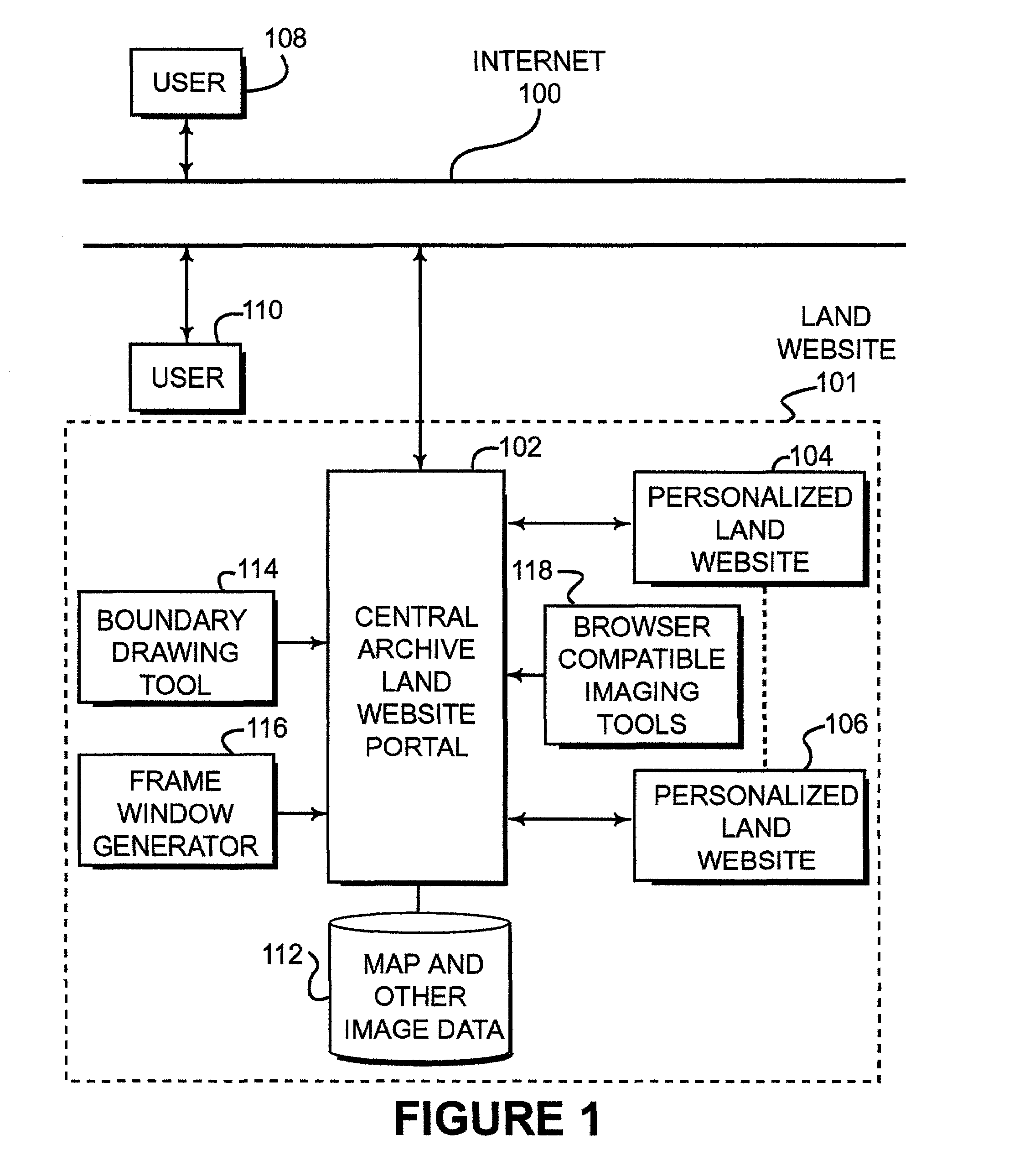
[0041]FIG. 1 is a schematic illustration of one embodiment of the present invention. As shown in FIG. 1, a central archive land website 101 is connected to the Internet that provides interactive connection to the central archive land website 101. The central archive land website 101 is connected to a land website portal 102 that functions as a portal for the land website 102. The land website portal 102 may have a number of personalized land websites 104, 106 that are provided to users via the Internet 100 by a connection through the land website portal 102. The personalized land websites 104, 106 may be generated and paid for by users such as user 108 who is also connected to the Internet 100. The user 108 may select a particular piece of land for which the user would like to establish a personalized land website. As disclosed below, the user 108 generates boundary data to identify the particular piece of property of interest. The land website portal 102 may include a server having...
PUM
 Abstract
Description
Claims
Application Information