
Three-dimensional virtual tour method and system

a three-dimensional virtual tour and virtual tour technology, applied in the field of computer systems, can solve the problems of not being able to visit the site by anyone, the viewing perspective of films and slideshows is limited, and it is impossible for everyone to personally view every site, etc., to achieve high-resolution three-dimensional, compact and efficient, and high-resolution

Inactive Publication Date: 2007-03-06
MICROSOFT TECH LICENSING LLC
View PDF12 Cites 23 Cited by
  • Summary
  • Abstract
  • Description
  • Claims
  • Application Information

AI Technical Summary

Benefits of technology

[0009]Briefly, the present invention provides a method and system that archive a three-dimensional site in a highly compact and efficient manner such that real-time three-dimensional exploration and interaction with the site is enabled, in high-resolution graphics using commercially available computer systems. To this end, information is collected about historical or other sites to produce a three-dimensional replica, comprising data corresponding to on the order of one million polygons. The three-dimensional replica data is processed to archive it into a highly-compact digital format. Once collected, formatted and stored, the archived information may later be used in real-time navigation to generate a highly accurate, high-resolution three-dimensional image from any perspective in the site to which a user can navigate.
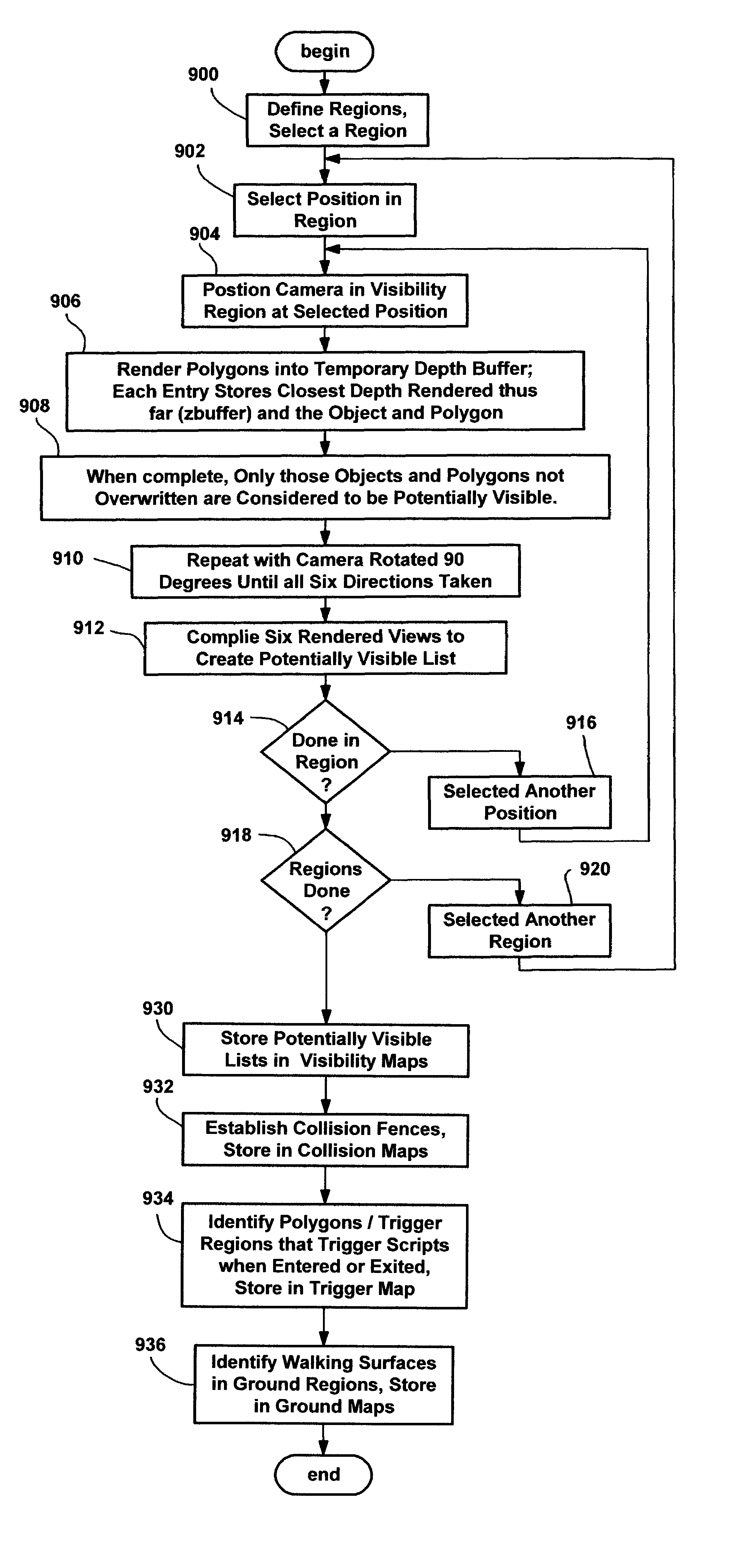
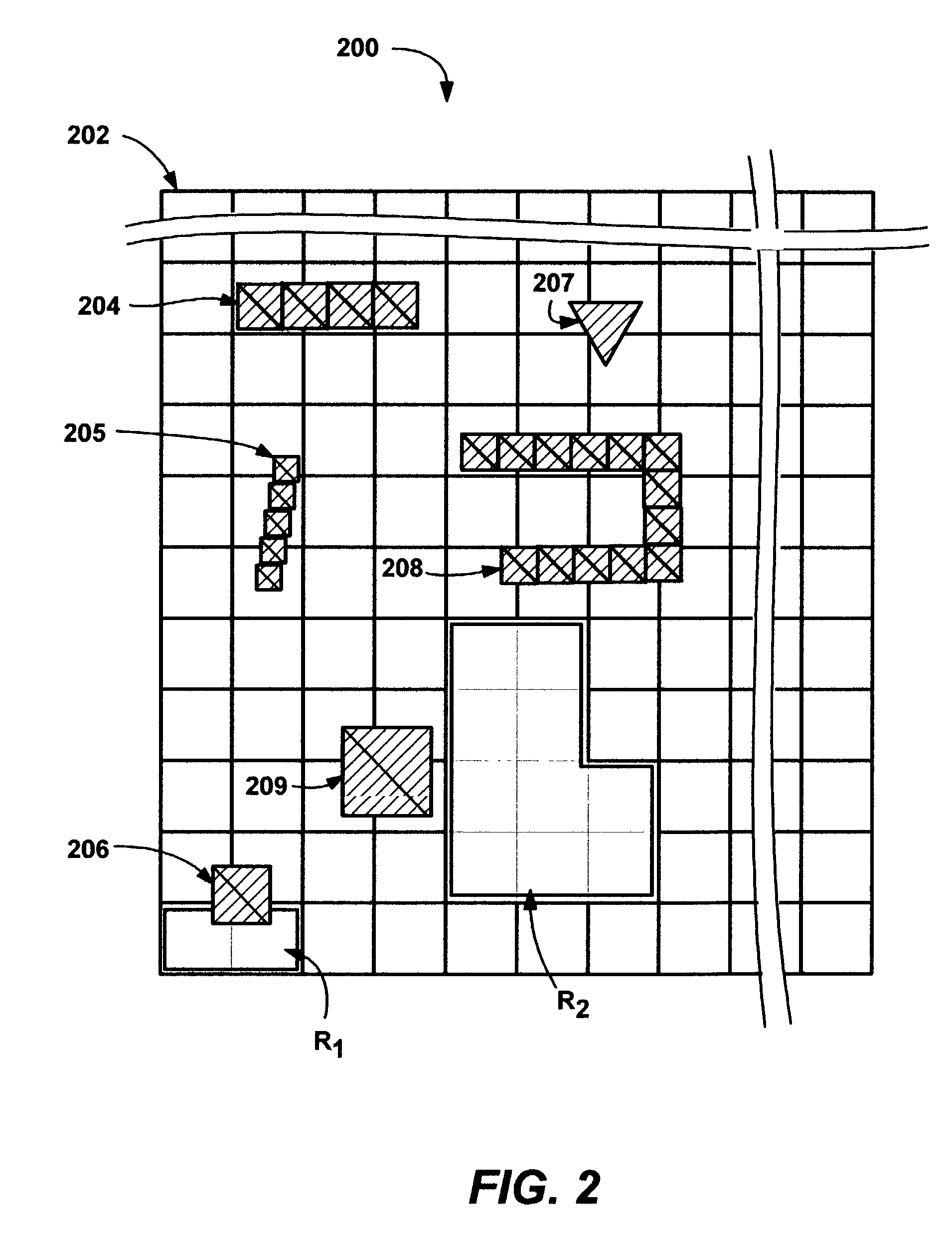
[0011]To generate the visibility map, a site is divided into a two-dimensional grid, and regions in the site are determined by an author. A visibility map for each region is generated by determining only those polygons that are potentially visible from the various camera positions in that region, taken in six viewing directions (forward, backward, up, down, left and right) per position. By limiting the polygons to only those that may be viewed from a region, and then knowing which region a user is in when navigating the site, the number of polygons that have to be handled at any given time are dramatically reduced. A per-region bitmap, with one bit corresponding to each possibly available polygon in the site, maps whether each polygon in the site is potentially visible from that region. The bitmap may be compressed before archiving it as the visibility map for that region.
[0014]During navigation, only the maps relevant to a user's current position are active, significantly reducing the amount of data that the navigation processing components need to deal with in real-time. Commands from the user, in conjunction with the relevant maps in the walkmap, determine the user's position, camera angle and direction in the site. Via the relevant visibility map for the current position, the possibly visibly polygons are known. Culling techniques, e.g., based on the camera angle / viewing direction, may further reduce the number of polygons that need to be handled. Those remaining polygons (e.g., on the order of a few hundred) are easily handled by the graphics subsystem to provide the real-time interactive environment, in high-resolution, three-dimensional graphics. The trigger map may be used to fire scripts as determined by the author, to produce various effects, e.g., such as to display labels upon selected objects in the site. As a result, a user experiences realistic navigation through a site in real time, using navigation commands to provide a first person, perspective tour of the site, including the freedom to explore each such site in a real-time, three-dimensional environment, at the viewer's own pace.

Problems solved by technology

When the educational experience is one related to touring a location such as a historic site, films and slideshows are not the same as actually exploring the site, as among other drawbacks, such films and slideshows are limited to that of the filming author's viewing perspective.
At the same time, it is impossible for everyone to personally view every site in which he or she may be interested in visiting.
In fact, some sites cannot be visited by anyone because they no longer exist, at least not in the way they once historically appeared.
Thus, at best such sites can only be recreated.
However, although multimedia software now exists as an educational tool, the massive amount of data needed to accurately and comprehensively present such information to computer users has not heretofore been able to provide high-quality results with such software.
Moreover, none of these prior attempts create the illusion of first person exploration, at least not to any reasonably realistic extent, even though such realistic first person exploration can be a highly effective educational tool.
For example, the portion of the world displayed at any time is limited to images which a three-dimensional rendering engine and video hardware can easily handle.
However, with an environment such as an architectural site, the author does not get to choose the images that appear in the virtual world, but rather needs to represent them as is (or as experts theorize they appeared).
As a consequence, the author cannot simply create the world as needed to match the hardware limitations.
Conventional CAD programs or the like cannot process such amounts of information fast enough to represent a site in a real-time interactive setting with any reasonable amount of quality.
Such programs cannot pass the information to the graphics cards, as existing graphics cards also would be overwhelmed by the large amount of polygons that need to be handled in real-time.

Method used


Image

  • Three-dimensional virtual tour method and system
  • Three-dimensional virtual tour method and system
  • Three-dimensional virtual tour method and system

Examples


Embodiment Construction

Exemplary Operating Environment

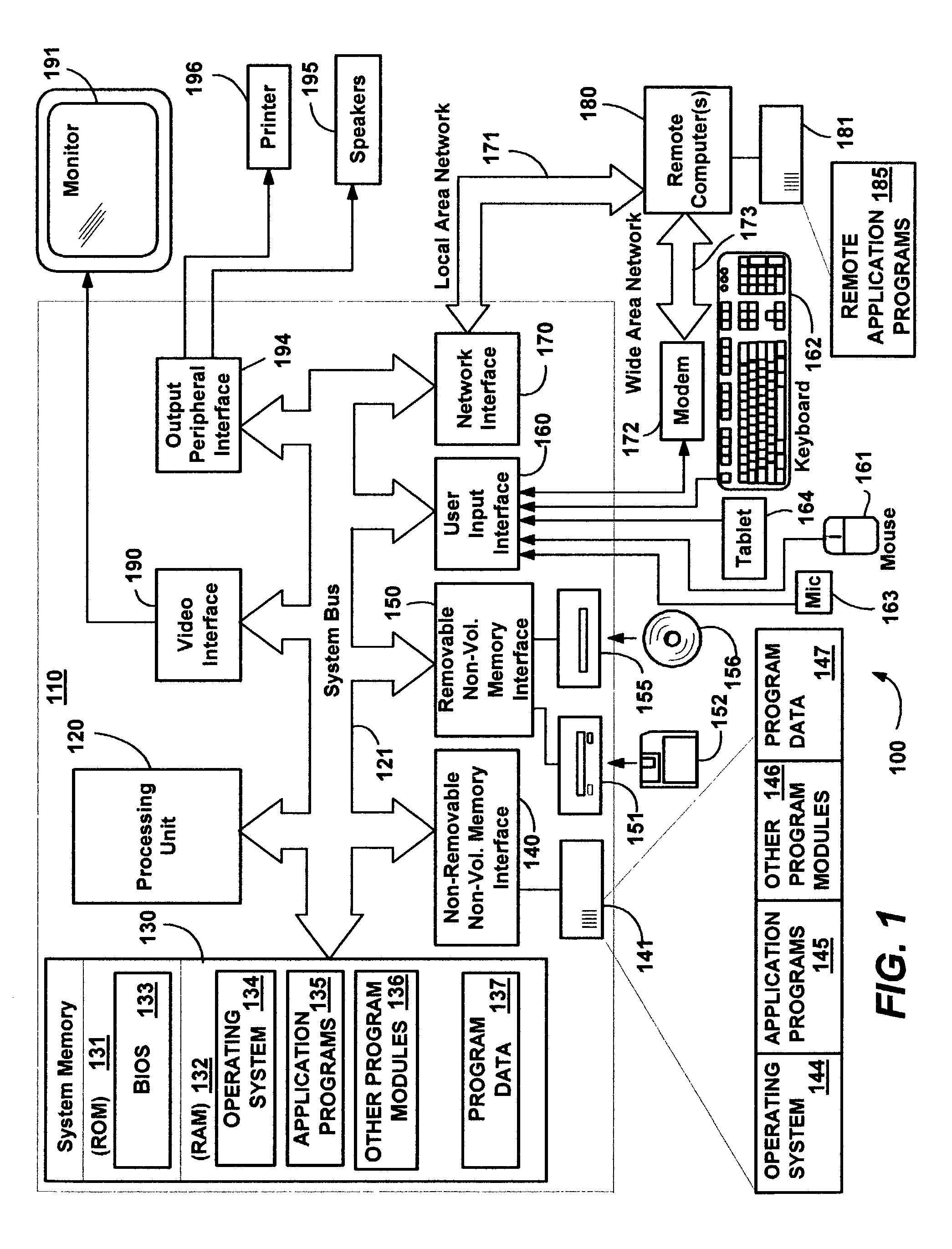
[0027]FIG. 1 illustrates an example of a suitable computing system environment 100 on which the invention may be implemented. The computing system environment 100 is only one example of a suitable computing environment and is not intended to suggest any limitation as to the scope of use or functionality of the invention. Neither should the computing environment 100 be interpreted as having any dependency or requirement relating to any one or combination of components illustrated in the exemplary operating environment 100.

[0028]The invention is operational with numerous other general purpose or special purpose computing system environments or configurations. Examples of well known computing systems, environments, and / or configurations that may be suitable for use with the invention include, but are not limited to: personal computers, server computers, hand-held or laptop devices, tablet devices, multiprocessor systems, microprocessor-based systems, set ...


PUM


Abstract

A method and system that archive a three-dimensional site in a highly-compact manner such that real-time, three-dimensional exploration and interaction with the site with high-resolution graphics is enabled. During authoring, information is collected about a site, and processed into a walkmap comprising a number of maps. A visibility map indicates which ones of the many polygons that make up a site are potentially visible from a given region. A collision map establishes where a can navigate in the site. A ground map tracks the terrain for reproducing camera heights and viewing angles, and a trigger map causes scripts to be fired from locations in the site. During navigation, only the maps relevant to a user's current position are active, whereby rapid rendering of an appropriate image for the user's current perspective is possible in real-time, providing a first person, perspective tour of the site in a perceived three-dimensional environment.

Description

FIELD OF THE INVENTION[0001]The present invention relates generally to computer systems, and more particularly to presenting visual information to users of a computer system.BACKGROUND OF THE INVENTION[0002]One of the significant educational benefits that users receive from computer systems is the ability to interact with the computer system, and thereby receive personalized instruction, without the constraints of group instruction. For example, although viewing a film or slideshow in a group setting is educational, a user may learn much more and / or better retain the information when viewing the same information on a computer system in which the user can pause, replay, link to related information and so forth as needed, and at a chosen pace.[0003]When the educational experience is one related to touring a location such as a historic site, films and slideshows are not the same as actually exploring the site, as among other drawbacks, such films and slideshows are limited to that of t...

Claims


Application Information

Patent Timeline
IPC IPC(8): G06T15/00G06T15/40
CPCG06T15/40
Inventor PELLA, JOHN P.KURIEL, YAACOV KORYHALE, CHARLES A.JENSEN, SCOTT A.
Owner MICROSOFT TECH LICENSING LLC
Learn More