
Systems and methods for broadcasting an unknown airport advisory

a technology of unknown airports and broadcasting methods, applied in the field of terrain awareness and warning systems, can solve the problem that the information in the digital terrain database may not recognize all possible or potential landing sites throughout the world

Active Publication Date: 2009-08-04
HONEYWELL INT INC
View PDF5 Cites 2 Cited by
  • Summary
  • Abstract
  • Description
  • Claims
  • Application Information

AI Technical Summary

Benefits of technology

The invention is a system and method that helps pilots land their aircraft at unknown airports or runways. It does this by alerting the pilot that they are approaching an unknown airport and giving them information about the airport, such as its location and any obstacles or hazards. This helps the pilot prepare for the landing and reduces the risk of accidents.

Problems solved by technology

One drawback of these systems is that the information in the digital terrain database may not recognize all possible or potential landing sites throughout the world.

Method used


Image

  • Systems and methods for broadcasting an unknown airport advisory
  • Systems and methods for broadcasting an unknown airport advisory
  • Systems and methods for broadcasting an unknown airport advisory

Examples


Embodiment Construction

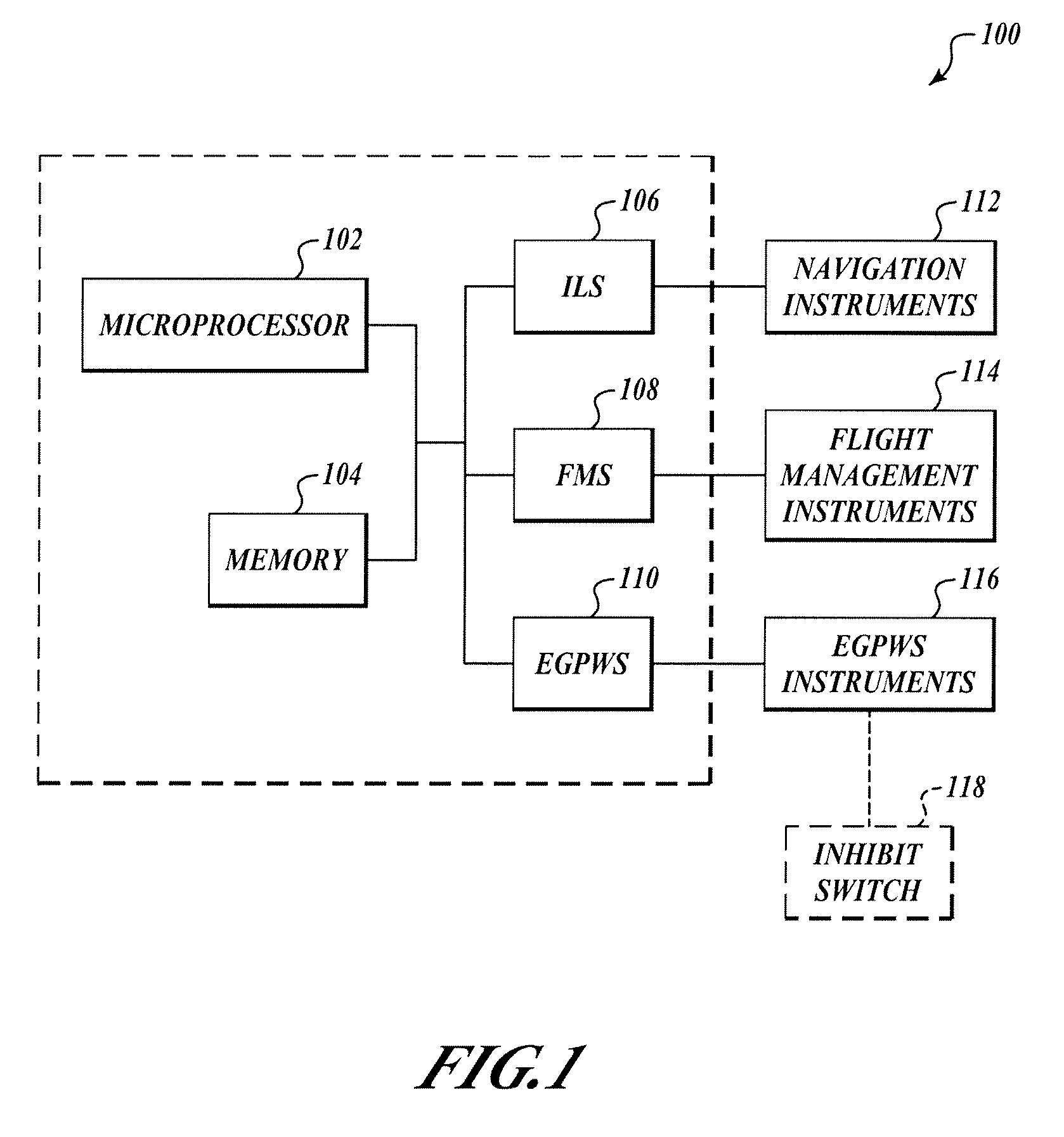
[0010]FIG. 1 shows a system 100 for an aircraft. The system 100 includes a processor 102 that is in communication with a memory 104. The processor 102 may also be in communication with an instrument landing system (ILS) 106, a flight management system (FMS) 108, an Enhanced Ground Proximity Warning System (EGPWS) 110 and / or or other data sources. In one embodiment, the ILS 106, the FMS 108, the EGPWS 110 and / or or other data sources gather and process information on the aircraft's configuration (e.g., landing configuration), position, etc. The EGPWS 110 may include a memory that is separate from the memory 104. In one embodiment, the ILS 106, the FMS 108, and the EGPWS 110 are coupled through an ARINC 429, ARINC 629 and / or other type of data bus that provides electrical and data characteristic protocols on how avionics equipment and systems should communicate with each other.

[0011]The EGPWS 110 communicates with the EGPWS instruments 116 to provide alerts and / or some other human-per...


PUM


Abstract

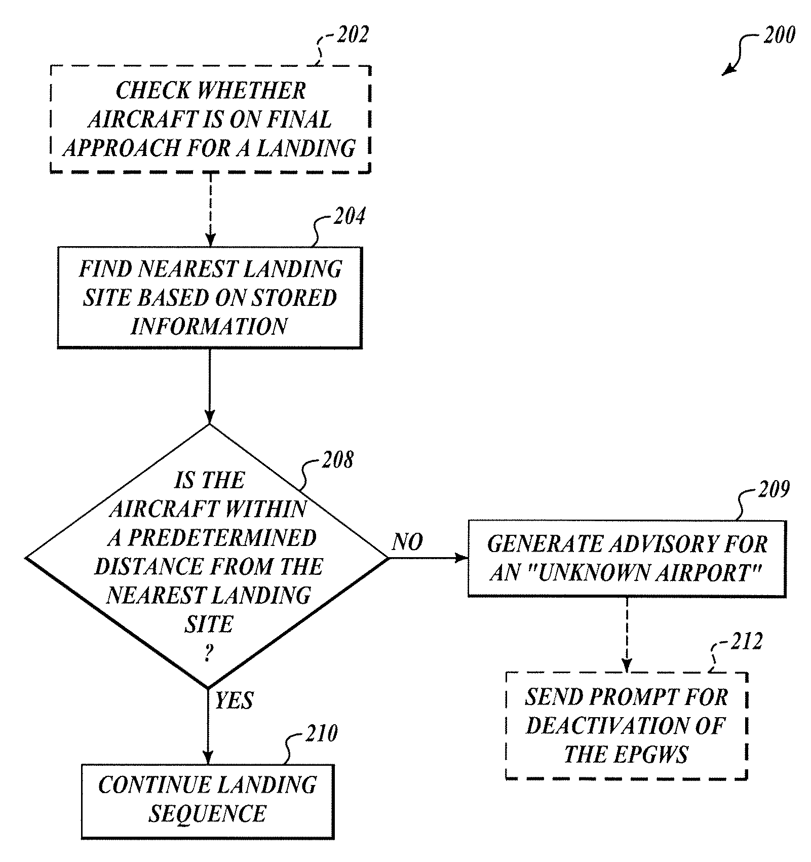
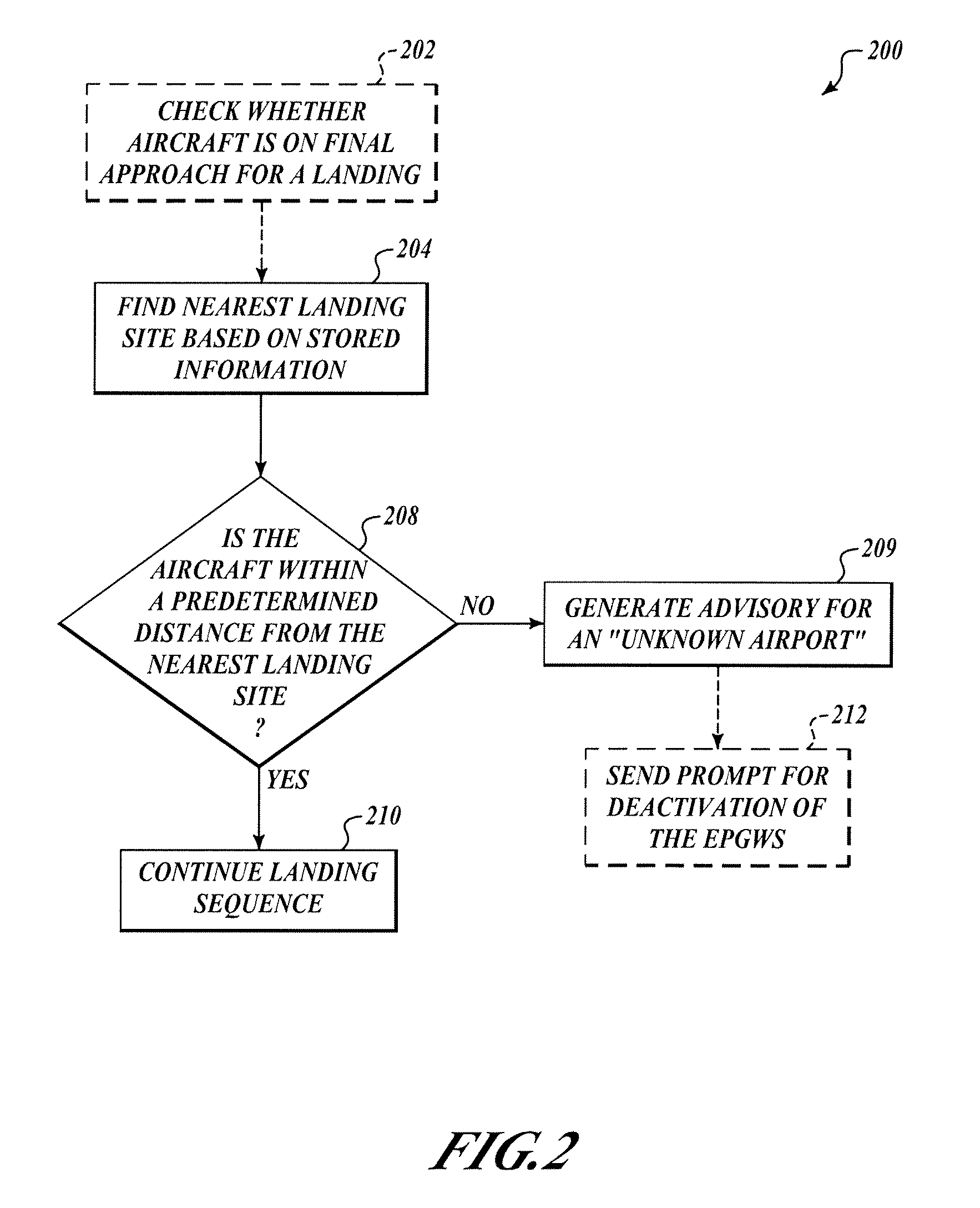
Systems and methods for advising a flight crew member that an enhanced ground proximity warning system (EGPWS), for example, may continue to provide terrain alerts, cautions, warnings, or the like because an intended landing site for the aircraft is not recognized within a database of airports. An unknown airport advisory is generated and broadcast after the aircraft is in a landing configuration, when the aircraft is greater than a threshold distance from the nearest landing site in the database, but before the terrain alerts are broadcast. The pilot may actuate a “terrain inhibit” selection device after receiving the advisory. The inhibit device may deactivate or mute subsequent alerts generated by the EGPWS during that particular landing sequence.

Description

BACKGROUND OF THE INVENTION[0001]A Terrain Awareness and Warning System (TAWS) is a system designed to alert pilots if their aircraft is in danger of making contact with a terrain feature. The terrain feature, by way of example, may be mountainous terrain, water terrain, or even a manmade structure.[0002]One type of TAWS is an Enhanced Ground Proximity Warning System (EGPWS) that utilizes a digital terrain database stored in a computer memory on the aircraft. The EGPWS utilizes on-board computers in conjunction with long-range navigation systems such as global positioning systems (GPS), inertial navigation systems (INS), radio-dependent navigational systems, or some combination of the above, to periodically compare the aircraft's position relative to information in the digital terrain database.[0003]One drawback of these systems is that the information in the digital terrain database may not recognize all possible or potential landing sites throughout the world. In such a situation,...

Claims


Application Information

Patent Timeline
Patent Type & Authority Patents(United States)
IPC IPC(8): G06G7/70
CPCG01C23/005G08G5/025G08G5/0021
Inventor CONNER, KEVIN JISHIHARA, YASUO
Owner HONEYWELL INT INC
Learn More