
Retro-geo spinning satellite utilizing time delay integration (TDI) for geosynchronous surveillance

a geosynchronous surveillance and retro-geo spinning technology, applied in vehicle position/course/altitude control, process and machine control, instruments, etc., can solve the problems of limited sbss-leo's ability to resolve small and close objects, increase the weight of the satellite, and limit the system's ability to detect both small objects and closely spaced objects. , to achieve the effect of quick scan

Active Publication Date: 2012-08-14
RAYTHEON CO
View PDF8 Cites 10 Cited by
  • Summary
  • Abstract
  • Description
  • Claims
  • Application Information

AI Technical Summary

Benefits of technology

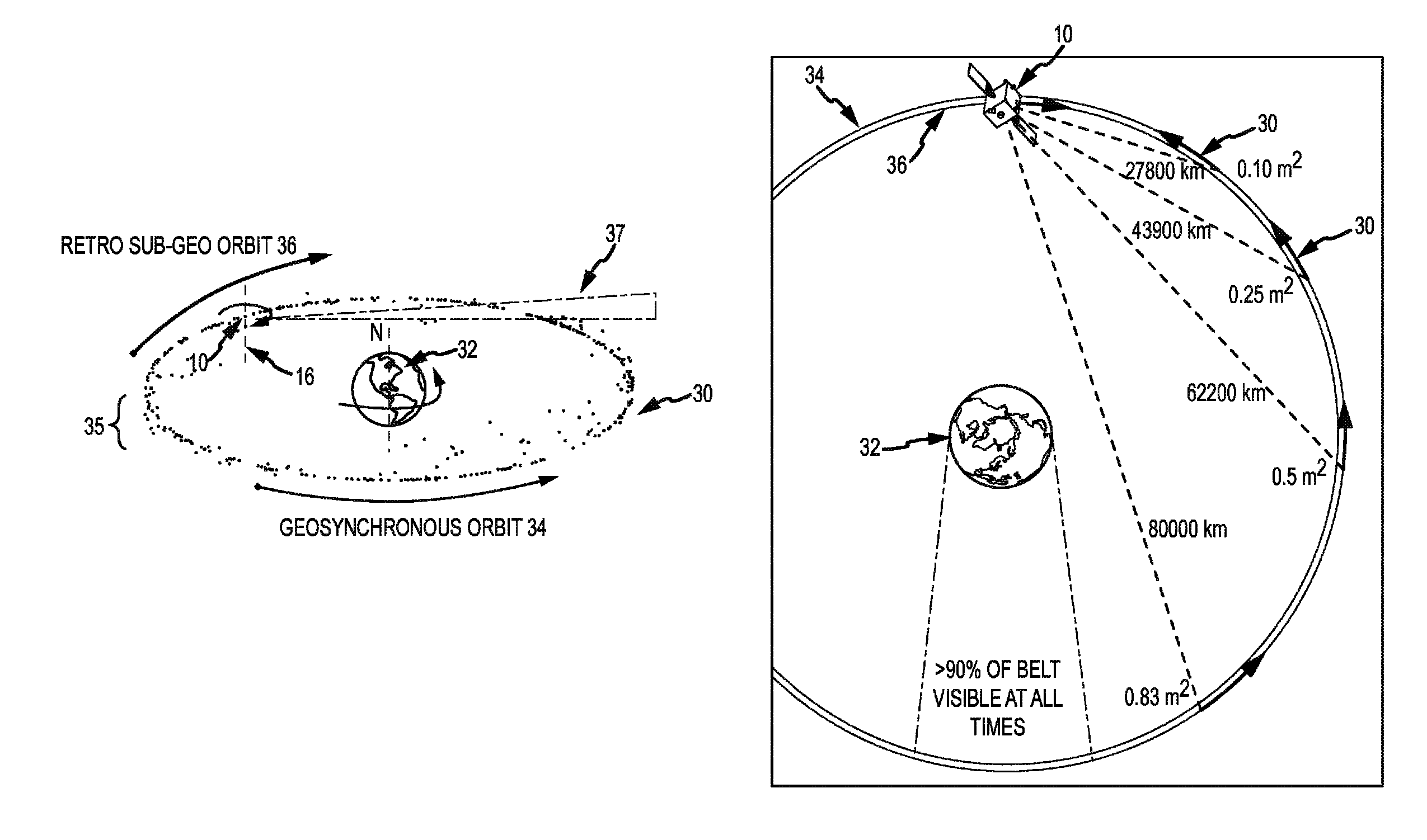
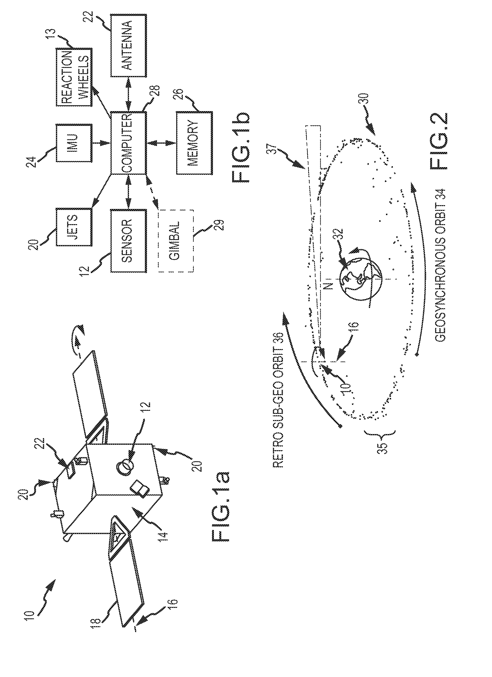
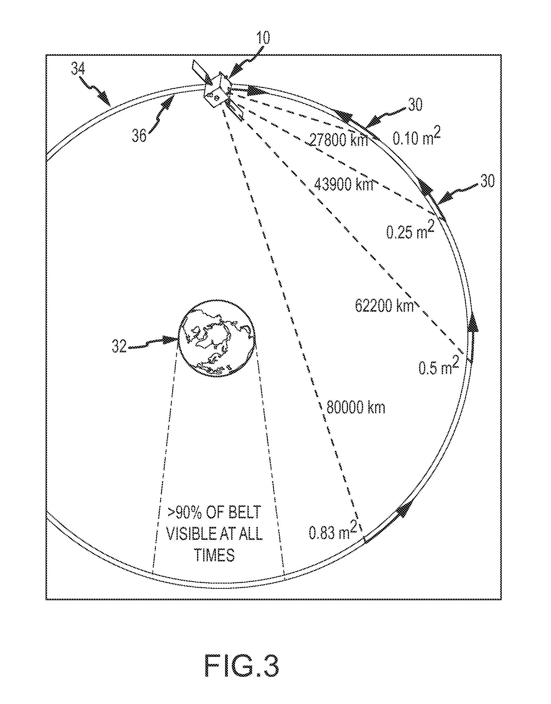
The invention is a low-cost solution for geosynchronous surveillance that can quickly scan the geobelt, generate a catalog of objects, and observe specific parts of the geobelt. It uses a small-aperture body-fixed sensor and a detector that detects incident photons continuously. The observer satellite spins continuously about an axis in an Earth frame of reference to sweep the sensor's FOV around the geobelt. The sensor's TDI synchronizes with the satellite's spin-rate and the target inertial LOS rate to generate a sequence of sensed images. The observer satellite detects any non-stellar objects in each image, assigns attributes to each object, and transmits a list of the objects and their attributes to Earth. The faster the observer satellite can spin, the faster it can update the list and a significant portion of the object catalog. The invention can detect and transmit at least (50%) of non-stellar objects in geosynchronous orbit and can detect a much larger fraction of objects in less time with the help of a second observer satellite.

Problems solved by technology

This limits the system's capability to detect both small objects and closely spaced objects.
SBSS-LEO's ability to resolve small and CSOs is limited by the fixed 36,000 km observation range.
SBSS-LEO can be commanded to look in a specific direction but the Earth blocks one-half of the telescope's field-of-view (FOV) at all times. The aperture size required to resolve small objects and CSOs at approximately 36,000 km and the gimbal increase the weight of the satellite, which in turn dramatically effects cost.
GeoST-LEO's ability to resolve small objects and CSOs is also limited by the fixed (approximate) 36,000 km observation range.
GeoST-LEO can be commanded to look in a specific direction but again the Earth blocks one-half of the telescope's field-of-regard (FOR) at all times. The aperture size required to resolve small objects and CSOs at 36,000 km increases the weight of the satellite, which in turn dramatically effects cost.

Method used


Image

  • Retro-geo spinning satellite utilizing time delay integration (TDI) for geosynchronous surveillance
  • Retro-geo spinning satellite utilizing time delay integration (TDI) for geosynchronous surveillance
  • Retro-geo spinning satellite utilizing time delay integration (TDI) for geosynchronous surveillance

Examples


Embodiment Construction

[0023]The present invention describes a method of conducting geosynchronous surveillance by injecting an observer satellite having a sensor into a retro sub or super geosynchronous orbit at approximately zero inclination. The observer satellite spins about an approximately North-South axis in an Earth frame of reference to sweep the sensor's FOV around the geobelt to detect objects at ranges that vary from a few thousand km to about 80,000 km. Sensor TDI is synchronized to the observer satellite's spin-rate and possibly its target inertial LOS rate to the objects in its FOV to realize longer integration times. The LOS rate is negligible at long range but becomes appreciable at shorter ranges where the small and CSOs are resolved. If sensor TDI is synchronized to only the spin-rate and not the sum of the spin-rate plus the LOS rate the percentage of small objects and CSOs detected may drop significantly. This approach facilitates faster scans of the entire geobelt, more timely update...


PUM


Abstract

Geosynchronous surveillance is conducted by injecting one or more observer satellites into a retro sub or super geosynchronous orbit at approximately zero inclination. The observer satellite spins about an approximately North-South axis in an Earth frame of reference to sweep a sensor's FOV around the geobelt. Sensor time delay integration (TDI) is synchronized to the observer satellite's spin-rate and possibly the sum of the spin-rate and the target inertial LOS rate to realize longer integration times. This approach facilitates faster scans of the entire geobelt, more timely updates of the catalog of tracked objects and resolution of small and closely spaced objects. An inexpensive small-aperture body-fixed visible sensor may be used.

Description

BACKGROUND OF THE INVENTION[0001]1. Field of the Invention[0002]This invention relates to space situational awareness and more particularly to the detection of objections in geosynchronous orbit about the Earth.[0003]2. Description of the Related Art[0004]An aspect of space situational awareness is the detection, cataloging and tracking of non-stellar objects in geosynchronous orbits. A geosynchronous orbit is an orbit around the equatorial plane (zero inclination plus or minus 15 degrees) of the Earth with the same rotation and same orbital period. A geosynchronous satellite flies over the same points on Earth at the same times each day. A circular orbit at zero inclination is referred to as geostationary. A geostationary satellite remains over the same point on Earth at all times. These satellites orbit at approximately 36,000 km above the Earth with an orbital period of 24 hours. Geosynchronous satellites are considered to be strategic assets by virtue of their enormous communica...

Claims


Application Information

Patent Timeline
Patent Type & Authority Patents(United States)
IPC IPC(8): B64G1/10
CPCB64G1/1021
Inventor VANCE, LEONARD D.
Owner RAYTHEON CO
Learn More