
System and method for spatial point-of-interest generation and automated trip segmentation using location data

a technology of location data and system and method, applied in the direction of navigation instruments, instruments, process and machine control, etc., to achieve the effect of fast gnss cluttering

Inactive Publication Date: 2014-09-23
UNIV OF SOUTH FLORIDA
View PDF5 Cites 20 Cited by
  • Summary
  • Abstract
  • Description
  • Claims
  • Application Information

AI Technical Summary

Benefits of technology

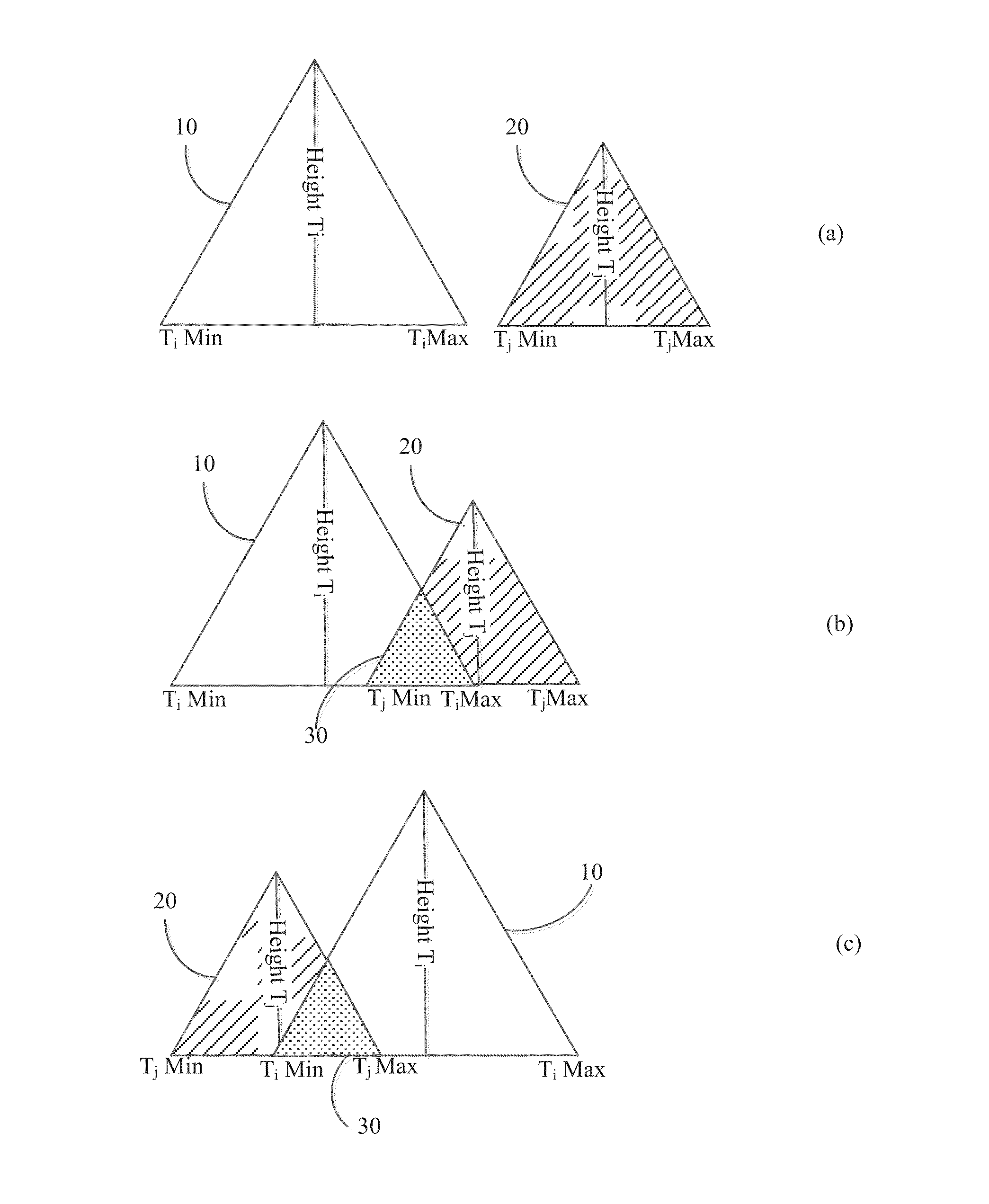
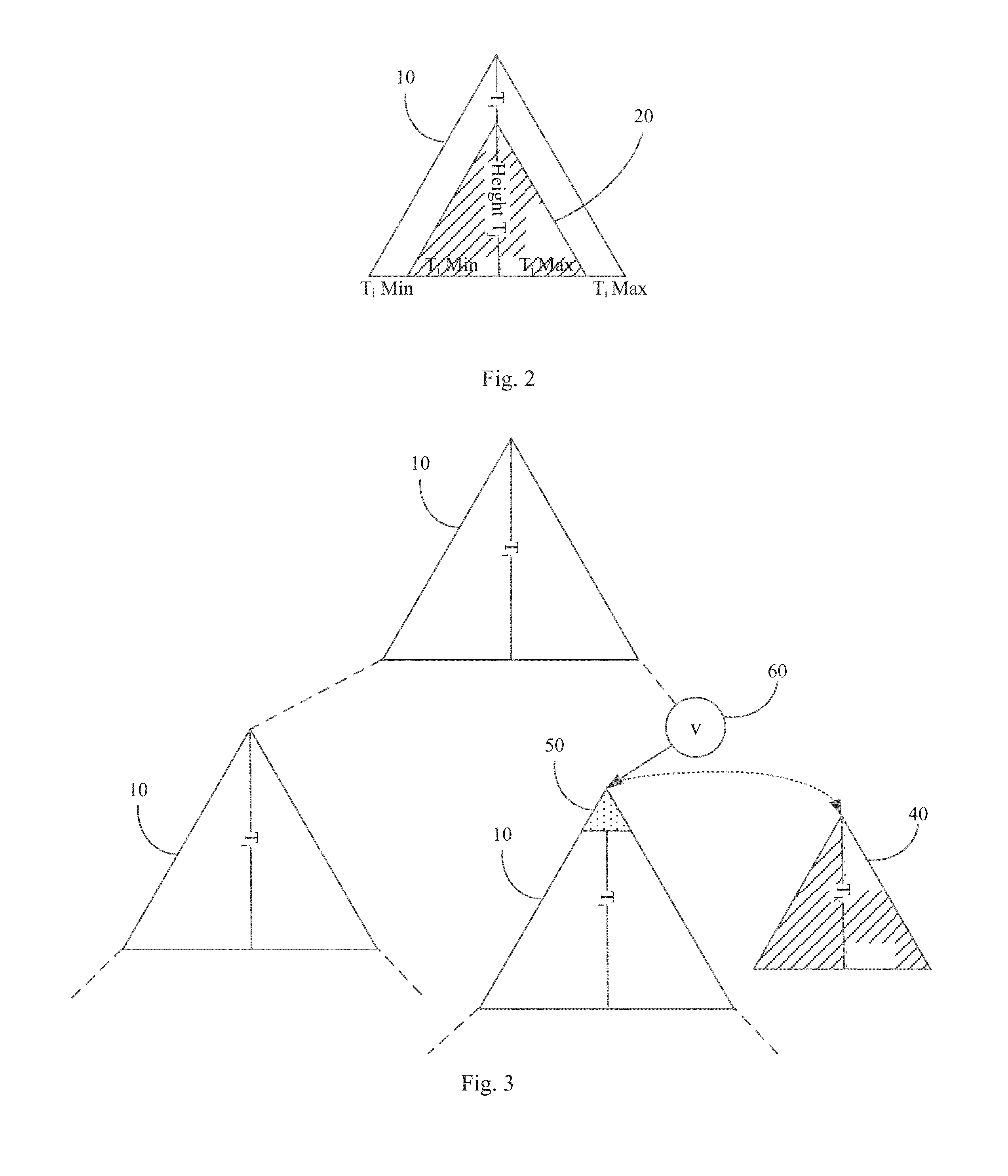
The present invention provides a way to quickly analyze GNSS position data and produce a series of "Points-of-Interest" which define the places where a user has stopped for a significant amount of time. This method uses a balanced binary tree to represent a cluster and merges two clusters in logarithmic running time, while keeping memory requirements low. The method can handle large tracking databases and is specifically designed to handle moderate amounts of data.

Problems solved by technology

However, as millions of GNSS receivers are being monitored at frequencies up to one per second, location-aware information systems struggle to quickly process overwhelming amounts of location data and transform this information in actionable intelligence.

Method used


Image

  • System and method for spatial point-of-interest generation and automated trip segmentation using location data
  • System and method for spatial point-of-interest generation and automated trip segmentation using location data
  • System and method for spatial point-of-interest generation and automated trip segmentation using location data

Examples


Embodiment Construction

[0020]The present invention now will be described more fully hereinafter with reference to the accompanying drawings, which form a part hereof, and which show, by way of illustration, specific embodiments by which the invention may be practiced. This invention may, however, be embodied in many different forms and should not be construed as limited to the embodiments set forth herein; rather, these embodiments are provided so that this disclosure will be thorough and complete, and will fully convey the scope of the invention to those skilled in the art. Among other things, the present invention may be embodied as methods or devices. Accordingly, the present invention may take the form of an entirely hardware embodiment, an entirely software embodiment or an embodiment combining software and hardware aspects. The software by also be part of computer system and may be stored on a non-transitory computer readable medium prior to execution. The following detailed description is, therefor...


PUM


Abstract

This present invention is a spatial data processing system and method that allows the automatic, rapid, scalable analysis and transformation of large amounts of travel behavior data (e.g., tracking data points) into individual “points-of-interest” and discrete trips stored in a spatial database. Each trip has a point-of-interest as a starting and ending location, and contains multiple positions (e.g. latitude and longitudes) which define the travel path of the user / device during that time period.

Description

CROSS-REFERENCE TO RELATED APPLICATIONS[0001]This application claims priority to currently U.S. Provisional Patent Application No. 61 / 502,061, filed on Jun. 28, 2011, entitled “System and Method for Spatial Point-of-Interest Generation and Automated Trip Segmentation Using Location Data”.STATEMENT OF GOVERNMENT INTEREST[0002]This invention was made with Government support under FDOT BDK85 TWO 977-14 awarded by the Federal Department of Transportation. The Government has certain rights in the invention.BACKGROUND OF INVENTION[0003]Global Navigation Satellite Systems (GNSS) are becoming increasingly ubiquitous in both military and civilian applications for tracking the movement of people and goods. However, as millions of GNSS receivers are being monitored at frequencies up to one per second, location-aware information systems struggle to quickly process overwhelming amounts of location data and transform this information in actionable intelligence.[0004]GPS enabled mobile phones supp...

Claims


Application Information

Patent Timeline
Patent Type & Authority Patents(United States)
IPC IPC(8): G01C21/26G01C21/00
CPCG01C21/30G08G1/00
Inventor BARBEAU, SEAN J.WINTERS, PHILIP L.PEREZ, RAFAELLABRADOR, MIGUELGEORGGI, NEVINEPERSAD, NARIN
Owner UNIV OF SOUTH FLORIDA
Learn More